Knob Lick, Metcalfe County, Kentucky
| Knob Lick, Kentucky | |
|---|---|
| Unincorporated community | |
 Knob Lick, Kentucky | |
| Coordinates: 37°04′42″N 85°41′40″W / 37.07833°N 85.69444°WCoordinates: 37°04′42″N 85°41′40″W / 37.07833°N 85.69444°W | |
| Country | United States |
| State | Kentucky |
| County | Metcalfe |
| Elevation | 801 ft (244 m) |
| Time zone | Central (CST) (UTC-6) |
| • Summer (DST) | CDT (UTC-5) |
| ZIP code | 42154 |
| Area code(s) | 270 |
| GNIS feature ID | 508404[1] |
Knob Lick is an unincorporated community in Metcalfe County, Kentucky, United States. Knob Lick is located on Kentucky Route 70, 8 miles (13 km) northwest of Edmonton. Knob Lick has a post office with ZIP code 42154.[2]
History
Knob Lick was settled in the 1790s as part of a tract of land granted to Austin Allen. The community was originally known as Antioch after the local church, which opened in 1838. A post office opened on June 10, 1848, under the name Knob Creek; the name was changed to Antioch in 1851, and the post office closed in 1857. The post office reopened on July 23, 1867, as Knob Lick; Frank S. Ewing was the first postmaster of the new post office. The name Knob Lick came from a lick located south of a knob north of the post office.[3]
References
- ↑ U.S. Geological Survey Geographic Names Information System: Knob Lick, Metcalfe County, Kentucky
- ↑ ZIP Code Lookup
- ↑ Rennick, Robert M. Kentucky Place Names. University Press of Kentucky. Retrieved 3 March 2011.
Municipalities and communities of Metcalfe County, Kentucky, United States | ||
|---|---|---|
| City | 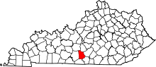 | |
| CDP | ||
| Other unincorporated communities | ||