Knapp, Dunn County, Wisconsin
| Knapp | |
|---|---|
| Village | |
 Knapp Location within the state of Wisconsin | |
| Coordinates: 44°57′16″N 92°4′50″W / 44.95444°N 92.08056°WCoordinates: 44°57′16″N 92°4′50″W / 44.95444°N 92.08056°W | |
| Country | United States |
| State | Wisconsin |
| County | Dunn |
| Area[1] | |
| • Total | 1.59 sq mi (4.12 km2) |
| • Land | 1.58 sq mi (4.09 km2) |
| • Water | 0.01 sq mi (0.03 km2) |
| Population (2010)[2] | |
| • Total | 463 |
| • Estimate (2012[3]) | 460 |
| • Density | 293.0/sq mi (113.1/km2) |
| Time zone | Central (CST) (UTC-6) |
| • Summer (DST) | CDT (UTC-5) |
| Area code(s) | 715 & 534 |
Knapp is a village in Dunn County, Wisconsin, United States. The population was 463 at the 2010 census.
History
A post office called Knapp has been in operation since 1872.[4] The village was named for John H. Knapp, an executive in the lumber industry.[5]
Geography
Knapp is located at 44°57′16″N 92°4′50″W / 44.95444°N 92.08056°W (44.954456, -92.080421).[6]
According to the United States Census Bureau, the village has a total area of 1.59 square miles (4.12 km2), of which, 1.58 square miles (4.09 km2) of it is land and 0.01 square miles (0.03 km2) is water.[1]
Demographics
| Historical population | |||
|---|---|---|---|
| Census | Pop. | %± | |
| 1890 | 480 | — | |
| 1910 | 413 | — | |
| 1920 | 478 | 15.7% | |
| 1930 | 424 | −11.3% | |
| 1940 | 436 | 2.8% | |
| 1950 | 424 | −2.8% | |
| 1960 | 374 | −11.8% | |
| 1970 | 369 | −1.3% | |
| 1980 | 419 | 13.6% | |
| 1990 | 419 | 0.0% | |
| 2000 | 421 | 0.5% | |
| 2010 | 463 | 10.0% | |
| Est. 2015 | 460 | [7] | −0.6% |
2010 census
As of the census[2] of 2010, there were 463 people, 214 households, and 122 families residing in the village. The population density was 293.0 inhabitants per square mile (113.1/km2). There were 230 housing units at an average density of 145.6 per square mile (56.2/km2). The racial makeup of the village was 97.8% White, 1.1% Native American, and 1.1% from two or more races. Hispanic or Latino of any race were 0.2% of the population.
There were 214 households of which 22.9% had children under the age of 18 living with them, 47.2% were married couples living together, 5.1% had a female householder with no husband present, 4.7% had a male householder with no wife present, and 43.0% were non-families. 34.1% of all households were made up of individuals and 17.8% had someone living alone who was 65 years of age or older. The average household size was 2.16 and the average family size was 2.78.
The median age in the village was 44.9 years. 19.4% of residents were under the age of 18; 5.4% were between the ages of 18 and 24; 25.5% were from 25 to 44; 27.1% were from 45 to 64; and 22.7% were 65 years of age or older. The gender makeup of the village was 52.3% male and 47.7% female.
2000 census
As of the census[9] of 2000, there were 421 people, 186 households, and 116 families residing in the village. The population density was 266.1 people per square mile (102.9/km²). There were 198 housing units at an average density of 125.1/sq mi (48.4/km²). The racial makeup of the village was 99.05% White, 0.71% African American, and 0.24% from two or more races. Hispanic or Latino of any race were 0.95% of the population.
There were 186 households out of which 29.0% had children under the age of 18 living with them, 51.1% were married couples living together, 9.1% had a female householder with no husband present, and 37.6% were non-families. 32.3% of all households were made up of individuals and 15.6% had someone living alone who was 65 years of age or older. The average household size was 2.26 and the average family size was 2.88.
In the village the population was spread out with 23.5% under the age of 18, 9.0% from 18 to 24, 30.2% from 25 to 44, 23.8% from 45 to 64, and 13.5% who were 65 years of age or older. The median age was 39 years. For every 100 females there were 94.9 males. For every 100 females age 18 and over, there were 95.2 males.
The median income for a household in the village was $38,472, and the median income for a family was $47,500. Males had a median income of $35,833 versus $20,089 for females. The per capita income for the village was $22,636. About 3.5% of families and 8.1% of the population were below the poverty line, including 7.1% of those under age 18 and 23.1% of those age 65 or over.
References
- 1 2 "US Gazetteer files 2010". United States Census Bureau. Retrieved 2012-11-18.
- 1 2 "American FactFinder". United States Census Bureau. Retrieved 2012-11-18.
- ↑ "Population Estimates". United States Census Bureau. Retrieved 2013-06-24.
- ↑ "Dunn County". Jim Forte Postal History. Retrieved 4 April 2015.
- ↑ Chicago and North Western Railway Company (1908). A History of the Origin of the Place Names Connected with the Chicago & North Western and Chicago, St. Paul, Minneapolis & Omaha Railways. p. 180.
- ↑ "US Gazetteer files: 2010, 2000, and 1990". United States Census Bureau. 2011-02-12. Retrieved 2011-04-23.
- ↑ "Annual Estimates of the Resident Population for Incorporated Places: April 1, 2010 to July 1, 2015". Retrieved July 2, 2016.
- ↑ "Census of Population and Housing". Census.gov. Retrieved June 4, 2015.
- ↑ "American FactFinder". United States Census Bureau. Retrieved 2008-01-31.
Municipalities and communities of Dunn County, Wisconsin, United States | ||
|---|---|---|
| City | 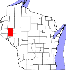 | |
| Villages | ||
| Towns | ||
| CDPs | ||
| Unincorporated communities | ||
| Ghost towns | ||
| Footnote | ‡This populated place also has portions in an adjacent county or counties | |