Colfax, Wisconsin
| Colfax, Wisconsin | |
|---|---|
| Village | |
| Coordinates: 44°59′55″N 91°42′14″W / 44.99861°N 91.70389°WCoordinates: 44°59′55″N 91°42′14″W / 44.99861°N 91.70389°W | |
| Country | United States |
| State | Wisconsin |
| County | Dunn |
| Area[1] | |
| • Total | 1.41 sq mi (3.65 km2) |
| • Land | 1.38 sq mi (3.57 km2) |
| • Water | 0.03 sq mi (0.08 km2) |
| Elevation[2] | 981 ft (299 m) |
| Population (2010)[3] | |
| • Total | 1,158 |
| • Estimate (2012[4]) | 1,158 |
| • Density | 839.1/sq mi (324.0/km2) |
| Time zone | Central (CST) (UTC-6) |
| • Summer (DST) | CDT (UTC-5) |
| Area code(s) | 715 & 534 |
| FIPS code | 55-16300[5] |
| GNIS feature ID | 1583002[2] |
| Website | http://www.villageofcolfaxwi.org/ |
Colfax is a village in Dunn County, Wisconsin, United States. The population was 1,158 at the 2010 census. The village is surrounded by the Town of Colfax.
History
The Colfax, Wisconsin tornado outbreak destroyed most of Colfax in 1958.
Geography
Colfax is located at 44°59′55″N 91°43′31″W / 44.99861°N 91.72528°W (44.998812, -91.725511).[6]
According to the United States Census Bureau, the village has a total area of 1.41 square miles (3.65 km2), of which, 1.38 square miles (3.57 km2) of it is land and 0.03 square miles (0.08 km2) is water.[1]
Demographics
| Historical population | |||
|---|---|---|---|
| Census | Pop. | %± | |
| 1880 | 66 | — | |
| 1910 | 701 | — | |
| 1920 | 905 | 29.1% | |
| 1930 | 919 | 1.5% | |
| 1940 | 992 | 7.9% | |
| 1950 | 1,044 | 5.2% | |
| 1960 | 885 | −15.2% | |
| 1970 | 1,026 | 15.9% | |
| 1980 | 1,149 | 12.0% | |
| 1990 | 1,110 | −3.4% | |
| 2000 | 1,136 | 2.3% | |
| 2010 | 1,158 | 1.9% | |
| Est. 2015 | 1,161 | [7] | 0.3% |
2010 census
As of the census[3] of 2010, there were 1,158 people, 478 households, and 291 families residing in the village. The population density was 839.1 inhabitants per square mile (324.0/km2). There were 524 housing units at an average density of 379.7 per square mile (146.6/km2). The racial makeup of the village was 97.2% White, 0.3% African American, 0.6% Native American, 0.2% from other races, and 1.7% from two or more races. Hispanic or Latino of any race were 1.7% of the population.
There were 478 households of which 30.8% had children under the age of 18 living with them, 44.1% were married couples living together, 12.3% had a female householder with no husband present, 4.4% had a male householder with no wife present, and 39.1% were non-families. 33.9% of all households were made up of individuals and 18% had someone living alone who was 65 years of age or older. The average household size was 2.29 and the average family size was 2.93.
The median age in the village was 41.8 years. 24.4% of residents were under the age of 18; 7.3% were between the ages of 18 and 24; 22.4% were from 25 to 44; 24.3% were from 45 to 64; and 21.6% were 65 years of age or older. The gender makeup of the village was 45.6% male and 54.4% female.
2000 census
As of the census[5] of 2000, there were 1,136 people, 467 households, and 294 families residing in the village. The population density was 817.0 people per square mile (315.5/km²). There were 488 housing units at an average density of 351.0 per square mile (135.6/km²). The racial makeup of the village was 98.59% White, 0.26% Black or African American, 0.18% Native American, 0.26% from other races, and 0.70% from two or more races. 1.32% of the population were Hispanic or Latino of any race.
There were 467 households out of which 30.8% had children under the age of 18 living with them, 51.2% were married couples living together, 9.4% had a female householder with no husband present, and 37.0% were non-families. 32.8% of all households were made up of individuals and 18.2% had someone living alone who was 65 years of age or older. The average household size was 2.31 and the average family size was 2.92.
In the village the population was spread out with 24.2% under the age of 18, 6.3% from 18 to 24, 25.6% from 25 to 44, 20.6% from 45 to 64, and 23.2% who were 65 years of age or older. The median age was 40 years. For every 100 females there were 87.5 males. For every 100 females age 18 and over, there were 85.2 males.
The median income for a household in the village was $31,118, and the median income for a family was $40,673. Males had a median income of $30,833 versus $21,741 for females. The per capita income for the village was $15,040. About 2.7% of families and 5.4% of the population were below the poverty line, including none of those under age 18 and 15.3% of those age 65 or over.
Education
Colfax schools include Colfax Elementary School, Colfax Middle School, and Colfax High School.
Newspaper
The Colfax Messenger, founded in 1897, is published weekly on Wednesdays.[9]
Museums
The Colfax Railroad Museum is located in Colfax.
Performing arts

The Red Cedar Sounds, an award-winning chapter of Sweet Adelines International is based in Colfax.[10]
References
- 1 2 "US Gazetteer files 2010". United States Census Bureau. Archived from the original on 2012-06-26. Retrieved 2012-11-18.
- 1 2 "US Board on Geographic Names". United States Geological Survey. 2007-10-25. Retrieved 2008-01-31.
- 1 2 "American FactFinder". United States Census Bureau. Retrieved 2012-11-18.
- ↑ "Population Estimates". United States Census Bureau. Archived from the original on 2013-06-17. Retrieved 2013-06-24.
- 1 2 "American FactFinder". United States Census Bureau. Archived from the original on 2013-09-11. Retrieved 2008-01-31.
- ↑ "US Gazetteer files: 2010, 2000, and 1990". United States Census Bureau. 2011-02-12. Retrieved 2011-04-23.
- ↑ "Annual Estimates of the Resident Population for Incorporated Places: April 1, 2010 to July 1, 2015". Retrieved July 2, 2016.
- ↑ "Census of Population and Housing". Census.gov. Archived from the original on May 11, 2015. Retrieved June 4, 2015.
- ↑ Colfax Messenger
- ↑ http://www.region22.org/colfa,.html
External links
Municipalities and communities of Dunn County, Wisconsin, United States | ||
|---|---|---|
| City | 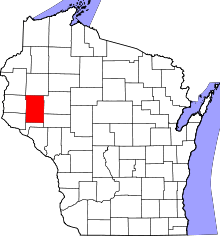 | |
| Villages | ||
| Towns | ||
| CDPs | ||
| Unincorporated communities | ||
| Ghost towns | ||
| Footnote | ‡This populated place also has portions in an adjacent county or counties | |