Kislingbury
| Kislingbury | |
 Kislingbury |
|
| Population | 1,221 [1](2001 census) 1,237 2011 census [2] |
|---|---|
| OS grid reference | SP697594 |
| – London | 69 miles (111 km) |
| Civil parish | Kislingbury |
| District | South Northamptonshire |
| Shire county | Northamptonshire |
| Region | East Midlands |
| Country | England |
| Sovereign state | United Kingdom |
| Post town | NORTHAMPTON |
| Postcode district | NN7 |
| Dialling code | 01604 |
| Police | Northamptonshire |
| Fire | Northamptonshire |
| Ambulance | East Midlands |
| EU Parliament | East Midlands |
| UK Parliament | Daventry |
|
|
Coordinates: 52°13′46″N 0°58′44″W / 52.229355°N 0.979027°W
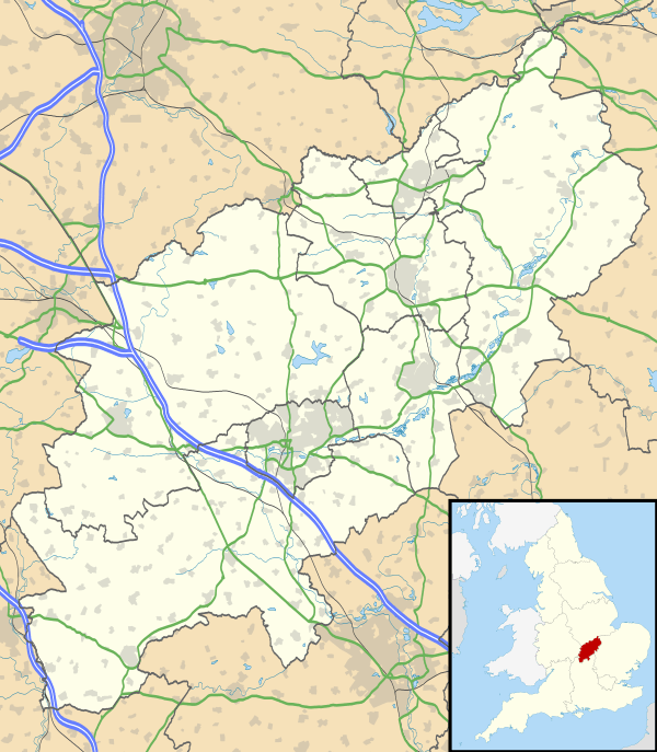
Kislingbury is a village in Northamptonshire, England, about 4 miles (6 km) west of Northampton town centre, and close to junctions 15A and 16 of the M1 motorway.
Demographics
2001 census data[1] shows 1,221 people resident in the Parish Council area consisting of 591 males and 630 females, in 497 household of which 79.5% were owner occupied or being purchased with a mortgage. At the 2011 census the population had increased to 1,237.[3]
Governance
The village is in the district council area of South Northamptonshire[4] where it is part of Harpole and Grange ward, together with the parishes of Milton Malsor, Harpole, Rothersthorpe and Gayton. It is within the area of Northamptonshire County Council and the Parliamentary Constituency of Daventry. The MP is currently Chris Heaton-Harris (Conservative). Prior to the 2010 General Election the village was in Northampton South constituency.
Transport
The A4500 main road runs just north of the village. The M1 London to Yorkshire motorway between junctions 15a and 16 passes and makes its presence known, close to the south west of the village, and junction 16 is just two miles distant.
Facilities
The village has three pub/restaurants, the most well-known being the Cromwell Cottage near the river, which has a tenuous historical connection with Oliver Cromwell: Parliamentarian forces spent a night nearby en route to Naseby. The others are the Old Red Lion along the High Street and The Sun Inn on Mill Road.
Surroundings
The River Nene flows past the village close by to the north, through an old, narrow bridge - narrow, that is, for both vehicles and the river which frequently floods. The most recent serious incident in 1998 caused flood damage to several houses in the village. Some flood attenuation work has since been carried out but it remains to be seen if this proves adequate. The village carries heavy traffic being on a route to the larger village of Bugbrooke with the large Campion Secondary School which serves the village and a large catchment area around. Heavy vehicles from sand quarries in the area and also Heygates Flour Mill also use the village main road. The village is on the same side of the motorway, and close to the Northampton Borough boundary with the urban area of the town slowly getting closer with developments to the western side of the town.
Kislingbury history timeline
The earliest evidence of settlers in the area is the discovery of an Iron Age funeral pot, complete with ashes, dated c1500BC at Upton.[5]
700 - 900AD Anglo Saxons settled in this part of the Nene Valley.
1042 - 1066 The parish of Ceselingeberie (as it was known then) was owned by a Saxon thegn name of Tonna, who also owned parts of Heyford, Stowe and Easton near Stamford.
1086 Domesday entries show Kislingbury divided into two manors, the smaller awarded to the Earl of Moreton by William the Conqueror. The larger given to Gilbert de Grant. Population ca.180 to 200. Through the years the village was owned by various families until eventually it was owned by Warine de Lisle who took up arms against the King Edward II in 1326 and was subsequently executed.
14th century
1326 The crown confiscated Warine de Lisles Manors therefore Kislingbury became the property of the crown but after the murder of Edward II the manor was restored to Warine's son Gerard. The manor then passed through families of Beauchamp to the Nevilles and Danvers. These were the last of the old mediaeval noblemen to control the parish.
1348 - 1349 The Black Death struck the village approximately one third of the population perished. The ironstone parish church built. The founder probably Gerald de Lisle during the reign of Edward III.
1360 Alexander, son of Robert the Chaplain of Kislingbury, took sanctuary in the church and confessed that he had killed Alexander Osebern of Harpole.
1377 First Poll Tax imposed, and again 1381.
15th century
1400s Kislingbury Town and Estate Charity founded.
1466 Rev John Rawlinson and Richard Rawlinson granted land to William Collins and other trustees of the Town and Estate Charity.
17th century
1611 Danvers family sell off Kislingbury to John Maunsell (a London lawyer) who then sell off parcels of land to local farmers. This had a significant effect in the village at it turned the community of mainly small tenant farmers into one of land-owning yeoman.
1645 Oliver Cromwell's troops stationed overnight prior to the battle of Naseby.
1663 May flood with around half to two thirds of houses were flooded to a depth of over 4 ft.
18th century
1740 Henry Jephcott (Rector) takes the Trustees of The Town and Estate Charity to the Chancery Court in London for using the charity's funds for their own purposes. The case was a victory for the Rector and a legal constitution was put in place to which the Trustee's had to abide.
1740s The Margaret Welch Charity founded.
1744 Decision made to educate the poor children of the village with funds from The Town and Estate Charity.
1745 First record of a child becoming a beneficiary of The Margaret Welch Charity.
1779 Act of Enclosure changed the village landscape considerably. Kislingbury Highway Charity founded, originally the Stone Pit Close Charity.
19th Century
1806 Town and Estate Charity purchase a house in the High Street, now part of 27 High Street, for school room and master's house.
1824/5 The first brick house built in Kislingbury, now 8 Mill Road.
1829 School moved possibly to part of the farm buildings, now 18 High Street.
1834 Village Workhouse closed and inmates transferred to the Union Workhouse Northampton.
1837 The school was moved yet again to its present site.
1838 Railway reached Northampton
1851 The number of farm labourers declined as land was used for animal husbandry and fewer farms used for arable farming.
1870 Act of Parliament provides primary education for all children. Before this schooling was a voluntary option and although there were 146 children on the school register, only 76 regularly attended. Implemented 1871.
1880s Factory Row, Mill Road built by shoemaker Samuel Collier of Northampton. Postal services and newspapers available in the village.
1810 Baptist Church founded.
1826 Wesleyan Chapel built in Chapel Lane.
1828 Baptist Chapel built in Mill Road on the site of the converted barn which was used for many years as the chapel.
1840s First grocers shop opened in Starmers Lane.
1884 Farm workers given the right to vote. (Town dwellers had this right from 1867.)
1888 Kislingbury Football Club formed.
1890 Kislingbury Cricket Club formed.
1891 Co-operative store opened in Church Lane and is still the village shop though now in private hands. Between 1801 and 1891 the population rose from 482 to 725 and dwellings from 105 to 168 (including some large dwellings divided up). Some of these houses were in very poor condition, some dating from the time of Elizabeth I.
1894 "The Vestry Meeting" by which parochial matters and administration were discussed and settled was abolished and elected parish councils formed.
1895 Typhoid outbreak caused by contaminated water drunk at the choir supper. 10 people died.
1898 Due to the Typhoid outbreak land was purchased on Berrywood Hill from which a spring arose and pure water piped to the village.
20th century
1913 First bus service available from the turn to either Daventry or Northampton.
1914/18 World War I. Twenty villagers lost their lives serving the country.
1920 War memorial raised in the church yard.
1922/3 Rural district council built six new homes off Bugbrooke Road and over 40 condemned houses some of them built in the reign of Elizabeth I demolished.
1923/4 Gas and Electricity laid to the village. Wesleyan Chapel closed and sold.
1939 Outbreak of World War II. Five men and a woman lost their lives serving the country. The village became home to several refugees, some made making their homes here permanently after the war.
1940 First tractor seen in the village.
1954 Council housing built in Millers Close, Twigden Road, Dukes Green, Mill Lane and Willow View. Many now privately owned by previous tenants. Construction of sewage plant.
1952 Village purchases old land army hostel and converts into a village hall.
1960s Construction of private houses in Willow View and Riverside Court.
1968/9 Construction of private houses in The Orchard and Hall Close. Formation of Kislingbury Playing Field Association.
1970s Wesleyan Chapel converted to private house.
1971 Re-formation of Kislingbury Bowls Club.
1972 Opening of Playing Field in Beech Lane. Purchased by public subscription.
1976 Due to the cost of maintaining the field, the Highways Charity sold it and invested the capital in investment funds approved by the Charity Commissioners
1977 Queen Elizabeth II's Silver Jubilee celebrations.
1992 Residents of the new part of Willow View hold street party to celebrate 25 years of living together as most of the original owners were still here.
1997 Old Village Hall demolished and part of the site sold for private houses with sufficient funds realised to replace the village hall with tradition style modern building. Construction of private houses in Lichfield Close and Ashby Court
1998 Very serious flooding again, the worse in living memory. Plans put into action to find ways and means to alleviate flooding ever happening again.
21st Century
2002 Queen Elizabeth II's Golden Jubilee celebrations. Village website established.
2003 Flood defences built by the Environment Agency along the river bank from The Whirly up to and including The Bridge and on to the playing fields. Cost £1.4 million. Funding was provided by the Welland and Nene Flood Defence Committee with grant aid from DEFRA. Population now 1,246 in 451 houses.
2004 25 September - Village "Future Needs Day" held to assist the design of a future needs questionnaire
References
- 1 2 "UK census 2001 - data". Retrieved 2008-08-28.
- ↑ SNC (2009). South Northamptonshire Council Year Book 2010-2011. Towcester NN12 7FA. p. 39.
- ↑ "Civil Parish population 2011". Office for National Statistics. Retrieved 5 July 2016.
- ↑ "SNC District Council". Retrieved 2008-08-28.
- ↑ Tutchener, John Victor (2000). Kislingbury, A Glimpse at its Past. Sunningdale Publishing. ISBN 0-9538266-0-0.
External links
![]() Media related to Kislingbury at Wikimedia Commons
Media related to Kislingbury at Wikimedia Commons