Kenefic, Oklahoma
| Kenefic, Oklahoma | |
|---|---|
| Town | |
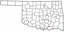 Location of Kenefic, Oklahoma | |
| Coordinates: 34°8′55″N 96°21′42″W / 34.14861°N 96.36167°WCoordinates: 34°8′55″N 96°21′42″W / 34.14861°N 96.36167°W | |
| Country | United States |
| State | Oklahoma |
| County | Bryan |
| Area | |
| • Total | 1.0 sq mi (2.5 km2) |
| • Land | 1.0 sq mi (2.5 km2) |
| • Water | 0.0 sq mi (0.0 km2) |
| Elevation | 673 ft (205 m) |
| Population (2010) | |
| • Total | 196 |
| • Density | 196.3/sq mi (75.8/km2) |
| Time zone | Central (CST) (UTC-6) |
| • Summer (DST) | CDT (UTC-5) |
| ZIP code | 74748 |
| Area code(s) | 580 |
| FIPS code | 40-39200[1] |
| GNIS feature ID | 1094325[2] |
Kenefic is a town in Bryan County, Oklahoma, United States. The population was 196 at the 2010 census, a 2 percent increase from 192 at the 2000 census.[3] The town was named for William Kenefick, president of the Missouri, Oklahoma and Gulf Railroad (MO&G), which had constructed a rail line through the region. The town name has been spelled both Kenefic and Kenefick throughout its history.[4]
Geography
According to the United States Census Bureau, the town has a total area of 1.0 square mile (2.6 km2), all of it land.
Climate
| Climate data for Kenefic, Oklahoma | |||||||||||||
|---|---|---|---|---|---|---|---|---|---|---|---|---|---|
| Month | Jan | Feb | Mar | Apr | May | Jun | Jul | Aug | Sep | Oct | Nov | Dec | Year |
| Average high °F (°C) | 50.1 (10.1) |
55.4 (13) |
64.4 (18) |
73.7 (23.2) |
80.6 (27) |
88.3 (31.3) |
93.9 (34.4) |
93.6 (34.2) |
85.5 (29.7) |
76.0 (24.4) |
63.7 (17.6) |
53.9 (12.2) |
73.3 (22.9) |
| Average low °F (°C) | 26.3 (−3.2) |
31.6 (−0.2) |
40.1 (4.5) |
50.6 (10.3) |
58.8 (14.9) |
66.7 (19.3) |
70.7 (21.5) |
69.4 (20.8) |
62.3 (16.8) |
50.7 (10.4) |
40.1 (4.5) |
30.5 (−0.8) |
49.8 (9.9) |
| Average precipitation inches (mm) | 2.0 (51) |
2.6 (66) |
3.7 (94) |
4.2 (107) |
5.6 (142) |
4.6 (117) |
2.3 (58) |
2.6 (66) |
5.4 (137) |
4.2 (107) |
3.1 (79) |
2.2 (56) |
42.6 (1,082) |
| Source #1: weather.com | |||||||||||||
| Source #2: Weatherbase [5] | |||||||||||||
Demographics
| Historical population | |||
|---|---|---|---|
| Census | Pop. | %± | |
| 1920 | 413 | — | |
| 1930 | 284 | −31.2% | |
| 1940 | 227 | −20.1% | |
| 1950 | 115 | −49.3% | |
| 1960 | 125 | 8.7% | |
| 1970 | 153 | 22.4% | |
| 1980 | 140 | −8.5% | |
| 1990 | 147 | 5.0% | |
| 2000 | 192 | 30.6% | |
| 2010 | 196 | 2.1% | |
| Est. 2015 | 204 | [6] | 4.1% |
As of the census[1] of 2000, there were 192 people, 69 households, and 48 families residing in the town. The population density was 196.3 people per square mile (75.6/km²). There were 77 housing units at an average density of 78.7 per square mile (30.3/km²). The racial makeup of the town was 78.65% White, 18.75% Native American, 1.04% from other races, and 1.56% from two or more races. Hispanic or Latino of any race were 1.04% of the population.
There were 69 households out of which 36.2% had children under the age of 18 living with them, 56.5% were married couples living together, 11.6% had a female householder with no husband present, and 29.0% were non-families. 23.2% of all households were made up of individuals and 13.0% had someone living alone who was 65 years of age or older. The average household size was 2.78 and the average family size was 3.35.
In the town the population was spread out with 32.8% under the age of 18, 8.3% from 18 to 24, 31.3% from 25 to 44, 17.2% from 45 to 64, and 10.4% who were 65 years of age or older. The median age was 29 years. For every 100 females there were 106.5 males. For every 100 females age 18 and over, there were 98.5 males.
The median income for a household in the town was $23,036, and the median income for a family was $24,464. Males had a median income of $22,500 versus $19,375 for females. The per capita income for the town was $10,763. About 21.8% of families and 23.9% of the population were below the poverty line, including 33.8% of those under the age of eighteen and 8.0% of those sixty five or over.
References
- 1 2 "American FactFinder". United States Census Bureau. Retrieved 2008-01-31.
- ↑ "US Board on Geographic Names". United States Geological Survey. 2007-10-25. Retrieved 2008-01-31.
- ↑ CensusViewer:Kenefic, Oklahoma Population
- ↑ O'Dell, Larry. "Kenefic," Encyclopedia of Oklahoma History and Culture, Oklahoma Historical Society, 2009. Accessed April 15, 2015.
- ↑ "Historical Weather for Kenefic, Oklahoma, United States".
- ↑ "Annual Estimates of the Resident Population for Incorporated Places: April 1, 2010 to July 1, 2015". Retrieved July 2, 2016.
- ↑ "Census of Population and Housing". Census.gov. Retrieved June 4, 2015.
Municipalities and communities of Bryan County, Oklahoma, United States | ||
|---|---|---|
| City | 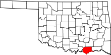 | |
| Towns | ||
| CDPs | ||
| Other unincorporated communities | ||
| Ghost towns | ||
| Achille | ||
|---|---|---|
| Bokchito | ||
| Caddo |
| |
| Colbert | ||
| Durant |
| |
| Kenefic | ||
| Nida | ||