Kampala–Mpigi Expressway
| Kampala–Mpigi Expressway | |
|---|---|
| Route information | |
| Length: | 22 mi (35 km) |
| History: |
Designated in 2016 (Expected) Expected completion in 2018 |
| Major junctions | |
| North end: | Kampala |
|
Kibuye Busega Kyengera Nsangi | |
| South end: | Mpigi |
| Highway system | |
| Roads in Uganda | |
The Kampala–Mpigi Expressway is a proposed four-lane, dual carriage highway in the Central Region of Uganda, connecting, Kampala, the capital city, and Mpigi, the headquarters of Mpigi District.
Location
The road starts at Kibuye, a neighborhood in Makindye Division in the city of Kampala. It continues southwest through Busega, Kyengera, and Nsangi to end at Mpigi, a distance of approximately 36 kilometres (22 mi).[1] The approximate coordinates of the road, near the town of Maya, are 0°15'54.0"N, 32°25'49.0"E (Latitude:0.265012; Longitude:32.430288).[2] The expressway is a component of Kampala–Masaka Road.[3]
Background
The current road is a two-lane single carriageway in good condition. The government of Uganda plans to widen the road to a four-lane dual carriage highway, as part of it efforts to decongest Kampala. It is envisaged that the construction will be funded under a public-private partnership arrangement.[4]
Timetable
Widening of the current two-lane road to a four-lane highway was expected to begin in 2016. However, in 2014, the China Communications Construction Company, which is constructing the Entebbe–Kampala Expressway that intersects with the Kampala–Mpigi Expressway, was contracted to construct that interchange at Busega and to construct 9 kilometres (6 mi) on the latter to save money and time.[5]
Construction costs
Application for funding has been made to the African Development Bank.[6] The estimated cost of the road was budgeted at approximately US$100 million, as reported by the Daily Monitor.[7] However, another source has put the cost at US$350 million.[8]
See also
References
- ↑ GFC (10 February 2016). "Distance between Kampala Road, Kampala, Central Region, Uganda and Mpigi Town Council offices, Mpigi, Central Region, Uganda". Globefeed.com (GFC). Retrieved 10 February 2016.
- ↑ Google (10 February 2016). "Location of Kampala–Mpigi Expressway" (Map). Google Maps. Google. Retrieved 10 February 2016.
- ↑ GFC (1 March 2016). "Map of Kampala–Masaka Road Showing Commonality With Kampala–Mpigi Expressway for the first 22 Miles". Globefeed.com (GFC). Retrieved 1 March 2016.
- ↑ UNRA (10 February 2016). "Uganda Roads PPP Projects: Kampala–Mpigi Expressway". Kampala: Uganda National Roads Authority (UNRA). Retrieved 10 February 2016.
- ↑ Wanyenya, Prisca (9 May 2014). "UNRA Announces Changes on Kampala-Entebbe Express Highway". The Red Pepper. Kampala.
- ↑ AfDB (28 October 2015). "Kampala–Mpigi & Mirama Hills Bridge (Kagitumba)–Kayonza–Rusumo Project (Rwanda/Uganda): Status - Pipeline". Abidjan: African Development Bank (AfDB). Retrieved 10 February 2016.
- ↑ Tumusiime, Abdulaziizi (16 January 2015). "UNRA to get Shs3 trillion for funding new road projects". Daily Monitor. Kampala. Retrieved 10 February 2016.
- ↑ Ogwang, Joel (23 October 2013). "Ugandan government joins World Bank to build $1.5b road projects". Kampala: AfricanInvestor.com Quoting New Vision. Retrieved 12 February 2016.
External links
- Uganda National Road Authority Homepage
- Ugandan Government Increases Road Network Funding
- Uganda: Work On Shs5 Trillion Jinja Expressway to Start in March 2016

Capital: Mpigi | ||
| Counties and sub-counties | Mawokota County | 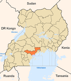 |
| Towns and villages | ||
| Geography | ||
| Economy | ||
| Notable landmarks | ||
| Transport | ||
| Health | ||
| Education | ||
| Notable people | ||

Coordinates: 00°15′54″N 32°25′49″E / 0.26500°N 32.43028°E