Entebbe
| Entebbe | |
|---|---|
 | |
 Entebbe Location in Uganda | |
| Coordinates: 00°03′00″N 32°27′36″E / 0.05000°N 32.46000°E | |
| Country |
|
| Region | Central Uganda |
| District | Wakiso District |
| Government | |
| • Mayor | Vincent Kayanja[1] |
| Area | |
| • Total | 21.7 sq mi (56.2 km2) |
| • Water | 8 sq mi (20 km2) |
| Elevation | 3,870 ft (1,180 m) |
| Population (2014 Census) | |
| • Total | 69,958[2] |
Entebbe is a major town in Central Uganda. On a Lake Victoria peninsula, approximately 37 kilometres (23 mi) southwest of the Ugandan capital, Kampala, it was once the seat of government for the Protectorate of Uganda prior to independence, in 1962. Entebbe is the location of Entebbe International Airport, Uganda's largest commercial and military airport, best known for the dramatic rescue of 100 hostages kidnapped by the resistance group of the PFLP-EO and Revolutionary Cells (RZ) organizations. Entebbe is also the location of State House, the official office and residence of the President of Uganda.
Etymology
The word came from Luganda language e ntebe which means 'seat' / 'chair'. Entebbe was the seat of the colonial governor in the early 1900s, when the country was a British protectorate, and is now the location of the official office and residence of the President of Uganda, hence the name. Entebbe is the seat of power in the country.
Location
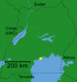
Entebbe sits on the northern shores of Lake Victoria, Africa's largest lake. The town is situated in Wakiso District, approximately 37 kilometres (23 mi) southwest of Kampala, Uganda's capital and largest city.[3] The municipality is located on a peninsula into Lake Victoria, covering a total area of 56.2 square kilometres (21.7 sq mi), out of which 20 km2 (7.7 sq mi) is water. The coordinates of Entebbe are:0°03'00.0"N, 32°27'36.0"E (Latitude:0.0500; Longitude:32.4600).[4]
Population
During the 2002 national census, Entebbe's population was estimated at about 55,100 people. In 2010, the Uganda Bureau of Statistics (UBOS) estimated the population of the town at 76,500. In 2011, UBOS estimated the population of Entebbe at approximately 79,700.[5] On 27 August 2014, the national population census put Entebbe's population at 69,958.[2]
History
"Entebbe", in the local Luganda language, means a "seat" and was probably named that because it was the place where a Baganda chief sat to adjudicate legal cases. It first became a British colonial administrative and commercial centre in 1893 when Sir Gerald Portal, a colonial Commissioner, used it as a base. Port Bell went on to become Kampala's harbour. Although no ships dock there now, there is still a jetty, which was used by Lake Victoria ferries. Entebbe is perhaps best known to Europeans as the home of Entebbe International Airport, the main international airport of Uganda, which was first opened in 1929. Entebbe airport was the scene of a hostage situation and a rescue operation in 4 July 1976, when soldiers from an elite unit of the Israeli army freed over 100 hostages following a hijacking by a group of Palestinian and German militia. It was also from this airport that Queen Elizabeth II departed Africa to return to England in 1952 when she learned of her father's death and that she had become Queen. The city of Entebbe also hosted final resolution talks to end the M23 rebellion.
Tourist attractions
- The extensive National Botanical Gardens, laid out in 1898, are located in Entebbe.
- Entebbe is the home of the Uganda Virus Research Institute (UVRI)
- Entebbe is the location of the Uganda Wildlife Education Centre (UWEC)[6] The Centre also serves as the national zoo. The entrance to the Centre is located near the jetty. Foreign visitors have noted the seeming incongruity of wild monkeys sitting in the trees over the Centre's paths.
- Entebbe is the location of Nkumba University, one of the more than thirty licensed institutions of tertiary education in Uganda.
- State House, the official residence of the President of Uganda, is located in Entebbe.[7]
- Entebbe is also home to the historical site in Kigungu where the first catholic missionaries Brother Amans and Father Mon Maple Lourdel landed to establish the catholic faith in Uganda.
 Sunset over Entebbe
- Bugonga Church in Entebbe
 Entebbe sits on the northern shores of Lake Victoria
 Entebbe along Lake Victoria
- Entebbe is home of the oldest golf course in East Africa called Entebbe Golf Club, which was established in 1900. Entebbe Golf Club is surrounded by the Uganda Wildlife Education Centre, (formerly Entebbe Zoo), on its south side.
Government and infrastructure
The head office of the Ministry of Works and Transport is in Entebbe.[8][9]
The head office of the Ugandan Civil Aviation Authority is on the property of Entebbe International Airport.[10]
Other points of interest
Other points of interest within the city limits or close to its edges include the offices of Entebbe City Council and several branches of foreign and indigenous commercial banks. The supermarket chain, Nakumatt, planned to open a store in Entebbe in 2012.[11] In 2014, the American fast-food chain KFC opened a franchise in the town.[12]
Climate
Entebbe experiences tropical rainforest climate (Af) according to the Köppen climate classification as the city has no real dry season throughout the year. The driest season is January with precipitation total 65 millimetres (2.6 in), while the wettest season is April with precipitation total 256 millimetres (10.1 in). The temperature is moderated by the altitude. The hottest month is February with average temperature 22.8 °C (73.0 °F), while the coolest month is July with average temperature 20.6 °C (69.1 °F).
| Climate data for Entebbe, Uganda (1961–1990) | |||||||||||||
|---|---|---|---|---|---|---|---|---|---|---|---|---|---|
| Month | Jan | Feb | Mar | Apr | May | Jun | Jul | Aug | Sep | Oct | Nov | Dec | Year |
| Record high °C (°F) | 31.3 (88.3) |
31.7 (89.1) |
30.6 (87.1) |
30.0 (86) |
28.9 (84) |
27.8 (82) |
28.1 (82.6) |
28.9 (84) |
29.8 (85.6) |
29.6 (85.3) |
31.7 (89.1) |
29.5 (85.1) |
31.7 (89.1) |
| Average high °C (°F) | 26.3 (79.3) |
27.3 (81.1) |
26.7 (80.1) |
26.0 (78.8) |
25.4 (77.7) |
25.2 (77.4) |
25.3 (77.5) |
25.9 (78.6) |
26.5 (79.7) |
26.5 (79.7) |
26.0 (78.8) |
26.5 (79.7) |
26.1 (79) |
| Average low °C (°F) | 18.0 (64.4) |
18.3 (64.9) |
18.5 (65.3) |
18.4 (65.1) |
18.0 (64.4) |
17.8 (64) |
17.2 (63) |
17.4 (63.3) |
17.4 (63.3) |
17.7 (63.9) |
17.9 (64.2) |
17.8 (64) |
17.9 (64.2) |
| Record low °C (°F) | 13.0 (55.4) |
10.7 (51.3) |
14.4 (57.9) |
12.2 (54) |
14.3 (57.7) |
14.0 (57.2) |
10.0 (50) |
12.0 (53.6) |
13.2 (55.8) |
13.9 (57) |
14.3 (57.7) |
13.8 (56.8) |
10.0 (50) |
| Average precipitation mm (inches) | 86.7 (3.413) |
84.4 (3.323) |
184.5 (7.264) |
264.4 (10.409) |
253.8 (9.992) |
116.2 (4.575) |
72.1 (2.839) |
77.8 (3.063) |
79.0 (3.11) |
127.6 (5.024) |
171.7 (6.76) |
120.6 (4.748) |
1,638.8 (64.52) |
| Average precipitation days (≥ 1.0 mm) | 7.3 | 7.3 | 13.1 | 16.8 | 16.2 | 9.4 | 6.9 | 6.3 | 7.1 | 10.7 | 13.6 | 10.2 | 124.9 |
| Average relative humidity (%) | 76 | 76 | 77 | 79 | 79 | 78 | 77 | 78 | 76 | 75 | 76 | 76 | 77 |
| Mean monthly sunshine hours | 234 | 204 | 205 | 181 | 191 | 187 | 197 | 194 | 194 | 205 | 202 | 214 | 2,408 |
| Source #1: World Meteorological Organization[13] | |||||||||||||
| Source #2: Deutscher Wetterdienst (extremes and humidity),[14] Danish Meteorological Institute (sun, 1931–1960)[15] | |||||||||||||
See also
References
- ↑ Ssebuyira, Martin (26 May 2011). "New Entebbe Mayor Faces Sh600 Million Debt Hurdle". Daily Monitor via AllAfrica.com. Retrieved 17 April 2014.
- 1 2 UBOS (27 August 2014). "The Population of The Regions of the Republic of Uganda And All Cities And Towns of More Than 15,000 Inhabitants". Citypopulation.de Quoting Uganda Bureau of Statistics (UBOS). Retrieved 12 December 2015.
- ↑ "Map Showing Kampala And Entebbe With Distance Marker". Globefeed.com. Retrieved 17 April 2014.
- ↑ Google (2 July 2015). "Location of Entebbe At Google Maps" (Map). Google Maps. Google. Retrieved 2 July 2015.
- ↑ "Estimated Population of Entebbe In 2002, 2010 & 2011" (PDF). Uganda Bureau of Statistics. Retrieved 17 April 2014.
- ↑ "UWEC Homepage". Uganda Wildlife Education Centre. Retrieved 18 April 2014.
- ↑ "Homepage of State House Entebbe". State House Entebbe. Retrieved 18 April 2014.
- ↑ "Home." Ministry of Works and Transport. Retrieved on 30 November 2013. "P.O. Box 10 Entebbe Plot 4/6, Airport Road, Ebb"
- ↑ "Contact Us." (Archive) Ministry of Works and Transport. 16 April 2010. Retrieved on 30 November 2013. "Ministry of Works and Transport Plot 4/6 Airport Road P.O.Box 10 Entebbe"
- ↑ "Contacts." Civil Aviation Authority17 December 2009. Retrieved on 28 January 2013. "Contact Information Head Office Entebbe International Airport P.O. Box 5536, Kampala"
- ↑ Namono, Lydia. "Foreign Retailers Flooding Uganda Market." Daily Monitor. Tuesday 20 March 2012. Retrieved on 28 January 2013.
- ↑ Ogwal, Lawrence (31 July 2014). "KFC Opens New Branch At Victoria Mall In Entebbe". Daily Monitor (Kampala). Retrieved 3 September 2014.
- ↑ "World Weather Information Service – Entebbe". World Meteorological Organization. Retrieved 1 September 2016.
- ↑ "Klimatafel von Entebbe (Flugh.) / Uganda" (PDF). Federal Ministry of Transport and Digital Infrastructure. Retrieved 14 June 2016.
- ↑ "STATIONSNUMMER 63705" (PDF). Ministry of Energy, Utilities and Climate. Archived from the original on January 16, 2013. Retrieved 14 June 2016.
External links
| Wikivoyage has a travel guide for Entebbe. |
![]() Media related to Entebbe at Wikimedia Commons
Media related to Entebbe at Wikimedia Commons

Coordinates: 00°03′00″N 32°27′36″E / 0.05000°N 32.46000°E