Kalkallo, Victoria
| Kalkallo Victoria | |
|---|---|
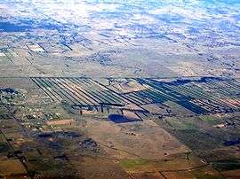 Region north of Kalkallo with volcano at Bald Hill | |
 Kalkallo | |
| Coordinates | 37°31′37″S 144°56′49″E / 37.52694°S 144.94694°ECoordinates: 37°31′37″S 144°56′49″E / 37.52694°S 144.94694°E |
| Postcode(s) | 3064 |
| Location |
|
| LGA(s) | City of Hume |
| State electorate(s) | Yuroke |
| Federal Division(s) | McEwen |
Kalkallo is a town in Victoria, Australia, 33 km north of Melbourne's central business district. It is local government area is the City of Hume.
Located on the Hume Freeway, Kalkallo has a few streets, a service station and a pub. It is surrounded by farms not yet developed by the urban sprawl of Melbourne. The nearest access to public transport is the Donnybrook railway station which is serviced by regional VLine trains.
History
The Kalkallo area is located on the traditional lands of the people of the Woiwurrung. It is believed that the clan which occupied land including the South Morang area was the Wurundjeri William. Colonisation occurred in Victoria from 1835, and land sales commenced in the Parish of Kalkallo in 1840.[1] An example of an early rural town settlement, Kalkallo contains many natural and cultural heritage sites of significance including churches, hotels, monuments, bridges, waterways and grasslands.[2] In 1848 residents began requesting a post office for the township, and Kinlochewe Post Office opened on 1 November 1850. The post office was located in the Robert Burns Inn on Summerhill Road and Sydney Road.[3] In 1854 it was moved and renamed Donnybrook, then renamed Kalkallo in 1874, before eventually closing in 1971.[4] During the gold rush years the town boomed as travellers made their way up Sydney Road and the township featured seventeen accommodation houses, a police station, jail and court house. In the 1870s the duplication of the Hume Highway and the opening of the north-east railway decimated the population.[5]
Environment
Kalkallo is located amongst the large Gilgai plain.[6] Located near Donovans Lane north-west of the town centre,[7] is Bald Hill volcano that last erupted over 1 million years ago.[8] Merri Creek runs through Kalkallo to the east of the township. The Kalkallo Grasslands are remnants of a large area of grassland which houses many threatened species of plants, amphibians and reptiles:[6]
Flora
- Gilgai Brown Grass
- Small Pepper Cress
- Dianella amoena
- Prasophyllum frenchii
- Pussy tails
- Narrow-leaf new holland daisy
- Chaffy bush-pea
- Smooth rice flower
- Plains Yam Daisy
Fauna
- Growling Grass Frog
- Red-chested buttonquail
- Plains froglet
- Common spade foot toad
- Cunninghams skink
- Bougainvilles skink
- Lowland copperhead
- Australian Smelt
- Water Rat
- Engaeus Quadrimanus
- Eastern three-lined skink
- Tussock skink
- Little whip snake
- Southern lined earless dragon
- Striped legless lizard
Planning
Kalkallo has been a focus of a number of town planning ideas since colonisation, but remains largely undeveloped in 2015, however there are a number of housing developments current being planned and built.
Garden City
As part of the publication We Must Go On: A Study of Planned Reconstruction and Housing F.O. Barnett along with W.O. Burt and Frank Heath focused on improvement of housing in Australia and Melbourne after World War II. Barnett and Burt played a significant role in the Housing Investigation and Slum Abolition Board and the garden city movement was a central focus proposed to solve the slum problems in Melbourne. Frank Heath was an architect who produced town plans based on garden city principles, and plans for Kalkallo as a garden city are printed in We Must Go On. The book does not detail the motives for these plans, however they were never implemented, and as a result Kalkallo remains a small township.
Urban Growth Boundary
Melbourne's Urban Growth Boundary was extended to include Kalkallo in 2010.[9] It was designated as part of the Urban Growth Zone in 2012. [10] Urban sprawl is a divisive topic in Melbourne as it is claimed to ease housing affordability, but can have significant impacts on the environment, as well as social impacts such as isolation due to a lack of transport infrastructure. The Victorian State Government has expanded the Urban Growth Boundary several times since 2002 as a result of the Melbourne 2030 plan (later known as Melbourne@5million). Melbourne 2030 introduced the notion of creating a limit on urban expansion. However, since the implementation of Melbourne 2030, the boundary has been extended, which is contradictory to a key objective. Plan Melbourne, established in May 2014 [11] highlighted the need for the Metropolitan Planning Authority to establish a permanent urban boundary to replace the urban growth boundary, and restrict further expansion.
Today
Kalkallo is a small town servicing the highway trade and surrounding agricultural district.[1] Current community infrastructure includes:
- Kalkallo Common (a 9.8 ha crown land grassland reserve managed by Hume City Council)
- Kalkallo Cemetery
- Kalkallo CFA
- John Laffan Memorial Reserve (an 8ha reserve containing two ovals)
New housing developments
As a result of the urban growth boundary expansion, there have been a number of new housing developments established:
- Merrifield [12]
Merrifield is an 880 hectare $8 Billion mixed-use development located on the corner of Donnybrook Road and the Hume Highway. Merrifield has been planned as an integrated mixed use development with capacity to provide 20,000 new jobs and homes for up to 30,000 people.
- Cloverton [13]
Located around the Ball Hill area, plans include a large metropolitan activity centre and a future train station north of Donnybrook.[14] Clovertown will eventually house 30,000 residents.
- Kallo [15]
A smaller development north of Donnybrook Road that will border Merri Creek, close to the existing Donnybrook train station. Master plans outline 730 homes with 2000 residents with facilities such as a community centre, primary school, open space, nature reserve and town centre.
- The Woods - Mickleham [16]
See also
- City of Whittlesea - the local government area of which Kalkallo was a part.
References
- 1 2 Metropolitan Planning Authority, Lockerbie Precinct Structure Plan (PDF), retrieved 2015-05-25
- ↑ Hume Planning Scheme, Townships Local Policy (PDF), retrieved 2015-05-20
- ↑ Craigieburn Historical Interest Group, Kinlochewe Post Office, retrieved 2015-05-22
- ↑ Premier Postal History, Post Office List, retrieved 2008-04-11
- ↑ Hutchison, Gary, In Memoriam: A guide to history and heritage of Victoria's cemeteries (PDF), retrieved 2015-05-20
- 1 2 Merri Creek Management Committee, Kalkallo-Donnybrook North Railway Reserve, retrieved 2015-05-22
- ↑ Victorian Resources Online, Bald Hill (Kalkallo), retrieved 2015-05-21
- ↑ Victorian Volcanos, Bald Hill (Kalkallo), retrieved 2015-05-21
- ↑ The Age, Melbourne Heads North to Kalkallo, retrieved 2015-05-21
- ↑ Metropolitan Planning Authority, Map Urban Growth Zone, retrieved 2015-05-21
- ↑ Plan Melbourne, Metropolitan Planning Strategy, retrieved 2015-05-10
- ↑ Merrifield Melbourne, Merrifield, retrieved 2015-05-25
- ↑ Stockland, Cloverton Master Plan (PDF), retrieved 2015-05-25
- ↑ Stockland, Cloverton, retrieved 2015-05-25
- ↑ Kallo, Kallo, retrieved 2015-05-28
- ↑ The Woods Mickleham, The Woods, retrieved 2015-05-28