Joon Aryk
| Joon Aryk (Жоон Арык) | |
| River | |
 | |
| Country | Kyrgyzstan |
|---|---|
| Region | Naryn Province |
| District | Kochkor District |
| Source | confluence of Kara-Kujur River and Telek River |
| Mouth | Chu River |
| - elevation | 1,802 m (5,912 ft) |
| - coordinates | KG 42°13′15.60″N 75°44′29″E / 42.2210000°N 75.74139°ECoordinates: KG 42°13′15.60″N 75°44′29″E / 42.2210000°N 75.74139°E |
| Length | 34.8 km (22 mi) |
| Basin | 1,340 km2 (517 sq mi) |
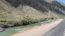
The Joon Aryk (Kyrgyz: Жоон Арык) is a river in Kochkor District of Naryn Province of Kyrgyzstan. It is formed by confluence of Kara-Kujur and Telek rivers. The length of the river is 34.8 km (22 mi), basin area - 1340 square kilometers, and average annual discharge - 11.4 cubic meters per second. Chu River is formed by the confluence of Kochkor River and Joon Aryk near village Kochkor.[1]
References
This article is issued from Wikipedia - version of the 6/15/2016. The text is available under the Creative Commons Attribution/Share Alike but additional terms may apply for the media files.