Jhalari-Pipaladi Municipality
| Jhalari-Pipaladi Municipality झलारी-पिपलाडी नगरपालिका | |
|---|---|
| Municipality | |
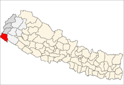
 Jhalari-Pipaladi Municipality Location in Nepal | |
| Coordinates (Jhalari-Pipaladi): 28°57′26″N 80°17′17″E / 28.95722°N 80.28806°ECoordinates: 28°57′26″N 80°17′17″E / 28.95722°N 80.28806°E | |
| Country |
|
| Regions | Eastern |
| Zone | Mahakali Zone |
| District | Kanchanpur District |
| Population (2011)[1] | |
| • Total | 42,026 |
| 2011 Nepal census | |
| Time zone | Nepal Time (UTC+5:45) |
| Area code(s) | +977-099 |
Jhalari-Pipaladi is a municipality in Kanchanpur District in the Mahakali Zone of south-western Nepal. The new municipality was formed by merging two existing villages—Jhalari and Pipaladi—on 18 May 2014.[2][3] The office of the municipality is that of the former Jhalari village development committee.
Population
At the time of the 2011 Nepal census, Jhalari and Pipaladi had a population of 24,347 and 17,679 people living in 4,782 and 3,243 individual households respectively.[1] Now it had a total population of 42,026 people living in 8,025 individual households.
References
- 1 2 "National Population and Housing Census 2011(Ward Level)" (PDF). Central Bureau of Statistics. Government of Nepal. November 2012. Retrieved November 2012. Check date values in:
|access-date=(help) - ↑ "72 new municipalities announced". My Republica.com. Retrieved 2014-06-10.
- ↑ "Government announces 72 new municipalities". The Kathmandu Post. Retrieved 2014-06-10.
External links
See also
Headquarter: Mahendranagar | ||
 | ||
This article is issued from Wikipedia - version of the 8/26/2016. The text is available under the Creative Commons Attribution/Share Alike but additional terms may apply for the media files.