Dodhara-Chandani Municipality
| Dodhara-Chandani Municipality दोधारा-चाँदनी नगरपालिका | |
|---|---|
| Municipality | |
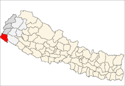
 Dodhara-Chandani Municipality Location in Nepal | |
| Coordinates (Dodhara-Chandani): 28°54′3″N 80°5′13″E / 28.90083°N 80.08694°ECoordinates: 28°54′3″N 80°5′13″E / 28.90083°N 80.08694°E | |
| Country |
|
| Regions | Far-Western |
| Zone | Mahakali Zone |
| District | Kanchanpur District |
| Population (2011)[1] | |
| • Total | 39,253 |
| 2011 Nepal census | |
| Time zone | Nepal Time (UTC+5:45) |
| Area code(s) | +977-99 |
Dodhara-Chandani is a municipality in Kanchanpur District in the Mahakali Zone of south-western Nepal. The new municipality was formed by merging two existing villages—Dodhara and Chandani—on 18 May 2014.[2][3] The office of the municipality is that of the former Dodhara village development committee.
Population
At the time of the 2011 Nepal census, Dodhara and Chandani had a population of 19,703 and 19,550 people living in 3,732 and 3,660 individual households respectively.[1] Now it had a total population of 39,253 people living in 7,392 individual households.
Education
The Bhanu Higher secondary school at Dodhara-chandani-6, is the only Bachelor level campus. Few Private schools and government managed schools, as well as few community managed schools are present here.
References
- 1 2 "National Population and Housing Census 2011(Ward Level)" (PDF). Central Bureau of Statistics. Government of Nepal. November 2012. Retrieved November 2012. Check date values in:
|access-date=(help) - ↑ "72 new municipalities announced". My Republica.com. Retrieved 2014-06-10.
- ↑ "Government announces 72 new municipalities". The Kathmandu Post. Retrieved 2014-06-10.
External links
See also
Headquarter: Mahendranagar | ||
 | ||