Jesterville, Maryland
| Jesterville | |
|---|---|
| Census-designated place | |
 Jesterville  Jesterville Location within the state of Maryland | |
| Coordinates: 38°17′12″N 75°53′45″W / 38.28667°N 75.89583°WCoordinates: 38°17′12″N 75°53′45″W / 38.28667°N 75.89583°W | |
| Country | United States |
| State | Maryland |
| County | Wicomico |
| Area[1] | |
| • Total | 1.820 sq mi (4.71 km2) |
| • Land | 1.586 sq mi (4.11 km2) |
| • Water | 0.234 sq mi (0.61 km2) |
| Elevation | 10 ft (3 m) |
| Population (2010)[2] | |
| • Total | 188 |
| • Density | 100/sq mi (40/km2) |
| Time zone | Eastern (EST) (UTC-5) |
| • Summer (DST) | EDT (UTC-4) |
| Area code(s) | 410 & 443 |
| GNIS feature ID | 590561[3] |
Jesterville is an unincorporated community and census-designated place in Wicomico County, Maryland, United States.[3] Its population was 188 as of the 2010 census.[2] It is part of the Salisbury, Maryland-Delaware Metropolitan Statistical Area.
References
- ↑ "US Gazetteer files: 2010, 2000, and 1990". United States Census Bureau. 2011-02-12. Retrieved 2011-04-23.
- 1 2 "American FactFinder". United States Census Bureau. Retrieved 2011-05-14.
- 1 2 "Jesterville". Geographic Names Information System. United States Geological Survey.
Municipalities and communities of Wicomico County, Maryland, United States | ||
|---|---|---|
| Cities | 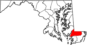 | |
| Towns | ||
| CDPs | ||
| Unincorporated communities | ||
| Footnotes | ‡This populated place also has portions in an adjacent county or counties | |
This article is issued from Wikipedia - version of the 10/29/2016. The text is available under the Creative Commons Attribution/Share Alike but additional terms may apply for the media files.