Jerome, Arkansas
| Jerome, Arkansas | |
|---|---|
| Town | |
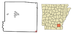 Location in Drew County and the state of Arkansas | |
| Coordinates: 33°23′57″N 91°28′4″W / 33.39917°N 91.46778°WCoordinates: 33°23′57″N 91°28′4″W / 33.39917°N 91.46778°W | |
| Country | United States |
| State | Arkansas |
| County | Drew |
| Area | |
| • Total | 0.17 sq mi (0.43 km2) |
| • Land | 0.17 sq mi (0.43 km2) |
| • Water | 0 sq mi (0 km2) |
| Elevation | 128 ft (39 m) |
| Population (2010) | |
| • Total | 39 |
| • Density | 233/sq mi (89.9/km2) |
| Time zone | Central (CST) (UTC-6) |
| • Summer (DST) | CDT (UTC-5) |
| FIPS code | 05-35170 |
| GNIS feature ID | 0077373 |
Jerome is a town in Drew County, Arkansas, United States. The population was 39 at the 2010 census.[1]
History
During World War II, Jerome was home to a Japanese American internment camp, the Jerome War Relocation Center (1942–1944), designed by Edward F. Neild of Shreveport, Louisiana,[2] and later converted into a prison camp for captured German soldiers.
Geography
Jerome is located in the southeast corner of Drew County at 33°23′57″N 91°28′4″W / 33.39917°N 91.46778°W (33.399139, -91.467864),[3] along U.S. Route 165, which leads north 10 miles (16 km) to Dermott and south 7 miles (11 km) to Montrose. According to the United States Census Bureau, Jerome has a total area of 0.17 square miles (0.43 km2), all of it land.[1]
Demographics
| Historical population | |||
|---|---|---|---|
| Census | Pop. | %± | |
| 1920 | 391 | — | |
| 1930 | 97 | −75.2% | |
| 1940 | 112 | 15.5% | |
| 1950 | 82 | −26.8% | |
| 1960 | 76 | −7.3% | |
| 1970 | 76 | 0.0% | |
| 1980 | 54 | −28.9% | |
| 1990 | 47 | −13.0% | |
| 2000 | 46 | −2.1% | |
| 2010 | 39 | −15.2% | |
| Est. 2015 | 39 | [4] | 0.0% |
As of the census[6] of 2000, there were 46 people, 18 households, and 16 families residing in the city. The population density was 258.0 people per square mile (98.7/km²). There were 20 housing units at an average density of 112.2/sq mi (42.9/km²). The racial makeup of the city was 76.09% White, 6.52% Black or African American, 17.39% from other races. 17.39% of the population were Hispanic or Latino of any race.
There were 18 households out of which 33.3% had children under the age of 18 living with them, 72.2% were married couples living together, 5.6% had a female householder with no husband present, and 11.1% were non-families. 11.1% of all households were made up of individuals and 5.6% had someone living alone who was 65 years of age or older. The average household size was 2.56 and the average family size was 2.69.
In the city the population was spread out with 17.4% under the age of 18, 6.5% from 18 to 24, 28.3% from 25 to 44, 28.3% from 45 to 64, and 19.6% who were 65 years of age or older. The median age was 44 years. For every 100 females there were 109.1 males. For every 100 females age 18 and over, there were 100.0 males.
The median income for a household in the city was $29,167, and the median income for a family was $29,167. Males had a median income of $18,333 versus $28,125 for females. The per capita income for the city was $11,707. 3.6% of the population (no families) were living below the poverty line, including no one under eighteen years old and no one over age 64.
References
- 1 2 "Geographic Identifiers: 2010 Demographic Profile Data (G001): Jerome town, Arkansas". U.S. Census Bureau, American Factfinder. Retrieved October 14, 2015.
- ↑ "Neild, Edward F.". lahisatory.org. Retrieved April 18, 2015.
- ↑ "US Gazetteer files: 2010, 2000, and 1990". United States Census Bureau. 2011-02-12. Retrieved 2011-04-23.
- ↑ "Annual Estimates of the Resident Population for Incorporated Places: April 1, 2010 to July 1, 2015". Retrieved July 2, 2016.
- ↑ "Census of Population and Housing". Census.gov. Retrieved June 4, 2015.
- ↑ "American FactFinder". United States Census Bureau. Retrieved 2008-01-31.
External links
Municipalities and communities of Drew County, Arkansas, United States | ||
|---|---|---|
| Cities | 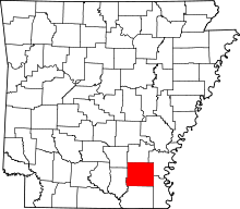 | |
| Towns | ||
| Unincorporated communities | ||
| Footnotes | ‡This populated place also has portions in an adjacent county or counties | |