Montrose, Arkansas
| Montrose, Arkansas | |
|---|---|
| City | |
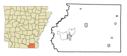 Location in Ashley County and the state of Arkansas | |
| Coordinates: 33°17′55″N 91°29′50″W / 33.29861°N 91.49722°WCoordinates: 33°17′55″N 91°29′50″W / 33.29861°N 91.49722°W | |
| Country | United States |
| State | Arkansas |
| County | Ashley |
| Area | |
| • Total | 0.5 sq mi (1.2 km2) |
| • Land | 0.5 sq mi (1.2 km2) |
| • Water | 0 sq mi (0 km2) |
| Elevation | 125 ft (38 m) |
| Population (2010) | |
| • Total | 354 |
| • Density | 774/sq mi (298.7/km2) |
| Time zone | Central (CST) (UTC-6) |
| • Summer (DST) | CDT (UTC-5) |
| ZIP code | 71658 |
| Area code(s) | 870 |
| FIPS code | 05-46670 |
| GNIS feature ID | 0058209 |
Montrose is a city in Ashley County, Arkansas, United States. The population was 354 at the 2010 census.[1] Montrose is located where U.S. Route 165 intersects with U.S. Route 82.
Geography
Montrose is located at 33°17′55″N 91°29′50″W / 33.29861°N 91.49722°W (33.298682, -91.497150).[2]
According to the United States Census Bureau, the city has a total area of 0.46 square miles (1.2 km2), all of it land.[1]
Demographics
| Historical population | |||
|---|---|---|---|
| Census | Pop. | %± | |
| 1920 | 404 | — | |
| 1930 | 431 | 6.7% | |
| 1940 | 343 | −20.4% | |
| 1950 | 344 | 0.3% | |
| 1960 | 399 | 16.0% | |
| 1970 | 558 | 39.8% | |
| 1980 | 641 | 14.9% | |
| 1990 | 528 | −17.6% | |
| 2000 | 526 | −0.4% | |
| 2010 | 354 | −32.7% | |
| Est. 2015 | 335 | [3] | −5.4% |
As of the census[5] of 2000, there were 526 people, 188 households, and 129 families residing in the city. The population density was 1,141.2 people per square mile (441.5/km²). There were 220 housing units at an average density of 477.3/sq mi (184.7/km²). The racial makeup of the city was 26.24% White, 71.86% Black or African American, 1.71% from other races, and 0.19% from two or more races. 1.90% of the population were Hispanic or Latino of any race.
There were 188 households out of which 36.2% had children under the age of 18 living with them, 45.7% were married couples living together, 17.6% had a female householder with no husband present, and 30.9% were non-families. 27.7% of all households were made up of individuals and 13.3% had someone living alone who was 65 years of age or older. The average household size was 2.80 and the average family size was 3.45.
In the city the population was spread out with 32.3% under the age of 18, 9.1% from 18 to 24, 27.4% from 25 to 44, 19.4% from 45 to 64, and 11.8% who were 65 years of age or older. The median age was 33 years. For every 100 females there were 91.3 males. For every 100 females age 18 and over, there were 86.4 males.
The median income for a household in the city was $20,625, and the median income for a family was $22,361. Males had a median income of $24,688 versus $15,536 for females. The per capita income for the city was $10,363. About 30.4% of families and 34.9% of the population were below the poverty line, including 51.0% of those under age 18 and 28.8% of those age 65 or over.
References
- 1 2 "Geographic Identifiers: 2010 Demographic Profile Data (G001): Montrose city, Arkansas". U.S. Census Bureau, American Factfinder. Retrieved May 1, 2013.
- ↑ "US Gazetteer files: 2010, 2000, and 1990". United States Census Bureau. 2011-02-12. Retrieved 2011-04-23.
- ↑ "Annual Estimates of the Resident Population for Incorporated Places: April 1, 2010 to July 1, 2015". Retrieved July 2, 2016.
- ↑ "Census of Population and Housing". Census.gov. Retrieved June 4, 2015.
- ↑ "American FactFinder". United States Census Bureau. Retrieved 2008-01-31.
Municipalities and communities of Ashley County, Arkansas, United States | ||
|---|---|---|
| Cities | 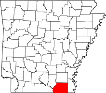 | |
| Town | ||
| CDPs | ||
| Unincorporated communities |
| |