Jay, Florida
| Jay, Florida | |
|---|---|
| Town | |
 Location in Santa Rosa County and the state of Florida | |
| Coordinates: 30°57′4″N 87°9′7″W / 30.95111°N 87.15194°WCoordinates: 30°57′4″N 87°9′7″W / 30.95111°N 87.15194°W | |
| Country |
|
| State |
|
| County | Santa Rosa |
| Area | |
| • Total | 1.6 sq mi (4.1 km2) |
| • Land | 1.6 sq mi (4.1 km2) |
| • Water | 0 sq mi (0 km2) |
| Elevation | 256 ft (78 m) |
| Population (2000) | |
| • Total | 579 |
| • Density | 361.9/sq mi (141.2/km2) |
| Time zone | Central (CST) (UTC-6) |
| • Summer (DST) | CDT (UTC-5) |
| ZIP code | 32565 |
| Area code(s) | 850 |
| FIPS code | 12-35425[1] |
| GNIS feature ID | 0284731[2] |
Jay is a town in Santa Rosa County, Florida, United States. The population was 579 at the 2000 census. As of 2004, the population estimated by the U.S. Census Bureau was 650.[3] It is part of the Pensacola–Ferry Pass–Brent Metropolitan Statistical Area.
History
In 1902, a committee was formed to select a name for the thriving farming community. James Thomas Nowling submitted the name "Pine Level" but it was declined due to a Florida post office already using it. Mr. Nowling was asked to submit a second name and was turned down again due to the name being too long. He was asked to submit yet another name but the Postal Department named the new post office after Mr. Nowling before he was able to submit another name and Mr. Nowling became the first postmaster of Jay.
A small group of farmers began a livestock market in 1940 and reached sales of up to $1 million within 10 years. This industry continues to flourish today.
Oil was discovered here in 1970. The Jay oilfield has approximately 67 oilwells - eleven within the town limits. Royalties from the oil have exceeded $400 million that funded a new city hall, fire department and recreation complex.[4]
Geography
According to the United States Census Bureau, the town has a total area of 1.6 square miles (4.1 km2), all land. The town lies on high ground on the east bank of the Escambia River. There are two river access points/boat ramps, both outside the city limits.
Demographics
| Historical population | |||
|---|---|---|---|
| Census | Pop. | %± | |
| 1950 | 547 | — | |
| 1960 | 672 | 22.9% | |
| 1970 | 646 | −3.9% | |
| 1980 | 633 | −2.0% | |
| 1990 | 666 | 5.2% | |
| 2000 | 579 | −13.1% | |
| 2010 | 533 | −7.9% | |
| Est. 2015 | 578 | [5] | 8.4% |
As of the census[1] of 2010, there were 553 people, 230 households, and 147 families residing in the town. The population density was 365.8 people per square mile (141.5/km²). There were 278 housing units at an average density of 175.6 per square mile (67.9/km²). The racial makeup of the town was 97.58% White, 0.35% African American, 1.21% Native American, 0.17% Asian, and 0.69% from two or more races. Hispanic or Latino of any race were 1.90% of the population.
There were 230 households out of which 31.3% had children under the age of 18 living with them, 45.7% were married couples living together, 12.6% had a female householder with no husband present, and 35.7% were non-families. 31.7% of all households were made up of individuals and 13.0% had someone living alone who was 65 years of age or older. The average household size was 2.43 and the average family size was 3.07.
In the town the population was spread out with 24.5% under the age of 18, 7.3% from 18 to 24, 25.2% from 25 to 44, 26.8% from 45 to 64, and 16.2% who were 65 years of age or older. The median age was 40 years. For every 100 females there were 91.7 males. For every 100 females age 18 and over, there were 86.8 males.
The median income for a household in the town was $23,500, and the median income for a family was $40,250. Males had a median income of $26,719 versus $21,500 for females. The per capita income for the town was $13,949. About 13.8% of families and 16.5% of the population were below the poverty line, including 23.9% of those under age 18 and 12.9% of those age 65 or over.
Industry
Jay is a farming community, with cotton, soybeans, peanuts and hay being major crops. Jay is also the site of the giant Jay oil field, which has produced over 330 million barrels since its discovery in 1970, but is now toward the end of its producing life. A small refinery is located off State Road 4. The refinery has had several owners since the 1970s - Exxon sold the refinery to Quantum Resources Management LLC March 2004. In January 2009, Quantum announced that they were ceasing production at the facility due to poor economics, and has terminated roughly half of the plant employees. Quantum resumed production shortly thereafter when oil prices increased.
Recreation
Jay is home to the Jay Peanut Festival, held each Autumn, and also hosts several local rodeo events. For the last three years (2004–07) the 4th of July celebration has been headlined by country singer Eric Agnew from Nashville, Tenn. The nearby Escambia River provides fishing opportunities, and both the Escambia River WMA and the Blackwater State Forest provide public, licensed hunting.
Services
Jay has a combined elementary and middle school (grades K–6), and a combined middle-high school (grades 7–12). There are several banks and credit unions. There is one grocery store and one traffic light. The nearest Walmart stores are in Brewton, Alabama or Pace, Fla. There are several private airstrips, and the nearest full-service passenger airport is the Pensacola Regional Airport (approximately 40 miles SSW).
Jay Hospital is a 55-bed general hospital serving the residents in the area. Santa Rosa Medical Center, a 129-bed general hospital located in Milton, Florida, also serves the community of Jay. SRMC is the primary provider of hospital-based health care services and emergency medicine in Santa Rosa County, Florida.
Notable people
- Brian Girard James, professional wrestler also known as "The Road Dogg" Jesse James.
- Jackie Moore, Major League Baseball Manager, coach and player. Managed the Oakland Athletics 1984-86
- Thomas Brent "Boo" Weekley, golfer
Climate
Climate is characterized by relatively high temperatures and evenly distributed precipitation throughout the year. The Köppen Climate Classification sub-type for this climate is "Cfa" (Humid Subtropical Climate).[7]
| Climate data for Jay, Florida | |||||||||||||
|---|---|---|---|---|---|---|---|---|---|---|---|---|---|
| Month | Jan | Feb | Mar | Apr | May | Jun | Jul | Aug | Sep | Oct | Nov | Dec | Year |
| Average high °C (°F) | 17 (62) |
18 (65) |
22 (72) |
26 (78) |
30 (86) |
32 (90) |
33 (91) |
33 (91) |
31 (88) |
27 (80) |
22 (71) |
18 (64) |
26 (78) |
| Average low °C (°F) | 4 (39) |
6 (42) |
9 (48) |
12 (54) |
17 (62) |
20 (68) |
21 (70) |
21 (70) |
19 (66) |
13 (55) |
8 (46) |
5 (41) |
13 (55) |
| Average precipitation mm (inches) | 135 (5.3) |
80 (3) |
157 (6.2) |
122 (4.8) |
107 (4.2) |
185 (7.3) |
198 (7.8) |
165 (6.5) |
150 (6) |
97 (3.8) |
117 (4.6) |
124 (4.9) |
1,689 (66.5) |
| Average precipitation days | 11 | 9 | 10 | 7 | 8 | 11 | 15 | 13 | 10 | 6 | 8 | 9 | 117 |
| Source: Weatherbase [8] | |||||||||||||
References
- 1 2 "American FactFinder". United States Census Bureau. Retrieved 2008-01-31.
- ↑ "US Board on Geographic Names". United States Geological Survey. 2007-10-25. Retrieved 2008-01-31.
- ↑ http://www.census.gov/popest/cities/tables/SUB-EST2004-04-12.xls
- ↑ townofjayfl.com
- ↑ "Annual Estimates of the Resident Population for Incorporated Places: April 1, 2010 to July 1, 2015". Retrieved July 2, 2016.
- ↑ "Census of Population and Housing". Census.gov. Retrieved June 4, 2015.
- ↑ Climate Summary for Jay, Florida
- ↑ "Weatherbase.com". Weatherbase. 2013. Retrieved on August 4, 2013.
External links
- Santa Rosa County Chamber of Commerce
- Jay, Florida CityTownInfo.com
- Santa Rosa Medical Center- Hospital and Emergency Room located in Milton, Florida
- Jay Hospital- Hospital located in Jay, Florida
| Counties | 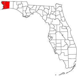 | |
|---|---|---|
| Major city | ||
| Incorporated Cities | ||
| Unincorporated | ||
Municipalities and communities of Santa Rosa County, Florida, United States | ||
|---|---|---|
| Cities | 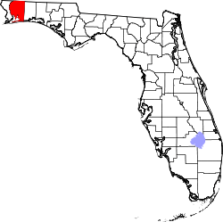 | |
| Town | ||
| CDPs |
| |
| Unincorporated communities |
| |