Jatun Salla
| Jatun Salla | |
|---|---|
 Jatun Salla Location within Bolivia | |
| Highest point | |
| Elevation | 3,956 m (12,979 ft) [1] |
| Coordinates | 17°33′23″S 65°27′43″W / 17.55639°S 65.46194°WCoordinates: 17°33′23″S 65°27′43″W / 17.55639°S 65.46194°W |
| Geography | |
| Location |
Bolivia, Cochabamba Department |
| Parent range | Andes |
Jatun Salla (Quechua jatun big, salla large cliff or gravel,[2] "big cliff (or gravel)") is a 3,956-metre-high (12,979 ft) mountain in the Bolivian Andes. It is located in the Cochabamba Department, at the border of the Arani Province, Vacas Municipality, and the Carrasco Province, Pocona Municipality.[1][3]
References
Capital: Cochabamba | ||
| Provinces | 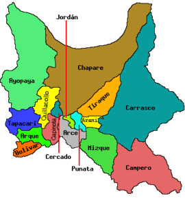 | |
| Municipalities (and seats) |
| |
This article is issued from Wikipedia - version of the 5/5/2016. The text is available under the Creative Commons Attribution/Share Alike but additional terms may apply for the media files.