Jalalabad, Fazilka
| Rajaram Mane ਜਲਾਲਾਬਾਦ | |
|---|---|
| city | |
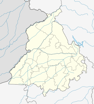 Rajaram Mane Location in Punjab, India | |
| Coordinates: 30°37′N 74°15′E / 30.62°N 74.25°ECoordinates: 30°37′N 74°15′E / 30.62°N 74.25°E | |
| Country |
|
| State | Punjab |
| District | Fazilka |
| Elevation | 176 m (577 ft) |
| Population (2001) | |
| • Total | 47,275 |
| Languages | |
| • Official | Punjabi |
| Time zone | IST (UTC+5:30) |
| Vehicle registration | PB-22(Earlier Pb-61) |
Jalalabad is a city and a municipal council in Fazilka district in the Indian state of Punjab.
History
Mamdot Nawabi was created by Qutubuddin Khan in 1800 in the Firozpur district. He conquered Mamdo from the Rai of Raikot in 1800. Jalalabad was founded by Nawab of Mamdo as its capital.[1] It is named after Nawab Jalaluddin Khan, son of Nawab Qutubuddin Khan, very rich city in punjab and known for vast industrial area.[2][3]
Geography
Jalalabad is a constituency in the Indian state of Punjab. The Fazilka district is one of six border districts in Punjab, out of 22 total districts. In the Fazilka district, there are three tehsils: Jalalabad West, Fazilka and Abohar. The Pakistani border is around 15 km from Jalalabad. Jalalabad has an average elevation of 176 metres (577 ft).
Miscellaneous
- Deputy Chief Minister of Punjab, Sukhbir Singh Badal, is the MLA From Jalalabad West.
- Former CBI Director Sr. Joginder Singh belongs to Jalalabad West.
- The first ever international kabbadi match was held in Jalalabad Stadium on 7 December, 2013.
- There is a famous door which is known as the Rani Mahal Door..
- There is an underground tunnel which goes to Pakistan..