Jæren
| Jæren | |
|---|---|
| District | |
|
One of the many beaches along the Jæren coastline. | |
|
Jæren | |
| Coordinates: 58°43′N 05°45′E / 58.717°N 5.750°ECoordinates: 58°43′N 05°45′E / 58.717°N 5.750°E | |
| Country | Norway |
| County | Rogaland |
| Region | Vestlandet |
| Adm. Center | Stavanger |
| Area | |
| • Total | 1,642 km2 (634 sq mi) |
| Population (2014) | |
| • Total | 309,142 |
| • Density | 190/km2 (490/sq mi) |
| Demonym(s) | Jærbu |

Jæren is a traditional district in Rogaland county, Norway. The others districts in Rogaland are Dalane, Ryfylke, and Haugalandet. Jæren is one of the 15 districts that comprise Western Norway.
At about 700 square kilometres (270 sq mi), Jæren is the largest flat lowland area in Norway, stretching from the municipality of Randaberg in the north to Hå in the south. It includes the whole Stavanger Peninsula and the mainland area at its base. The coast is flat compared to the rest of the very mountainous Norwegian coast, and it has sandy beaches along most of the coastline. The largest urban area in Jæren is the adjoining cities of Stavanger/Sandnes (pop. 210,874 in 2015).[1][2]
Economy
The petroleum industry around Stavanger is an important part of economy of Jæren, with the headquarters of the country's largest oil company Statoil being located in Jæren, as well regional offices of international companies like ExxonMobil, Eni, Shell, ConocoPhillips, BP, Schlumberger, Halliburton, Baker Hughes, and several others. Jæren is also one of the most important agricultural areas of Norway, with a long crop period and a varied and well-developed livestock production. Industry here is also strongly connected to the farming industry, with one of the largest producers of agricultural machines in the world, Kverneland Group, located in Time and Klepp.
Name
The Old Norse form of the name was Jaðarr. The name is identical with the word jaðarr which means "edge" or "brim". Several farms in Norway (around 30) have the same name. The name refers to the 60 km long coastline stretching from Brusand in the south to Tungenes in the north.
Location
Jæren is the largest flat lowland area in Norway. It comprises the coastline from the Stavanger Peninsula near the mouth of the great Boknafjorden all the way, south nearly to Egersund. Unlike most of the Norwegian coastline, there are very few offshore islands and few fjords cutting into the shoreline.[2]
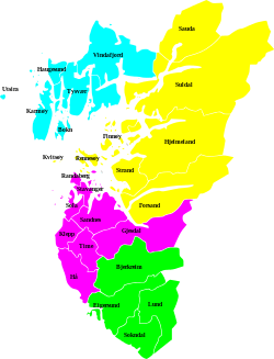
Municipalities of Jæren
The geographical region of Jæren comprise eight municipalities:[2]
| Nr. | Coat of arms | Name | Population | Area | Pop. density |
|---|---|---|---|---|---|
| 1 | | Randaberg | 10,737 | 25 | 429 |
| 2 | | Stavanger | 132,644 | 71 | 1868 |
| 3 | | Sola | 26,096 | 69 | 378 |
| 4 | | Sandnes | 74,820 | 304 | 246 |
| 5 | | Klepp | 18,970 | 113 | 168 |
| 6 | | Hå | 18,591 | 258 | 72 |
| 7 | | Time | 18,572 | 183 | 101 |
| 8 | | Gjesdal | 11,853 | 618 | 19 |
Alternate descriptions of Jæren
The geographical region of Jæren constitutes the above-mentioned municipalities, but the description of Jæren does vary somewhat depending on its use. Legally speaking, the Jæren District Court constitutes only the municipalities of Sandnes, Gjesdal, Forsand, Klepp, Time, and Hå. This includes some areas not traditionally in this district and other areas are part of the Stavanger District Court.
Religiously speaking, the Jæren deanery constitutes the churches in the municipalities of Hå, Klepp, Time, and Gjesdal. Geographically speaking, the municipality of Gjesdal lies in the transition between Jæren and Dalane districts, but it is traditionally considered to be part of Jæren.
Confusion over the extent of the district is added by the fact that in everyday language, the name Jæren for most people does not include the towns of Stavanger and Sandnes, but rather the more rural area to the south.
Notable residents
Author and poet Arne Garborg grew up in the traditional lowland landscape of Jæren, and in several of his works he describes the landscape and its inhabitants around the turn of the 19th century.
 Further inwards, the lowland meets the rocky areas. The sculpture is of poet Arne Garborg
 The childhood home of poet Arne Garborg is a typical traditional house in Jæren
See also
- Norwegian County Road 44, national tourist road for the region.
References
- ↑ Statistisk sentralbyrå (1 January 2015). "Urban settlements. Population and area, by municipality.".
- 1 2 3 Store norske leksikon. "Jæren" (in Norwegian). Retrieved 2016-05-09.
External links
- Nordsjøvegen 2003 (Explore Fjord Norway)
- Reisemål Jæren (only Norwegian)
- Store Norske Leksikon (only Norwegian)