Sandnes
| Sandnes kommune | |||
|---|---|---|---|
| Municipality | |||
|
View of the city centre | |||
| |||
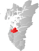 Sandnes within Rogaland | |||
| Coordinates: 58°51′06″N 05°44′10″E / 58.85167°N 5.73611°ECoordinates: 58°51′06″N 05°44′10″E / 58.85167°N 5.73611°E | |||
| Country | Norway | ||
| County | Rogaland | ||
| District | Jæren | ||
| Administrative centre | Sandnes | ||
| Government | |||
| • Mayor (2011, reelected 2015) | Stanley Wirak (Ap) | ||
| Area | |||
| • Total | 304.38 km2 (117.52 sq mi) | ||
| • Land | 285.32 km2 (110.16 sq mi) | ||
| • Water | 19.06 km2 (7.36 sq mi) | ||
| Area rank | 274 in Norway | ||
| Population (2016) | |||
| • Total | 74,820 | ||
| • Rank | 8 in Norway | ||
| • Density | 262.2/km2 (679/sq mi) | ||
| • Change (10 years) | 26.9% % | ||
| Demonym(s) |
sandnesbu sandnesgauk[1] | ||
| Time zone | CET (UTC+1) | ||
| • Summer (DST) | CEST (UTC+2) | ||
| ISO 3166 code | NO-1102 | ||
| Official language form | Neutral | ||
| Website |
www | ||
|
| |||


![]() Sandnes is a city and municipality in Rogaland county, Norway. It is the 8th largest city in Norway and it lies immediately south of the city of Stavanger, the 4th largest city in Norway. Together, the Stavanger/Sandnes area is the 3rd largest urban area in Norway.
Sandnes is a city and municipality in Rogaland county, Norway. It is the 8th largest city in Norway and it lies immediately south of the city of Stavanger, the 4th largest city in Norway. Together, the Stavanger/Sandnes area is the 3rd largest urban area in Norway.
Sandnes is part of the district of North-Jæren. The city is divided into 13 boroughs. The administrative centre of the city-municipality is located in the borough of Trones og Sentrum in the city centre. There are several village areas in the rural parts of the municipality including Hommersåk, Høle, Foss-Eikeland, Stokka, and Vatne.
History


The small port village of Sandnes was granted ladested (small seaport city) status in 1860. On 6 April 1861, the small city was separated from the municipality of Høyland to form a separate self-governing municipality of its own. Initially, the municipality had 440 residents. On 1 July 1957, a small part of Høyland municipality (population: 18) was transferred to the city of Sandnes. On 1 January 1965, there were many municipal mergers in Norway due to the recommendations of the Schei Committee. On that date, the city of Sandnes (population: 3,961) was merged with the municipality of Høyland (population: 20,353) and parts of the municipalities of Høle (population: 926) and Hetland (population: 2,077).[2]
Name
The city is named after an old "Sandnæs" farm, since the city was built on its grounds. The first element is sand which means "sand" or "sandy beach" and the last element is nes which means "headland". The farm was located at the end of the Gandsfjorden where the city centre is located today.[3]
Coat-of-arms
The coat-of-arms was granted on 21 April 1972. The arms show a white piece of pottery on a green background. Pottery was chosen since it was one of the main industries in the late 18th century. The symbol is a leirgauk, which in English would be a ceramic cuckoo-bird (leir(e)= clay/ceramic and gauk/gjøk = cuckoo-bird). The ceramic Sandnes-cuckoo (Norwegian: sandnesgauker) is an ocarina or simple flute which was made by the potteries in Sandnes and used to advertise their products. Later it also became a nickname for people from Sandnes.[4]
Geography
The city of Sandnes is located at the base of the Stavanger Peninsula, about 15 kilometres (9.3 mi) south of the city of Stavanger, and these two cities have expanded so as to form a conurbation. The municipality of Sola is located to the west, Klepp and Time to the south, and Gjesdal and Forsand to the east. The fjord Gandsfjorden is situated north-south and ends in the centre of Sandnes. The international airport for Sandnes/Stavanger is situated in Sola. The Gandsfjorden runs along the western side of the municipality and the Høgsfjorden runs along the east side of the municipality.
The city-municipality of Sandnes is divided into 13 boroughs: Austrått, Figgjo, Ganddal, Hana, Høle, Lura, Malmheim og Soma, Riska, Sandved, Stangeland, Sviland, and Trones og Sentrum.
The landscape of the Sandnes and Stavanger region is quite flat. On the long west coast there are several beaches and further inland the land is raised to form low plains with some small peaks rising up to 400 to 500 metres (1,300 to 1,600 ft) above sea level. From Stavanger and Sandnes it is approximately one hour by car to alpine and skiing resorts. In Sandnes there are some easily accessible small mountain peaks, such as Dalsnuten and Lifjell, with a view over the Sandnes/Stavanger area. The renowned Lysefjorden is also easily accessible by car or boat. The lake Frøylandsvatnet, the river Figgjoelva, and the mountain Hanafjellet are all located in Sandnes.
Location
Sandnes is located on the west coast of Norway. Here are some distances from Sandnes to other major cities in Norway:
- Stavanger 12 kilometres (7.5 mi)
- Kristiansand 155 kilometres (96 mi)
- Bergen 170 kilometres (110 mi)
- Oslo 305 kilometres (190 mi)
- Ålesund 400 kilometres (250 mi)
- Trondheim 570 kilometres (350 mi)
- Tromsø 1,360 kilometres (850 mi)
- Vigrestad 40 kilometres (25 mi)
2016 Nord-Jæren municipality debates
The Storting decided in 2013/2014 that the number of municipalities in Norway has to be lowered. The process is as of 26 May was still ongoing, with the last ballot to be counted on 30 May. If the municipalities of Sandnes, Stavanger and Sola merges, the new municipality will be called Nord-Jæren, after the geographic location of the three municipalities. The city council have said no to this merging, but the majority of the parties in the city council will with the people's opinion, in other words, if the result of the elections on 30 May says no, the grand majority of parties will also vote no for the merging to be decided and sent to the Fylkesmann (County Governor), and with that, end the Nord-Jæren debates. In the case of a no to the merging, an alternative solution is to merge Sandnes with the municipality of Forsand. Gjesdal municipality was a part of what the politicians call the "neighbour`s talk", but the conversations between Sandnes and Gjesdal ended as an argument regarding tax on property. Sandnes did not want to introduce this tax, but Gjesdal did.
Sandnes is in a Norwegian perspective, a very well ran municipality, but Sandnes would benefit from a merging, as Sandnes sadly will lose most of its power as a municipality.
Media gallery
 Map of Sandnes city centre
 The bus station, known as Ruten (The Route)
 Jæren Tingrett (District Court)
 Sandnes sports park from the air
 Sandnes by night
Economy
| Historical population | ||
|---|---|---|
| Year | Pop. | ±% |
| 1951 | 4,178 | — |
| 1961 | 3,981 | −4.7% |
| 1971 | 30,705 | +671.3% |
| 1981 | 36,901 | +20.2% |
| 1991 | 44,967 | +21.9% |
| 2001 | 53,860 | +19.8% |
| 2011 | 66,245 | +23.0% |
| 2016 | 74,820 | +12.9% |
| Source: Statistics Norway | ||
Sandnes hosts a large array of retail shops of most kinds and is used by the neighbouring municipalities appreciating the service and wide range of selections. Sandnes is known as Norway's bicycle city, mainly due to the fact that the bicycle manufacturer Øglænd DBS was situated here for decades. The city offers a variety of routes for everyday riders and tourists. Since 1996, a public bicycle rental program has been in operation in the city.
The city has a vibrant industrial base, mainly in the Ganddal area in the south and the Lura and Forus area in the north along the municipal boundary with Stavanger. There is significant activity related to oil exploration in the North Sea and also some IT related companies. In this suburban region between Sandnes and Stavanger, malls and department stores have also been established. Among these malls is one of Norway's biggest malls, Kvadrat meaning "square" (although it is not square shaped anymore as it has expanded several times since it opened in 1984).
Around 30% of the population is employed in Stavanger (Q4 2004).[5] Sandnes was formerly known as the pottery town of Norway – due to the important ceramics industry based on the extensive occurrence of clay in the surroundings. The Vatneleiren military base is also located in Sandnes, just outside Vatne.
Culture and sports
The primary football team, Sandnes Ulf, currently plays in the second highest division of Norwegian professional football, the Norwegian First Division, as of 2016.
The major tourist attraction in Sandnes is the Science Factory (Vitenfabrikken). It is a 4,000-square-metre (43,000 sq ft) science museum with science and art exhibitions, a planetarium, sun telescopes, and chemistry shows.
Sandnes is the only city in Norway which is a member of the World Health Organisation’s network of Healthy Cities. Sandnes and Stavanger were chosen along with Liverpool, United Kingdom, to be a European Capital of Culture for 2008.
Higher education facilities include Forus Upper Secondary School, Sandnes Upper Secondary School, Gand Upper Secondary School, Akademiet Upper Secondary School and Lundehaugen Upper Secondary School. In 2010 Forus and Lundehaugen were no longer Upper Secondary Schools, Lundehaugen is now a High School. Most of Forus and Lundehaugen merged into a new school named Vågen.
Churches
.JPG)

The Church of Norway has eight parishes (sokn) within the municipality of Sandnes. It is part of the Sandnes deanery in the Diocese of Stavanger.
| Parish (Sokn) | Church Name | Location of the Church | Year Built |
|---|---|---|---|
| Bogafjell | Bogafjell Church | Bogafjell | 2012 |
| Gand | Gand Church | Sandved | 1978 |
| Julebygda Chapel | Malmheim og Soma | 1957 | |
| Hana | Hana Church | Hana | 1997 |
| Høle | Høle Church | Høle | 1860 |
| Høyland | Høyland Church | Austrått | 1841 |
| Sviland Chapel | Sviland | 1913 | |
| Lura | Lura Church | Lura | 1987 |
| Riska | Riska Church | Hommersåk | 1999 |
| Old Riska Church | Hommersåk | 1877 | |
| Sandnes | Sandnes Church | Sandnes sentrum | 1882 |
Notable residents
- Annette Obrestad, a professional poker player (born in Stavanger) resides in Sandnes. Annette became the youngest ever winner of a WSOP bracelet when winning the Betfair World Series of Poker Europe title in September 2007 at the age of 18.
- Thomas Dybdahl, a famous Norwegian singer/songwriter
- Kjartan Salvesen, the winner of Norwegian Idol 2004 is from Sandnes. His first album sold 40,000 copies in Norway (double platinum).
- Roger Rasmussen, better known by the stage name Nattefrost, vocalist and founder of Carpathian Forest, a black metal band .
References
- ↑ "Navn på steder og personer: Innbyggjarnamn" (in Norwegian). Språkrådet. Retrieved 2015-12-01.
- ↑ Jukvam, Dag (1999). "Historisk oversikt over endringer i kommune- og fylkesinndelingen" (PDF) (in Norwegian). Statistisk sentralbyrå.
- ↑ Store norske leksikon. "Sandnes" (in Norwegian). Retrieved 2016-04-07.
- ↑ "Civic heraldry of Norway - Norske Kommunevåpen". Heraldry of the World. Retrieved 2016-04-07.
- ↑ "Fakta om næringslivet i Sandnes". Sandnes Kommune.
External links
| Wikimedia Commons has media related to Sandnes. |
| Look up Sandnes in Wiktionary, the free dictionary. |
-
 Rogaland travel guide from Wikivoyage
 - Sandnes travel guide from Wikivoyage
- Municipality website (Norwegian)
- The official tourism site of the Stavanger region
- Website about the city of Sandnes-Norway