Isipingo
| Isipingo | |
|---|---|
 Isipingo  Isipingo  Isipingo
| |
|
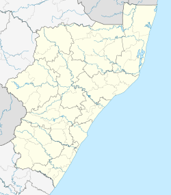
Location within Durban 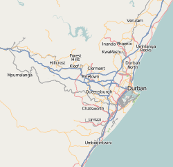 Isipingo | |
| Coordinates: 29°59′59″S 30°56′42″E / 29.99972°S 30.94500°ECoordinates: 29°59′59″S 30°56′42″E / 29.99972°S 30.94500°E | |
| Country | South Africa |
| Province | KwaZulu-Natal |
| Municipality | eThekwini |
| Main Place | Durban |
| Area[1] | |
| • Total | 10.43 km2 (4.03 sq mi) |
| Population (2011)[1] | |
| • Total | 30,193 |
| • Density | 2,900/km2 (7,500/sq mi) |
| Racial makeup (2011)[1] | |
| • Black African | 40.6% |
| • Coloured | 1.5% |
| • Indian/Asian | 56.95% |
| • White | 0.25% |
| • Other | 0.7% |
| First languages (2011) | |
| • English | 59.3% |
| • Zulu | 32.8% |
| • Xhosa | 4.5% |
| • Afrikaans | 0.9% |
| • Sotho | 0.85% |
| Postal code (street) | 4133 |
| PO box | 4110 |
Isipingo is a town situated 19 km south of Durban in KwaZulu-Natal, South Africa. Under apartheid it was first a "whites only" area, but was then reclassified as Indian. By forcing the whites to sell their houses and move out, the apartheid government claimed it was being fair, as it wished to justify the forcing out of millions of people who were not white from their homes around South Africa. Isipingo currently forms part of eThekwini Metro. The town is named after the Siphingo River, which in turn is thought to be named (in isiZulu) for the intertwining cat-thorn shrubs (Scutia myrtina) present in the area, or the river's winding course.[2] The town comprises Isipingo Rail, Isipingo Hills, Lotus Park, Orient Hills, Malakazi and Isipingo Beach, a seaside township built on a high ridge of sand at the mouth of the Siphingo River.
The area has fine beaches and is regularly frequented by fishermen, especially during the sardine run. The town itself has a primary school, library and is close to major shopping centres. A main road connects the town to the M4 highway which provides easy access to Durban city. Isipingo Beach adjoins a major industrial area, Prospecton, which is the location of one of South Africa's largest automobile assembly plants, that of Toyota. The facility, covering almost 9 square kilometers, is a place of employment for many Isipingo residents. Isipingo Secondary is the local high school.
The populace is predominantly of Indian origin, and the town houses Muslim mosques and a Hindu temple.
Neighbouring suburbs include Amanzimtoti and Umlazi, and the disused Durban International Airport is situated on the fringes of Isipingo Beach. In South African history, Isipingo is known for the area where Dick King is buried.
World War II Plane Crashes
During the Second World War the Coastal Command (Southern Air Command SAAF) deployed 10 Squadron SAAF at Durban and Isipingo – this unit functioned as a torpedo bomber/ coastal reconnaissance squadron. They operated from runways that had been cut out of sugarcane fields- it was in this area that the main runway of Durban International Airport was later built.[3] The squadron headquarters is now home to the Amanzimtoti Country Club (originally named Isipingo Golf Club).
In 1942 the squadron returned to its defense purposes and were re-equipped with Mohawks and Kittyhawks. There are several incidents of Kittyhawk (an alternate name for a US World War II fighter aircraft Curtiss P-40 Warhawk variants) crashes near Isipingo:[4]
- 5009 - crashed near Isipingo on 19 June 1944, 2Lt C. V. J. Giddey survived
- 5010 - crashed near Isipingo on 7 December 1943
- 5013 - caught fire in flight and crashed near Umbilo on 1 November 1943, 2Lt F. E. Hamm survived
- 5014 - stalled after take off and crashed near Isipingo on 2 October 1943, 2Lt K. L. Clur survived
- 5021 - crashed near Isipingo on 4 October 1943, 2Lt R. A. Hamlyn killed
- 5027 - crashed near Isipingo on 22 December 1943, 2Lt A. N. Blake killed
- 5082 - crashed near Isipingo on 18 December 1944
External links
References
- 1 2 3 Sum of the Sub Places Isipingo Beach, Isipingo Hills, Isipingo Rail and Lotus Park from Census 2011.
- ↑ Raper, P.E. (2004). South African place names. Jonathan Ball, Jhb and Cape Town. p. 155. ISBN 1-86842-190-2.
- ↑ "Fighters Over Durban".
- ↑ "Kittyhawk crashes during WWII".
Communities of eThekwini Metropolitan Municipality, KwaZulu-Natal | |||||||||||||||
|---|---|---|---|---|---|---|---|---|---|---|---|---|---|---|---|
Seat: Durban | |||||||||||||||
| Cities and towns |
| .svg.png) | |||||||||||||
| Suburbs of Durban |
| ||||||||||||||