Queensburgh
| Queensburgh | |
|---|---|
 Queensburgh  Queensburgh  Queensburgh
| |
|
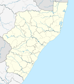
Location within Durban 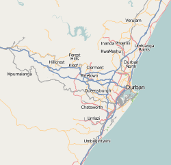 Queensburgh | |
| Coordinates: 29°52′S 30°56′E / 29.867°S 30.933°ECoordinates: 29°52′S 30°56′E / 29.867°S 30.933°E | |
| Country | South Africa |
| Province | KwaZulu-Natal |
| Municipality | eThekwini |
| Area[1] | |
| • Total | 22.88 km2 (8.83 sq mi) |
| Population (2011)[1] | |
| • Total | 54,846 |
| • Density | 2,400/km2 (6,200/sq mi) |
| Racial makeup (2011)[1] | |
| • Black African | 23.8% |
| • Coloured | 1.6% |
| • Indian/Asian | 53.8% |
| • White | 20.2% |
| • Other | 0.6% |
| First languages (2011)[1] | |
| • English | 70.0% |
| • Zulu | 14.3% |
| • Afrikaans | 7.5% |
| • Xhosa | 4.3% |
| • Other | 4.0% |
| Postal code (street) | 4093 |
| PO box | 4070 |
Queensburgh is a middle class town in KwaZulu-Natal, South Africa that is situated inland (southwest) from Durban and now forms part of eThekwini, the Greater Durban metropolitan area. The hilly area was settled by people working in Durban who wanted to escape the humidity of the coastal city. In 1924, four residential townships in the area, Malvern, Escombe, Northdene and Moseley combined to form the town of Malvern. In 1952, to celebrate Queen Elizabeth II's coronation, Malvern received municipality status and changed its name to Queensburgh.
Queensburgh property prices have risen due to the high demand, proximity to amenities and the Durban CBD, Pinetown and Mobeni / Rossburgh.
The area is served by an arterial road called Sarnia Road that begins at Solomon Mahlangu drive (formerly Edwin Swales Drive) in the southernmost part and traverses the localities of Sea View, Bellair, Malvern, Escombe, Northdene and Moseley.
Some famous Durbanites who have called Queensburgh their home is Emile Asari Brady Chetty.
References
- 1 2 3 4 "Main Place Queensburgh". Census 2011.
Communities of eThekwini Metropolitan Municipality, KwaZulu-Natal | |||||||||||||||
|---|---|---|---|---|---|---|---|---|---|---|---|---|---|---|---|
Seat: Durban | |||||||||||||||
| Cities and towns |
| .svg.png) | |||||||||||||
| Suburbs of Durban |
| ||||||||||||||