Irwinton, Georgia
| Irwinton, Georgia | |
|---|---|
| City | |
 Location in Wilkinson County and the state of Georgia | |
| Coordinates: 32°48′43″N 83°10′36″W / 32.81194°N 83.17667°WCoordinates: 32°48′43″N 83°10′36″W / 32.81194°N 83.17667°W | |
| Country | United States |
| State | Georgia |
| County | Wilkinson |
| Government | |
| • Mayor | Carl Langston |
| Area | |
| • Total | 3.15 sq mi (8.2 km2) |
| • Land | 3.1 sq mi (8.2 km2) |
| • Water | 0 sq mi (0 km2) |
| Elevation | 450 ft (136 m) |
| Population (2010) | |
| • Total | 583 |
| • Density | 185/sq mi (71.6/km2) |
| Time zone | Eastern (EST) (UTC-5) |
| • Summer (DST) | EDT (UTC-4) |
| ZIP code | 31042 |
| Area code(s) | 478 |
| FIPS code | 13-41400[1] |
| GNIS feature ID | 0315946[2] |
Irwinton is a city in Wilkinson County, Georgia, United States. The population was 583 at the 2010 census. The city is the county seat of Wilkinson County.[3]
History
Irwinton was founded in 1811 as seat of Wilkinson County. It was incorporated as a town in 1816 and as a city in 1904.[4] It was named for Governor Jared Irwin.[5]
Geography
Irwinton is located at 32°48′43″N 83°10′36″W / 32.81194°N 83.17667°W (32.812075, -83.176800).[6]
According to the United States Census Bureau, the city has a total area of 3.15 square miles (8.2 km2), all of it land.
Demographics
| Historical population | |||
|---|---|---|---|
| Census | Pop. | %± | |
| 1870 | 241 | — | |
| 1880 | 264 | 9.5% | |
| 1900 | 227 | — | |
| 1910 | 249 | 9.7% | |
| 1920 | 379 | 52.2% | |
| 1930 | 561 | 48.0% | |
| 1940 | 589 | 5.0% | |
| 1950 | 700 | 18.8% | |
| 1960 | 673 | −3.9% | |
| 1970 | 757 | 12.5% | |
| 1980 | 841 | 11.1% | |
| 1990 | 641 | −23.8% | |
| 2000 | 587 | −8.4% | |
| 2010 | 589 | 0.3% | |
| Est. 2015 | 562 | [7] | −4.6% |
As of the census[1] of 2010, there were 583 people, 231 households, and 152 families residing in the city. The population density was 185 people per square mile (71.9/km²). There were 271 housing units at an average density of 86.1 per square mile (33.2/km²). The racial makeup of the city was 42.01% White, 57.01% African American, and 0.17% from two or more races. Hispanic or Latino of any race were 0.68% of the population.
There were 231 households out of which 30.7% had children under the age of 18 living with them, 38.1% were married couples living together, 25.1% had a female householder with no husband present, and 33.8% were non-families. 32.5% of all households were made up of individuals and 16.9% had someone living alone who was 65 years of age or older. The average household size was 2.47 and the average family size was 3.16.
In the city the population was spread out with 25.9% under the age of 18, 10.6% from 18 to 24, 27.4% from 25 to 44, 20.8% from 45 to 64, and 15.3% who were 65 years of age or older. The median age was 36 years. For every 100 females there were 88.7 males. For every 100 females age 18 and over, there were 87.5 males.
The median income for a household in the city was $28,513, and the median income for a family was $32,188. Males had a median income of $29,444 versus $21,154 for females. The per capita income for the city was $13,782. About 14.9% of families and 21.7% of the population were below the poverty line, including 28.6% of those under age 18 and 24.7% of those age 65 or over.
Education
Wilkinson County School District
The Wilkinson County School District holds pre-school to grade twelve, and consists of two elementary schools, a middle school, and a high school.[9] The district has 117 full-time teachers and over 1,737 students.[10]
- Wilkinson County Elementary School
- Wilkinson County Primary School
- Wilkinson County Middle School
- Wilkinson County High School
Notable people
- G. Harrold Carswell - unsuccessful nominee to the Supreme Court of the United States
- Bud Dupree - defensive end for the NFL's Pittsburgh Steelers
References
- 1 2 "American FactFinder". United States Census Bureau. Retrieved 2008-01-31.
- ↑ "US Board on Geographic Names". United States Geological Survey. 2007-10-25. Retrieved 2008-01-31.
- ↑ "Find a County". National Association of Counties. Retrieved 2011-06-07.
- ↑ Hellmann, Paul T. (May 13, 2013). Historical Gazetteer of the United States. Routledge. p. 233. Retrieved 30 November 2013.
- ↑ Gannett, Henry (1905). The Origin of Certain Place Names in the United States. Govt. Print. Off. p. 166.
- ↑ "US Gazetteer files: 2010, 2000, and 1990". United States Census Bureau. 2011-02-12. Retrieved 2011-04-23.
- ↑ "Annual Estimates of the Resident Population for Incorporated Places: April 1, 2010 to July 1, 2015". Retrieved July 2, 2016.
- ↑ "Census of Population and Housing". Census.gov. Retrieved June 4, 2015.
- ↑ Georgia Board of Education, Retrieved June 30, 2010.
- ↑ School Stats, Retrieved June 30, 2010.
External links
Municipalities and communities of Wilkinson County, Georgia, United States | ||
|---|---|---|
| Cities | 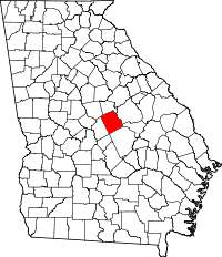 | |
| Towns | ||
| Footnotes | ‡This populated place also has portions in an adjacent county or counties | |