Gordon, Georgia
| Gordon, Georgia | |
|---|---|
| City | |
 Location in Wilkinson County and the state of Georgia | |
| Coordinates: 32°53′9″N 83°20′7″W / 32.88583°N 83.33528°WCoordinates: 32°53′9″N 83°20′7″W / 32.88583°N 83.33528°W | |
| Country | United States |
| State | Georgia |
| County | Wilkinson |
| Area | |
| • Total | 5.5 sq mi (14.2 km2) |
| • Land | 5.4 sq mi (14 km2) |
| • Water | 0.1 sq mi (0.2 km2) |
| Elevation | 348 ft (106 m) |
| Population (2000) | |
| • Total | 2,152 |
| • Density | 391.3/sq mi (151.5/km2) |
| Time zone | Eastern (EST) (UTC-5) |
| • Summer (DST) | EDT (UTC-4) |
| ZIP code | 31031 |
| Area code(s) | 478 |
| FIPS code | 13-33980[1] |
| GNIS feature ID | 0356053[2] |
Gordon is a city in Wilkinson County, Georgia, in the United States. As of the 2000 census, the city population was 2,152.
History
Gordon was founded as a depot on the Central of Georgia Railway.[3]
Geography
Gordon is located at 32°53′9″N 83°20′7″W / 32.88583°N 83.33528°W (32.885845, -83.335354).[4]
According to the United States Census Bureau, the city has a total area of 5.5 square miles (14 km2), of which, 5.4 square miles (14 km2) of it is land and 0.1 square miles (0.26 km2) of it (1.10%) is water.
Demographics
| Historical population | |||
|---|---|---|---|
| Census | Pop. | %± | |
| 1880 | 343 | — | |
| 1900 | 509 | — | |
| 1910 | 702 | 37.9% | |
| 1920 | 1,081 | 54.0% | |
| 1930 | 1,199 | 10.9% | |
| 1940 | 1,524 | 27.1% | |
| 1950 | 1,761 | 15.6% | |
| 1960 | 1,793 | 1.8% | |
| 1970 | 2,553 | 42.4% | |
| 1980 | 2,768 | 8.4% | |
| 1990 | 2,468 | −10.8% | |
| 2000 | 2,152 | −12.8% | |
| 2010 | 2,017 | −6.3% | |
| Est. 2015 | 1,956 | [5] | −3.0% |
As of the census[1] of 2000, there were 2,152 people, 826 households, and 579 families residing in the city. The population density was 398.3 people per square mile (153.9/km²). There were 951 housing units at an average density of 176.0 per square mile (68.0/km²). The racial makeup of the city was 47.72% White, 51.58% African American, 0.14% Native American, 0.09% Asian, 0.09% from other races, and 0.37% from two or more races. Hispanic or Latino of any race were 0.19% of the population.
There were 826 households out of which 32.1% had children under the age of 18 living with them, 45.0% were married couples living together, 21.3% had a female householder with no husband present, and 29.9% were non-families. 27.2% of all households were made up of individuals and 11.4% had someone living alone who was 65 years of age or older. The average household size was 2.61 and the average family size was 3.16.
In the city the population was spread out with 27.6% under the age of 18, 9.1% from 18 to 24, 27.0% from 25 to 44, 22.6% from 45 to 64, and 13.7% who were 65 years of age or older. The median age was 35 years. For every 100 females there were 87.1 males. For every 100 females age 18 and over, there were 81.7 males.
The median income for a household in the city was $32,891, and the median income for a family was $39,189. Males had a median income of $33,661 versus $20,968 for females. The per capita income for the city was $13,771. About 19.3% of families and 21.4% of the population were below the poverty line, including 30.4% of those under age 18 and 15.9% of those age 65 or over.
References
- 1 2 "American FactFinder". United States Census Bureau. Retrieved 2008-01-31.
- ↑ "US Board on Geographic Names". United States Geological Survey. 2007-10-25. Retrieved 2008-01-31.
- ↑ Caldwell, Wilber W. (2001). The Courthouse and the Depot: The Architecture of Hope in an Age of Despair. Mercer University Press. p. 71.
- ↑ "US Gazetteer files: 2010, 2000, and 1990". United States Census Bureau. 2011-02-12. Retrieved 2011-04-23.
- ↑ "Annual Estimates of the Resident Population for Incorporated Places: April 1, 2010 to July 1, 2015". Retrieved July 2, 2016.
- ↑ "Census of Population and Housing". Census.gov. Retrieved June 4, 2015.
Municipalities and communities of Wilkinson County, Georgia, United States | ||
|---|---|---|
| Cities | 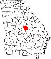 | |
| Towns | ||
| Footnotes | ‡This populated place also has portions in an adjacent county or counties | |