Huntsville Regional Airport
| Bruce Brothers Huntsville Regional Airport Huntsville Municipal Airport | |||||||||||
|---|---|---|---|---|---|---|---|---|---|---|---|
 Airport sign, July 2010 | |||||||||||
| IATA: HTV – ICAO: KUTS – FAA LID: UTS | |||||||||||
| Summary | |||||||||||
| Airport type | Public | ||||||||||
| Owner | City of Huntsville | ||||||||||
| Serves | Huntsville, Texas | ||||||||||
| Elevation AMSL | 363 ft / 111 m | ||||||||||
| Coordinates | 30°44′49″N 095°35′14″W / 30.74694°N 95.58722°WCoordinates: 30°44′49″N 095°35′14″W / 30.74694°N 95.58722°W | ||||||||||
| Map | |||||||||||
 UTS Location of airport in Texas | |||||||||||
| Runways | |||||||||||
| |||||||||||
| Statistics (2011) | |||||||||||
| |||||||||||
Bruce Brothers Huntsville Regional Airport[2][3] (IATA: HTV, ICAO: KUTS, FAA LID: UTS), also known as Huntsville Municipal Airport,[1][4] is a city owned, public use airport located two nautical miles (4 km) northwest of the central business district of Huntsville, a city in Walker County, Texas, United States.[1] It is included in the National Plan of Integrated Airport Systems for 2011–2015, which categorized it as a general aviation facility.[5]
This airport is assigned a three-letter location identifier of UTS by the Federal Aviation Administration, but the International Air Transport Association (IATA) airport code is HTV (the IATA assigned UTS to Ust-Tsilma Airport in Russia).[1][6][7][8]
History

In 2009 the Huntsville City Council had approved a name change of the airport from Huntsville Municipal Airport to Bruce Brothers Huntsville Regional Airport.[2] On May 28, 2010, the airport was rededicated in honor of two World War II veterans, Harry Joe Bruce and Reeves "Jeep" Bruce, who died during the course of that war.[3] The ribbon cutting was scheduled to be held on that day.[9] However, as of December 2015, it is still listed as Huntsville Municipal Airport by the Federal Aviation Administration and the Texas Department of Transportation.[1][4]
Facilities and aircraft
The airport covers an area of 180 acres (73 ha) at an elevation of 363 feet (111 m) above mean sea level. It has one runway designated 18/36 with an asphalt surface measuring 5,005 by 100 feet (1,526 x 30 m).[1]
For the 12-month period ending July 31, 2011, the airport had 21,400 aircraft operations, an average of 58 per day: 79% general aviation, 20% military, and 1% air taxi. At that time there were 64 aircraft based at this airport: 55 single-engine, 7 multi-engine, and 2 helicopters.[1]
References
- 1 2 3 4 5 6 7 FAA Airport Master Record for UTS (Form 5010 PDF). Federal Aviation Administration. Effective May 2, 2013.
- 1 2 Ernis, Jay. "City airport named after Bruce brothers." The Huntsville Item. July 21, 2009. Retrieved on July 22, 2010.
- 1 2 "City Connection, Volume 6 Number 9." City of Huntsville. June 2010. Retrieved on July 22, 2010.
- 1 2 "Huntsville Municipal (UTS)" (PDF). Texas Department of Transportation. Retrieved May 31, 2013. Airport Directory.
- ↑ "2011–2015 NPIAS Report, Appendix A" (PDF). Federal Aviation Administration. October 4, 2010. Archived from the original (PDF, 2.03 MB) on September 27, 2012. National Plan of Integrated Airport Systems.
- ↑ "Airline and Airport Code Search". International Air Transport Association (IATA). Retrieved November 14, 2016.
- ↑ "Huntsville Municipal Airport (IATA: HTV, ICAO: KUTS, FAA: UTS)". Great Circle Mapper. Retrieved November 14, 2016.
- ↑ "Ust'-Cil'ma Airport (IATA: UTS, ICAO: UUYX)". Great Circle Mapper. Retrieved November 14, 2016.
- ↑ "Minutes from the Huntsville City Council Meeting held on the 4th Day of May 2010" City of Huntsville. Retrieved on July 22, 2010.
External links
- Huntsville Airport Master Plan – City of Huntsville
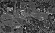
- Aerial image as of January 1995 from USGS The National Map
- FAA Terminal Procedures for UTS, effective December 8, 2016
- Resources for this airport:
- FAA airport information for UTS
- AirNav airport information for KUTS
- ASN accident history for HTV
- FlightAware airport information and live flight tracker
- NOAA/NWS latest weather observations
- SkyVector aeronautical chart, Terminal Procedures
