Ossineke Township, Michigan
| Ossineke Township, Michigan | |
|---|---|
| Township | |
 | |
 Ossineke Township Location within the state of Michigan | |
| Coordinates: 44°54′59″N 83°43′36″W / 44.91639°N 83.72667°WCoordinates: 44°54′59″N 83°43′36″W / 44.91639°N 83.72667°W | |
| Country | United States |
| State | Michigan |
| County | Alpena |
| Area | |
| • Total | 107.2 sq mi (277.7 km2) |
| • Land | 105.8 sq mi (273.9 km2) |
| • Water | 1.5 sq mi (3.9 km2) |
| Elevation | 722 ft (220 m) |
| Population (2010) | |
| • Total | 1,675 |
| • Density | 16/sq mi (6.1/km2) |
| Time zone | Eastern (EST) (UTC-5) |
| • Summer (DST) | EDT (UTC-4) |
| ZIP code | 49766 |
| Area code(s) | 989 |
| FIPS code | 26-61520[1] |
| GNIS feature ID | 1626866[2] |
Ossineke Township is a civil township of Alpena County in the U.S. state of Michigan. The population was 1,675 at the 2010 census.[3]
Communities
Hubbard Lake is an unincorporated community situated about one mile north of the water body, Hubbard Lake, which is entirely within Alcona County. The community is on the Thunder Bay River at 44°52′25″N 83°35′14″W / 44.87361°N 83.58722°W with an elevation of 732 feet (223 m) above sea level.[4] An early settler, John Ellsworth, began farming here in 1878. Descendants of John Ellsworth still own some of the farmland today. He became the first postmaster in June 1893.[5] The 49747 ZIP code also includes the northern and western shores of Lake Hubbard in Alcona County, as well as portions of western Caledonia Township and Alcona Township. In Alpena County, the ZIP code includes a large portion of central and eastern Ossineke Township and also extends into Wilson Township.[6]
The unincorporated community of Ossineke is located a few miles to the east in Sanborn Township.
Geography
According to the United States Census Bureau, the township has a total area of 107.2 square miles (277.7 km2), of which 105.8 square miles (273.9 km2) is land and 1.5 square miles (3.9 km2), or 1.39%, is water.[3]
Demographics
As of the census[1] of 2000, there were 1,761 people, 675 households, and 512 families residing in the township. The population density was 16.6 per square mile (6.4/km²). There were 1,043 housing units at an average density of 9.8 per square mile (3.8/km²). The racial makeup of the township was 98.75% White, 0.06% African American, 0.17% Native American, 0.06% Asian, and 0.97% from two or more races. Hispanic or Latino of any race were 0.57% of the population.
There were 675 households out of which 31.4% had children under the age of 18 living with them, 66.4% were married couples living together, 5.5% had a female householder with no husband present, and 24.1% were non-families. 21.6% of all households were made up of individuals and 10.8% had someone living alone who was 65 years of age or older. The average household size was 2.60 and the average family size was 3.02.
In the township the population was spread out with 25.3% under the age of 18, 7.2% from 18 to 24, 25.5% from 25 to 44, 27.0% from 45 to 64, and 15.0% who were 65 years of age or older. The median age was 40 years. For every 100 females there were 102.9 males. For every 100 females age 18 and over, there were 101.8 males.
The median income for a household in the township was $34,375, and the median income for a family was $39,643. Males had a median income of $30,461 versus $21,250 for females. The per capita income for the township was $16,473. About 6.8% of families and 10.8% of the population were below the poverty line, including 17.2% of those under age 18 and 5.4% of those age 65 or over.
References
- 1 2 "American FactFinder". United States Census Bureau. Retrieved 2008-01-31.
- ↑ U.S. Geological Survey Geographic Names Information System: Ossineke Township, Michigan
- 1 2 "Geographic Identifiers: 2010 Demographic Profile Data (G001): Ossineke township, Alpena County, Michigan". U.S. Census Bureau, American Factfinder. Retrieved June 10, 2013.
- ↑ U.S. Geological Survey Geographic Names Information System: Hubbard Lake, Michigan
- ↑ Romig, Walter (1986) [1973]. Michigan Place Names. Detroit, Michigan: Wayne State University Press. ISBN 0-8143-1838-X.
- ↑ 49747 5-Digit ZCTA, 497 3-Digit ZCTA - Reference Map - American FactFinder, U.S. Census Bureau
External links
Municipalities and communities of Alpena County, Michigan, United States | ||
|---|---|---|
| City | 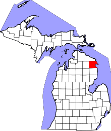 | |
| Village | ||
| Townships | ||
| Other unincorporated communities | ||
| Footnotes | ‡This populated place also has portions in an adjacent county or counties | |