Maple Ridge Township, Alpena County, Michigan
| Maple Ridge Township, Michigan | |
|---|---|
| Township | |
 Location of Maple Ridge Twp. within Alpena County | |
 Maple Ridge Township Location within the state of Michigan | |
| Coordinates: 45°7′15″N 83°34′11″W / 45.12083°N 83.56972°WCoordinates: 45°7′15″N 83°34′11″W / 45.12083°N 83.56972°W | |
| Country | United States |
| State | Michigan |
| County | Alpena |
| Area | |
| • Total | 53.8 sq mi (139.4 km2) |
| • Land | 51.6 sq mi (133.7 km2) |
| • Water | 2.2 sq mi (5.7 km2) |
| Elevation | 712 ft (217 m) |
| Population (2010) | |
| • Total | 1,690 |
| • Density | 33/sq mi (12.6/km2) |
| Time zone | Eastern (EST) (UTC-5) |
| • Summer (DST) | EDT (UTC-4) |
| FIPS code | 26-51220[1] |
| GNIS feature ID | 1626677[2] |
Maple Ridge Township is a civil township of Alpena County in the U.S. state of Michigan. The population was 1,690 at the 2010 census.[3] There is a fire department and township hall located here.
Communities
Bolton is an unincorporated community in the township approximately 12 miles (19 km) northwest of Alpena along the partially abandoned Detroit and Mackinac Railway at 45°10′53″N 83°35′23″W / 45.18139°N 83.58972°W.[4] It was named for Henry Bolton, who along with Donal McRae opened a general store in Alpena in 1866. From 1871, as Bolton & McRae, they operated one of the leading cedar lumbering firms in the area. A post office operated here from October 1880 until March 1955.[5]
Cathro is an unincorporated community in the township approximately 10 miles (16 km) northwest of Alpena along the Detroit and Mackinac Railway at 45°09′32″N 83°33′16″W / 45.15889°N 83.55444°W.[6] The community was named for George Cathro, a prominent farmer in the area. A post office operated here from November 1894 until March 1955.[5]
Geography
According to the United States Census Bureau, the township has a total area of 53.8 square miles (139.4 km2), of which 51.6 square miles (133.7 km2) is land and 2.2 square miles (5.7 km2), or 4.08%, is water.[3]
Demographics
As of the census[1] of 2000, there were 1,715 people, 640 households, and 490 families residing in the township. The population density was 33.0 per square mile (12.8/km²). There were 814 housing units at an average density of 15.7 per square mile (6.1/km²). The racial makeup of the township was 99.30% White, 0.06% African American, 0.35% Native American, 0.06% Asian, and 0.23% from two or more races. Hispanic or Latino of any race were 0.17% of the population.
There were 640 households out of which 36.1% had children under the age of 18 living with them, 65.5% were married couples living together, 7.0% had a female householder with no husband present, and 23.3% were non-families. 19.4% of all households were made up of individuals and 8.6% had someone living alone who was 65 years of age or older. The average household size was 2.68 and the average family size was 3.07.
In the township the population was spread out with 27.9% under the age of 18, 5.9% from 18 to 24, 29.3% from 25 to 44, 23.9% from 45 to 64, and 12.9% who were 65 years of age or older. The median age was 38 years. For every 100 females there were 103.4 males. For every 100 females age 18 and over, there were 107.0 males.
The median income for a household in the township was $35,871, and the median income for a family was $38,490. Males had a median income of $33,482 versus $20,192 for females. The per capita income for the township was $16,024. About 10.0% of families and 12.2% of the population were below the poverty line, including 16.4% of those under age 18 and 9.6% of those age 65 or over.
References
- 1 2 "American FactFinder". United States Census Bureau. Retrieved 2008-01-31.
- ↑ U.S. Geological Survey Geographic Names Information System: Maple Ridge Township, Alpena County, Michigan
- 1 2 "Geographic Identifiers: 2010 Demographic Profile Data (G001): Maple Ridge township, Alpena County, Michigan". U.S. Census Bureau, American Factfinder. Retrieved June 10, 2013.
- ↑ U.S. Geological Survey Geographic Names Information System: Bolton, Michigan
- 1 2 Romig, Walter (1986) [1973]. Michigan Place Names. Detroit, Michigan: Wayne State University Press. ISBN 0-8143-1838-X.
- ↑ U.S. Geological Survey Geographic Names Information System: Cathro, Michigan
External links
Municipalities and communities of Alpena County, Michigan, United States | ||
|---|---|---|
| City | 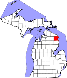 | |
| Village | ||
| Townships | ||
| Other unincorporated communities | ||
| Footnotes | ‡This populated place also has portions in an adjacent county or counties | |