Hoxie, Arkansas
| Hoxie, Arkansas | |
|---|---|
| City | |
 Location in Lawrence County and the state of Arkansas | |
| Coordinates: 36°2′55″N 90°58′38″W / 36.04861°N 90.97722°WCoordinates: 36°2′55″N 90°58′38″W / 36.04861°N 90.97722°W | |
| Country | United States |
| State | Arkansas |
| County | Lawrence |
| Government | |
| • Type | Municipal |
| • Mayor | Lanny Tinker |
| Area | |
| • Total | 4 sq mi (10.3 km2) |
| • Land | 4 sq mi (10.3 km2) |
| • Water | 0 sq mi (0 km2) |
| Elevation | 269 ft (82 m) |
| Population (2010) | |
| • Total | 2,780 |
| • Density | 704.3/sq mi (273.5/km2) |
| Time zone | Central (CST) (UTC-6) |
| • Summer (DST) | CDT (UTC-5) |
| ZIP code | 72433 |
| Area code(s) | 870 |
| FIPS code | 05-33580 |
| GNIS feature ID | 0057952 |
Hoxie is a town in Lawrence County, Arkansas, United States. It lies immediately south of Walnut Ridge. The population was 2,780 at the 2010 census.
Geography
Hoxie is located at 36°2′55″N 90°58′38″W / 36.04861°N 90.97722°W (36.048616, -90.977296).[1]
According to the United States Census Bureau, the city has a total area of 4.0 square miles (10 km2), all land.
List of highways
U.S. Highways 63 and 67 intersect and cross each other in Hoxie. U.S. 63 enters Arkansas at the Missouri line at Thayer, Missouri, and Mammoth Spring, Arkansas, two contiguous cities. U.S. 63 then goes southeastward to connect with Interstate 55 near Turrell, in Crittenden County. It runs contiguous with I-55 and I-40 for a ways. Both those interstates cross the Mississippi River into Memphis, Tennessee. U.S. 63 is then contiguous with a number of other routes southward in Arkansas, leaving Arkansas for Louisiana at Junction City, in Union County. U.S. 67 is a southwest--northeast bisector of Arkansas.
Two railroads, the Burlington Northern-Santa Fe and the Union Pacific, have mainline tracks that cross each other at Hoxie--the BNSF in a generally northwest-southeast direction, and the UP in a generally north and south direction. This same situation also occurs in Jonesboro, in Craighead County.
Demographics
| Historical population | |||
|---|---|---|---|
| Census | Pop. | %± | |
| 1890 | 102 | — | |
| 1900 | 125 | 22.5% | |
| 1910 | 915 | 632.0% | |
| 1920 | 1,711 | 87.0% | |
| 1930 | 1,448 | −15.4% | |
| 1940 | 1,466 | 1.2% | |
| 1950 | 1,855 | 26.5% | |
| 1960 | 1,886 | 1.7% | |
| 1970 | 2,265 | 20.1% | |
| 1980 | 2,961 | 30.7% | |
| 1990 | 2,676 | −9.6% | |
| 2000 | 2,817 | 5.3% | |
| 2010 | 2,780 | −1.3% | |
| Est. 2015 | 2,680 | [2] | −3.6% |
As of the census[4] of 2010, there were 2,780 people, 1,108 households, and 797 families residing in the city. The population density was 707.5 people per square mile (273.3/km²). There were 1,241 housing units at an average density of 311.7 per square mile (120.4/km²). The racial makeup of the city was 98.15% White, 0.46% Black or African American, 0.39% Native American, 0.07% Pacific Islander, 0.28% from other races, and 0.64% from two or more races. 1.49% of the population were Hispanic or Latino of any race.
There were 1,108 households out of which 36.0% had children under the age of 18 living with them, 53.6% were married couples living together, 14.9% had a female householder with no husband present, and 28.0% were non-families. 24.7% of all households were made up of individuals and 12.2% had someone living alone who was 65 years of age or older. The average household size was 2.54 and the average family size was 3.03.
In the city the population was spread out with 27.9% under the age of 18, 9.4% from 18 to 24, 28.1% from 25 to 44, 21.8% from 45 to 64, and 12.9% who were 65 years of age or older. The median age was 34 years. For every 100 females there were 91.9 males. For every 100 females age 18 and over, there were 86.8 males.
The median income for a household in the city was $24,726, and the median income for a family was $30,085. Males had a median income of $26,583 versus $18,418 for females. The per capita income for the city was $12,190. About 20.7% of families and 24.2% of the population were below the poverty line, including 31.3% of those under age 18 and 28.0% of those age 65 or over.
History
On August 17, 2014, at 2:30 AM, two Union Pacific freight trains collided in Hoxie, killing two people and causing the evacuation of about 500 people within a 1.5 square mile radius. U.S. 67 was closed for approximately one week for cleanup and repair. [5]
Education
Public education for elementary and secondary school students is provided by the Hoxie School District, which leads to graduation from Hoxie High School. The school mascot and athletic emblem is the Mustang with green and white serving as the school colors.
The third Arkansas school to integrate
On June 25, 1955, largely the result of the recent Brown v. Board of Education ruling, Hoxie's superintendent, Kunkel Edward Vance, spearheaded plans to integrate the schools, and he received the unanimous support of Hoxie's school board. On July 11, 1955, Hoxie schools recommenced and allowed African American students to attend. Vance insisted that all facilities, including restrooms and cafeterias, be integrated.[6]
Segregationists from outside the area converged on Hoxie in an unsuccessful attempt to reverse the school board decision. Approximately half of the white students boycotted the schools beginning on August 4, 1955. The Hoxie School Board filed suit against the segregationist leaders from Hoxie and elsewhere in the state and charged them with trespassing on school property, threatening picket lines, organizing boycotts, and intimidating school officials. In November 1955, United States District Judge for the Eastern District of Arkansas Thomas C. Trimble ruled that pro-segregationists had "planned and conspired" to prevent integration in Hoxie. In December 1955, he issued a permanent injunction and restraining order against the segregationists. Their appeal in the Eight Circuit Court of Appeals was opposed by United States Attorney General Herbert Brownell and the U.S. Department of Justice. This marked the first intervention by the attorney general in support of any school district attempting to comply with the Brown decision. On October 25, 1956, the court ruled in favor of the Hoxie School Board.
U.S. Attorney Osro Cobb recalls that the situation at Hoxie
had reached the point of possible bloodshed. Guns were being carried; threats were being made, and violence could have erupted at any moment. Notwithstanding, a conference exploring the situation and its possible effects on the community with the individuals at the core of the problem had worked a minor miracle. It demonstrated that while passions and prejudice in race relations often hurl reason aside, reason can be restored at the conference table where there is dedication by the parties to the public interest. That is the lesson to ber learned from Hoxie.[7]
Notable people
- Billy Taylor, All-American football player
- Miller Williams, poet
References
| Wikimedia Commons has media related to Hoxie, Arkansas. |
- ↑ "US Gazetteer files: 2010, 2000, and 1990". United States Census Bureau. 2011-02-12. Retrieved 2011-04-23.
- ↑ "Annual Estimates of the Resident Population for Incorporated Places: April 1, 2010 to July 1, 2015". Retrieved July 2, 2016.
- ↑ "Census of Population and Housing". Census.gov. Retrieved June 4, 2015.
- ↑ "American FactFinder". United States Census Bureau. Retrieved 2008-01-31.
- ↑ "2 killed, 2 hurt as freight trains collide in Arkansas". USA Today. August 17, 2014. Retrieved August 18, 2014.
- ↑ Jerry Vervack, Road to Armageddon: Arkansas and Brown v. Board of Education, May 17, 1954, to September 2, 1957. (Fayetteville, Arkansas: MA Thesis, University of Arkansas, 1978).
- ↑ Osro Cobb, Osro Cobb of Arkansas: Memoirs of Historical Significance (Little Rock, Arkansas: Rose Publishing Company, 1989), pp. 172–173.
External links
- Hoxie Public Schools
- Encyclopedia of Arkansas History & Culture entry: Hoxie (Lawrence County)
Municipalities and communities of Lawrence County, Arkansas, United States | ||
|---|---|---|
| Cities | 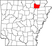 | |
| Towns | ||
| Unincorporated communities | ||