Howard, Colorado
| Howard, Colorado | |
|---|---|
| Census-designated place | |
 Howard Location within the state of Colorado | |
| Coordinates: 38°26′55″N 105°50′04″W / 38.44861°N 105.83444°WCoordinates: 38°26′55″N 105°50′04″W / 38.44861°N 105.83444°W | |
| Country |
|
| State |
|
| Counties | Fremont[1] |
| Area | |
| • Total | 16.8 sq mi (43.4 km2) |
| • Land | 16.8 sq mi (43.4 km2) |
| • Water | 0.0 sq mi (0.0 km2) |
| Elevation[1] | 6,716 ft (2,047 m) |
| Population (2010 census) | |
| • Total | 723 |
| • Density | 43/sq mi (16.7/km2) |
| Time zone | MST (UTC-7) |
| • Summer (DST) | MDT (UTC-6) |
| ZIP code[2] | 81233 |
| FIPS code | 08-37655 |
| GNIS feature ID | 191723 |
Howard is a census-designated place and a U.S. post office in Fremont County, Colorado, United States. The population as of the 2010 census was 723.[3] The Howard Post Office has the ZIP code 81233.[2]
A post office called Howard has been in operation since 1882.[4] The community has the name of John Howard, a local pioneer.[5]
Geography
Howard is located in southwestern Fremont County at 38°26′55″N 105°50′04″W / 38.44861°N 105.83444°W (38.448749,-105.834560), along the Arkansas River. U.S. Route 50 passes through the CDP, leading northwest 13 miles (21 km) to Salida and east 46 miles (74 km) to Cañon City, the Fremont County seat. Howard is bordered to the southeast by Coaldale.
According to the U.S. Census Bureau, the Howard CDP has an area of 16.8 square miles (43.4 km2), all land.[6] The CDP boundaries extend southwest from the Arkansas River Valley up the eastern slopes of the Sangre de Cristo Range within San Isabel National Forest.
See also
References
- 1 2 "US Board on Geographic Names". United States Geological Survey. 2007-10-25. Retrieved 2008-01-31.
- 1 2 "ZIP Code Lookup" (JavaScript/HTML). United States Postal Service. December 28, 2006. Retrieved December 28, 2006.
- ↑ Colorado Trend Report 2: State and Complete Places (Sub-state 2010 Census Data). Missouri Census Data Center. Accessed 2011-02-25.
- ↑ "Post offices". Jim Forte Postal History. Retrieved 27 June 2016.
- ↑ Dawson, John Frank. Place names in Colorado: why 700 communities were so named, 150 of Spanish or Indian origin. Denver, CO: The J. Frank Dawson Publishing Co. p. 27.
- ↑ "Geographic Identifiers: 2010 Census Summary File 1 (G001): Howard CDP, Colorado". American Factfinder. U.S. Census Bureau. Retrieved April 21, 2016.
Municipalities and communities of Fremont County, Colorado, United States | ||
|---|---|---|
| Cities | 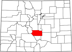 | |
| Towns | ||
| CDPs | ||
| Unincorporated communities | ||