Hoquiam, Washington
| Hoquiam, Washington | |
|---|---|
| City | |
|
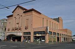
Downtown Hoquiam | |
 Location of Hoquiam, Washington | |
| Coordinates: 46°58′49″N 123°53′8″W / 46.98028°N 123.88556°WCoordinates: 46°58′49″N 123°53′8″W / 46.98028°N 123.88556°W | |
| Country | United States |
| State | Washington |
| County | Grays Harbor |
| Area[1] | |
| • Total | 15.60 sq mi (40.40 km2) |
| • Land | 9.02 sq mi (23.36 km2) |
| • Water | 6.58 sq mi (17.04 km2) |
| Elevation | 20 ft (6 m) |
| Population (2010)[2] | |
| • Total | 8,726 |
| • Estimate (2015)[3] | 8,405 |
| • Density | 967.4/sq mi (373.5/km2) |
| Time zone | Pacific (PST) (UTC-8) |
| • Summer (DST) | PDT (UTC-7) |
| ZIP code | 98550 |
| Area code(s) | 360 |
| FIPS code | 53-32300 |
| GNIS feature ID | 1512309[4] |
| Website | www.cityofhoquiam.com |

Hoquiam (/ˈhoʊkwiəm/ US dict: hōk′·wē·əm) is a city in Grays Harbor County, Washington, United States. The town borders the city of Aberdeen at Myrtle Street, with Hoquiam to the west. The two cities share a common economic history in lumbering and exporting, but Hoquiam has maintained its independent identity. Aberdeen is more populated, but the two cities have a long rivalry, especially in high school sports (see Sports).
Hoquiam (Ho'-kwee-um, or Ho-kwim, to natives) was incorporated on May 21, 1890. Its name comes from a Native-American word meaning "hungry for wood", so named from the great amount of driftwood at the mouth of the Hoquiam River.[5][6] In 2010 the population was 8,726.
History
One of the first logging operations in Hoquiam was established by Ed Campbell in 1872.[7]
About 10 years later, Captain Asa M. Simpson, a Pacific Coast mariner and businessman in the lumber industry from San Francisco, provided the financing for the Northwestern Mill.[8] In 1881, Simpson sent his manager, George Emerson, to Hoquiam to establish a mill there, and Emerson purchased 300 acres for the new mill and lumber operation. By September 1882, the Simpson mill was producing its first lumber products.[7]
.jpg)
In 1886, Captain Simpson merged his mill with the Miller Brother’s mill, also located in Hoquiam, and named it the Northwest Lumber Company[9] The mill was later renamed the Simpson Lumber Company, and retained that name until 1906. In 1913, Frank J. Shields became the new manager at the mill at Hoquiam.[10]
The extension of the railroad from Aberdeen to Hoquiam, beginning in 1898, contributed to the continued importance of logging and lumber in Hoquiam.[7] The importance of logging and related products continued to be relevant to Hoquiam’s economy, and in 1927, a pulp mill was established under the name of Grays Harbor Pulp Company. A year later, a Pennsylvania company- the Hammerhill Paper Company- became interested in Grays Harbor Pulp Company. When the Pennsylvania company bought stock in the Grays Harbor Pulp Company, the Grays Harbor pulp Company built a paper mill and became the Grays Harbor Pulp & Paper Company. In 1936, the Grays Harbor Pulp and Paper Company merged with Rayonier Incorporated,[7] a company which used a certain kind of pulp to produce rayon.[11]
In 1907, Hoquiam was home to Industrial Workers of the World Industrial Union No. 276.[12]
Geography
According to the United States Census Bureau, the city has a total area of 15.60 square miles (40.40 km2), of which, 9.02 square miles (23.36 km2) is land and 6.58 square miles (17.04 km2) is water.[1]
Climate
Hoquiam experiences a Mediterranean climate (Köppen climate classification Csb) that borders closely on an oceanic climate. Outside of the mild and dry summer season, rainfall is generally very high and monthly totals of over 20 inches (510 mm) are not unknown. Snowfall is rare and indeed does not fall many years, however in the winter of 1964/1965 as much as 40.8 inches (1.0 m) of snow fell in two storms.
| Climate data for Hoquiam, Washington | |||||||||||||
|---|---|---|---|---|---|---|---|---|---|---|---|---|---|
| Month | Jan | Feb | Mar | Apr | May | Jun | Jul | Aug | Sep | Oct | Nov | Dec | Year |
| Record high °F (°C) | 63 (17) |
72 (22) |
77 (25) |
83 (28) |
93 (34) |
96 (36) |
99 (37) |
98 (37) |
96 (36) |
83 (28) |
70 (21) |
60 (16) |
99 (37) |
| Average high °F (°C) | 46.7 (8.2) |
49.9 (9.9) |
52.2 (11.2) |
55.7 (13.2) |
60.4 (15.8) |
64.0 (17.8) |
67.6 (19.8) |
68.3 (20.2) |
67.5 (19.7) |
60.1 (15.6) |
51.8 (11) |
46.9 (8.3) |
57.6 (14.2) |
| Average low °F (°C) | 37.1 (2.8) |
37.8 (3.2) |
38.7 (3.7) |
41.4 (5.2) |
45.9 (7.7) |
50.1 (10.1) |
52.7 (11.5) |
53.4 (11.9) |
50.9 (10.5) |
45.5 (7.5) |
40.5 (4.7) |
37.3 (2.9) |
44.3 (6.8) |
| Record low °F (°C) | 16 (−9) |
13 (−11) |
22 (−6) |
27 (−3) |
29 (−2) |
36 (2) |
35 (2) |
40 (4) |
32 (0) |
28 (−2) |
12 (−11) |
9 (−13) |
9 (−13) |
| Average precipitation inches (mm) | 10.37 (263.4) |
7.67 (194.8) |
7.35 (186.7) |
4.88 (124) |
3.13 (79.5) |
2.23 (56.6) |
1.17 (29.7) |
1.57 (39.9) |
2.98 (75.7) |
6.52 (165.6) |
10.73 (272.5) |
10.71 (272) |
69.31 (1,760.4) |
| Average snowfall inches (cm) | 2.3 (5.8) |
0.7 (1.8) |
0.3 (0.8) |
0 (0) |
0 (0) |
0 (0) |
0 (0) |
0 (0) |
0 (0) |
0 (0) |
0.4 (1) |
1.3 (3.3) |
5 (12.7) |
| Average precipitation days (≥ 0.01 inch) | 22 | 19 | 21 | 18 | 14 | 13 | 7 | 8 | 10 | 16 | 21 | 23 | 192 |
| Source: [13] | |||||||||||||
Demographics
| Historical population | |||
|---|---|---|---|
| Census | Pop. | %± | |
| 1890 | 1,302 | — | |
| 1900 | 2,608 | 100.3% | |
| 1910 | 8,171 | 213.3% | |
| 1920 | 10,058 | 23.1% | |
| 1930 | 12,766 | 26.9% | |
| 1940 | 10,835 | −15.1% | |
| 1950 | 11,123 | 2.7% | |
| 1960 | 10,762 | −3.2% | |
| 1970 | 10,466 | −2.8% | |
| 1980 | 9,719 | −7.1% | |
| 1990 | 8,972 | −7.7% | |
| 2000 | 9,097 | 1.4% | |
| 2010 | 8,726 | −4.1% | |
| Est. 2015 | 8,405 | [14] | −3.7% |
| U.S. Decennial Census[15] 2015 Estimate[3] | |||
2010 census
As of the census[2] of 2010, there were 8,726 people, 3,480 households, and 2,119 families residing in the city. The population density was 967.4 inhabitants per square mile (373.5/km2). There were 3,938 housing units at an average density of 436.6 per square mile (168.6/km2). The racial makeup of the city was 85.5% White, 0.8% African American, 3.9% Native American, 1.1% Asian, 0.2% Pacific Islander, 4.2% from other races, and 4.2% from two or more races. Hispanic or Latino of any race were 9.5% of the population.
There were 3,480 households of which 32.3% had children under the age of 18 living with them, 37.5% were married couples living together, 16.5% had a female householder with no husband present, 6.8% had a male householder with no wife present, and 39.1% were non-families. 30.7% of all households were made up of individuals and 13.6% had someone living alone who was 65 years of age or older. The average household size was 2.48 and the average family size was 3.03.
The median age in the city was 37.6 years. 24.2% of residents were under the age of 18; 10.2% were between the ages of 18 and 24; 24.5% were from 25 to 44; 26.1% were from 45 to 64; and 15% were 65 years of age or older. The gender makeup of the city was 48.9% male and 51.1% female.
2000 census
As of the 2000 census, there were 9,097 people, 3,640 households, and 2,245 families residing in the city. The population density is 992 people per square mile (383/km²). There are 4,023 housing units, with an average density of 438.7 per square mile (169.4/km²). The racial distribution of the city is 89.32% White, 5.75% Latino, 3.86% Native American, 1.18% Asian, 0.32% African-American, 0.07% Pacific Islander, 2.09% from other races, and 3.18% from two or more races. The white population breaks down as 14.6% American, 13.8% German, 9.6% Irish, 6.8% English and 5.7% Norwegian ancestry.
There are 3,640 households of which 31.8% have children under the age of 18 living with them, 41.8% are married couples living together, 14.7% have a female head of house with no husband present, and 38.3% are non-families. 31.6% of all households are made up of individuals and 15.4% have someone living alone who is 65 years of age or older. The average household size is 2.47 persons and the average family size is 3.09 members.
The population is aligned with 27.4% under the age of 18, 8.6% from 18 to 24, 26.6% from 25 to 44, 22.0% from 45 to 64, and 15.3% who are 65 years of age or older. The median age is 36 years. For every 100 females there are 94.7 males. For every 100 females age 18 and over, there are 89.3 males.
The median household income is $29,658 and the median family income is $34,859. The median male income is $33,417 versus $23,558 for females. The per capita income for the city is $15,089. With 19.0% of the population and 16.1% of families are below the poverty line. Of the total population, 26.5% of those under the age of 18 and 8.9% of those 65 and older are living below the poverty line.
Arts and culture


Annual events
Hoquiam is the home of the Loggers' Playday, celebrated with a parade and logging competition every September, in which loggers from around the world come to participate.
Hoquiam sponsors the Shorebird Festival, the Logger's Playday, the Hoquiam's Riverfest, and the On Track Arts Festival.
Sports
The main sports team in the town is the Hoquiam High School Grizzlies, the Crimson and Gray. In 2004, the boys basketball team completed a perfect 28-0 season and won the state 2A championship. Victories included non-league wins over Lincoln High of Tacoma, Bellevue High, two over archrival Aberdeen High, and a win over a touring team from Australia. It was the only game the Australians lost during their tour.
In 2006, the Washington Interscholastic Activities Association (WIAA) changed the enrollment limit for the 2A classification allowing Aberdeen to drop to 2A along with other schools in the area creating a new league. The old league football rivalry which celebrated its 100th anniversary in 2006 was renewed with the 101st meeting between Hoquiam and Aberdeen on October 14. Hoquiam Grizzlies won 20-6. Although Aberdeen holds the overall record at 67-33-5 as of the 2010 season.
Hoquiam and Aberdeen High Schools also compete against each other in an annual Fall food drive, referred to as the "Food Ball" and dedicated to helping local low-income families. In this competition everyone wins regardless of which school collects the most food donations.
Since 1981, Hoquiam High School has hosted the largest distance running event on the Washington coast. The Hoquiam Grizzly Alumni Cross Country Invitational features 35+ schools and 1,000+ high school runners every October. Hoquiam also sponsors the Grizzly Alumni Wrestling tournament in January and Volleyball tournament in September.
The city was also home of the Western Baseball League's Grays Harbor Gulls from 1995 to 1997. They played their home games at Olympic Stadium listed on the National Register of Historic Places. The city is now home of the Grays Harbor Bearcats, a developmental football team of the North American Football League (NAFL).
Infrastructure
The local airport, Bowerman Airport (IATA: HQM, ICAO: KHQM, FAA LID: HQM), is coastal Washington's only jet-capable airport. It has a 5,000-foot (1,524 m) runway and a parallel taxiway located on a narrow peninsula extending westward into Grays Harbor. Hoquiam is also home to dozens of species of migratory birds that nest along the water's edge during the milder months.
Notable people
- Anton Anderson - chief engineer of Alaska Railroad; Mayor of Anchorage; worked as a surveyor in Hoquiam.
- Thomas J. Autzen - pioneer in plywood manufacturing.
- Eldon Bargewell - U.S. Army general; commander of Delta Force.
- Robert Cantwell - novelist and critic; lived in Hoquiam.
- Harris Ellsworth - U.S. Congressman from Oregon.
- Jack Elway - football player and coach.
- George H. Hitchings - co-recipient of 1988 Nobel Prize in Physiology or Medicine.
- Lynn Kessler - eight-term member of Washington State House of Representatives; lives in Hoquiam.
- Walt Morey - author.
- Howard P. Robertson - mathematician and physicist known for contributions to physical cosmology and the uncertainty principle.
- Martin F. Smith - U.S. Representative from Washington; practiced law in Hoquiam.
- William Boeing - Aviator who founded the Boeing company.
References
- 1 2 "US Gazetteer files 2010". United States Census Bureau. Retrieved 2012-12-19.
- 1 2 "American FactFinder". United States Census Bureau. Retrieved 2012-12-19.
- 1 2 "Population Estimates". United States Census Bureau. Retrieved June 19, 2016.
- ↑ "Hoquiam". Geographic Names Information System. United States Geological Survey.
- ↑ Gulick, Bill (1996). A Traveler's History of Washington. Caldwell, Idaho: Caxton Press. p. 164. ISBN 0-87004-371-4.
- ↑ Gannett, Henry (1905). The Origin of Certain Place Names in the United States. Govt. Print. Off. p. 161.
- 1 2 3 4 Van Syckle, Ed. A Brief Historical Sketch of Grays Harbor Washington. Chambers of Commerce of Hoquiam and Aberdeen, Washington, 1942.
- ↑ Lawrence, Michael. Historic American Engineering Record: Hoquiam River Bridge, National Park Service, 1993.
- ↑ Prosser, William Farrand. A History of the Puget Sound Country: Its Resources, Its commerce and Its People: with Some Reference to Discoveries and Explorations in North America from the Time of Christopher Columbus Down to that of George Vancouver in 1792, Lewis Publishing Company, 1903.
- ↑ Hunt, Herbet & Floyd C. Kaylor. Washington, West of the Cascades: Historical and Descriptive; the explorers, the Indians, the Pioneers, the Modern, Volume 3. S.J. Clarke publishing company, 1917
- ↑ Ficken, Robert E. The Forested Land: A History of Lumbering in Western Washington. University of Washington Press, Seattle, 1987.
- ↑ "Statement of Receipts and Expenditures". Industrial Union Bulletin. 1 (26). 24 August 1907. p. 3.
- ↑ "HOQUIAM FCWOS AP, WASHINGTON (453807)". Western Regional Climate Centre. Retrieved 1 November 2011.
- ↑ "Annual Estimates of the Resident Population for Incorporated Places: April 1, 2010 to July 1, 2015". Retrieved July 2, 2016.
- ↑ "U.S. Decennial Census". Census.gov. Retrieved June 6, 2013.
External links
| Wikimedia Commons has media related to Hoquiam, Washington. |
- Official city website
- Hoquiam, Washington at DMOZ
- Northwestern Lumber Company Photos, 1900-1935 Collection includes photos of logging operations in and around Hoquiam, Wa.
Municipalities and communities of Grays Harbor County, Washington, United States | ||
|---|---|---|
| Cities | 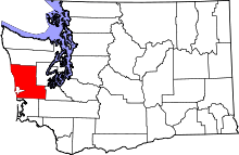 | |
| CDPs | ||
| Other unincorporated communities | ||
| Indian reservations | ||
| Footnotes | ‡This populated place also has portions in an adjacent county or counties | |