Holly Hill, South Carolina
| Holly Hill, South Carolina | |
|---|---|
| Town | |
|
Downtown Holly Hill, April 2015 | |
 Location in Orangeburg County, South Carolina | |
| Coordinates: 33°19′N 80°25′W / 33.317°N 80.417°WCoordinates: 33°19′N 80°25′W / 33.317°N 80.417°W | |
| Country | United States |
| State | South Carolina |
| County | Orangeburg |
| Area | |
| • Total | 1.4 sq mi (3.5 km2) |
| • Land | 1.3 sq mi (3.5 km2) |
| • Water | 0.0 sq mi (0 km2) |
| Elevation | 105 ft (32 m) |
| Population (2000) | |
| • Total | 1,281 |
| • Density | 949/sq mi (366.4/km2) |
| Time zone | EST (UTC−5) |
| • Summer (DST) | EDT (UTC−4) |
| ZIP code | 29059 |
| Area code | 803 |
| FIPS code | 45-34360[1] |
| GNIS feature ID | 1223233[2] |
| Website |
www |

Holly Hill is a town in Orangeburg County, South Carolina, United States. The population was 1,281 at the 2000 census. Prior to 1910 it was located in the northwest portion of Saint James Goose Creek Township, Berkeley County.
History
Dantzler Plantation and Providence Methodist Church are listed on the National Register of Historic Places.[3]
Geography
Holly Hill is located at 33°19′N 80°25′W / 33.317°N 80.417°W (33.3243, -80.4112).[4]
According to the United States Census Bureau, the town has a total area of 1.4 square miles (3.6 km2), all of it land.
Demographics
| Historical population | |||
|---|---|---|---|
| Census | Pop. | %± | |
| 1890 | 814 | — | |
| 1900 | 256 | −68.6% | |
| 1910 | 342 | 33.6% | |
| 1920 | 522 | 52.6% | |
| 1930 | 702 | 34.5% | |
| 1940 | 1,062 | 51.3% | |
| 1950 | 1,116 | 5.1% | |
| 1960 | 1,235 | 10.7% | |
| 1970 | 1,178 | −4.6% | |
| 1980 | 1,785 | 51.5% | |
| 1990 | 1,478 | −17.2% | |
| 2000 | 1,281 | −13.3% | |
| 2010 | 1,277 | −0.3% | |
| Est. 2015 | 1,237 | [5] | −3.1% |
As of the census[1] of 2000, there were 1,281 people, 502 households, and 359 families residing in the town. The population density was 950.7 people per square mile (366.4/km²). There were 575 housing units at an average density of 426.7 per square mile (164.5/km²). The racial makeup of the town was 48.95% White, 50.04% African American, 0.39% Native American, 0.08% Asian, and 0.55% from two or more races. Hispanic or Latino of any race were 0.47% of the population.
There were 502 households out of which 27.9% had children under the age of 18 living with them, 50.6% were married couples living together, 18.9% had a female householder with no husband present, and 28.3% were non-families. 26.5% of all households were made up of individuals and 13.9% had someone living alone who was 65 years of age or older. The average household size was 2.53 and the average family size was 3.05.
In the town the age distribution of the population shows 24.4% under the age of 18, 8.2% from 18 to 24, 23.8% from 25 to 44, 26.0% from 45 to 64, and 17.6% who were 65 years of age or older. The median age was 40 years. For every 100 females there were 79.9 males. For every 100 females age 18 and over, there were 76.5 males.
The median income for a household in the town was $33,036, and the median income for a family was $43,611. Males had a median income of $36,944 versus $21,346 for females. The per capita income for the town was $16,437. About 10.7% of families and 15.7% of the population were below the poverty line, including 20.2% of those under age 18 and 14.3% of those age 65 or over.
Notable people
- Willie Randolph – former Major League Baseball player and manager
- Brett Gardner – Left fielder for the New York Yankees
- Eddie Sweat – groom to U. S. Triple Crown winner Secretariat
- Frank Culbertson, Jr. – former NASA Space Shuttle astronaut
References
- 1 2 "American FactFinder". United States Census Bureau. Retrieved 2008-01-31.
- ↑ "US Board on Geographic Names". United States Geological Survey. 2007-10-25. Retrieved 2008-01-31.
- ↑ National Park Service (2010-07-09). "National Register Information System". National Register of Historic Places. National Park Service.
- ↑ "US Gazetteer files: 2010, 2000, and 1990". United States Census Bureau. 2011-02-12. Retrieved 2011-04-23.
- ↑ "Annual Estimates of the Resident Population for Incorporated Places: April 1, 2010 to July 1, 2015". Retrieved July 2, 2016.
- ↑ "Census of Population and Housing". Census.gov. Retrieved June 4, 2015.
External links
Municipalities and communities of Orangeburg County, South Carolina, United States | ||
|---|---|---|
| City | 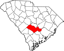 | |
| Towns | ||
| CDPs |
| |
| Unincorporated communities | ||