Elloree, South Carolina
| Elloree, South Carolina | |
|---|---|
| Town | |
| Motto: "A Small Slice of Southern Living" | |
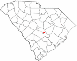 Location of Elloree, South Carolina | |
| Coordinates: 33°32′N 80°34′W / 33.533°N 80.567°WCoordinates: 33°32′N 80°34′W / 33.533°N 80.567°W | |
| Country | United States |
| State | South Carolina |
| County | Orangeburg |
| Area | |
| • Total | 15.0 sq mi (2.5 km2) |
| • Land | 15.0 sq mi (2.5 km2) |
| • Water | 0.0 sq mi (0.0 km2) |
| Elevation | 164 ft (50 m) |
| Population (2000) | |
| • Total | 742 |
| • Density | 772.3/sq mi (298.2/km2) |
| Time zone | Eastern (EST) (UTC-5) |
| • Summer (DST) | EDT (UTC-4) |
| ZIP code | 29047 |
| Area code(s) | 803 |
| FIPS code | 45-23470[1] |
| GNIS feature ID | 1247661[2] |
| Website |
www |
Elloree is a town in Orangeburg County, South Carolina, United States. The population was 742 at the 2000 census.
History
Trinity Lutheran Church was added to the National Register of Historic Places in 2008.[3]
Geography
Elloree is located at 33°32′N 80°34′W / 33.533°N 80.567°W (33.5321, -80.5718).[4]
According to the United States Census Bureau, the town has a total area of 1.0 square mile (2.6 km2), all of it land.
Demographics
| Historical population | |||
|---|---|---|---|
| Census | Pop. | %± | |
| 1890 | 311 | — | |
| 1900 | 413 | 32.8% | |
| 1910 | 540 | 30.8% | |
| 1920 | 925 | 71.3% | |
| 1930 | 1,098 | 18.7% | |
| 1940 | 1,123 | 2.3% | |
| 1950 | 1,127 | 0.4% | |
| 1960 | 1,031 | −8.5% | |
| 1970 | 940 | −8.8% | |
| 1980 | 909 | −3.3% | |
| 1990 | 939 | 3.3% | |
| 2000 | 742 | −21.0% | |
| 2010 | 692 | −6.7% | |
| Est. 2015 | 681 | [5] | −1.6% |
As of the census[1] of 2000, there were 742 people, 340 households, and 199 families residing in the town. The population density was 772.3 people per square mile (298.4/km²). There were 381 housing units at an average density of 396.5 per square mile (153.2/km²). The racial makeup of the town was 55.66% White, 43.94% African American, 0.13% Native American, and 0.27% from two or more races. Hispanic or Latino of any race were 0.13% of the population.
There were 340 households out of which 21.2% had children under the age of 18 living with them, 37.6% were married couples living together, 17.4% had a female householder with no husband present, and 41.2% were non-families. 37.9% of all households were made up of individuals and 23.5% had someone living alone who was 65 years of age or older. The average household size was 2.18 and the average family size was 2.89.
In the town the population was spread out with 20.6% under the age of 18, 7.8% from 18 to 24, 22.4% from 25 to 44, 24.8% from 45 to 64, and 24.4% who were 65 years of age or older. The median age was 45 years. For every 100 females there were 77.5 males. For every 100 females age 18 and over, there were 71.7 males.
The median income for a household in the town was $22,574, and the median income for a family was $35,380. Males had a median income of $26,838 versus $21,641 for females. The per capita income for the town was $21,711. About 12.3% of families and 21.1% of the population were below the poverty line, including 33.3% of those under age 18 and 14.6% of those age 65 or over.
Notable people
- William H. Brandenburg, retired Major General
- Chris Antley, jockey, rode winning horses at the Kentucky Derby and the Preakness Stakes.
- Template:Rodney Anderson, Major General, US Army Retired. Paratrooper, 82D Airborne Division
+Template:Elizabeth Cheeseboro Johnson Landowner and Matriarch of the Bonaparte, Bostick, Thompson and Johnson family. Owner of hundreds of prime acreage in Orangeburg and Calhoun counties. Lands that still remain with her heirs.
References
- 1 2 "American FactFinder". United States Census Bureau. Retrieved 2008-01-31.
- ↑ "US Board on Geographic Names". United States Geological Survey. 2007-10-25. Retrieved 2008-01-31.
- ↑ National Park Service (2010-07-09). "National Register Information System". National Register of Historic Places. National Park Service.
- ↑ "US Gazetteer files: 2010, 2000, and 1990". United States Census Bureau. 2011-02-12. Retrieved 2011-04-23.
- ↑ "Annual Estimates of the Resident Population for Incorporated Places: April 1, 2010 to July 1, 2015". Retrieved July 2, 2016.
- ↑ "Census of Population and Housing". Census.gov. Retrieved June 4, 2015.
External links
Municipalities and communities of Orangeburg County, South Carolina, United States | ||
|---|---|---|
| City | 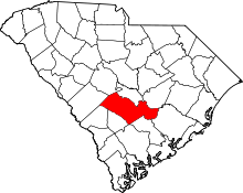 | |
| Towns | ||
| CDPs |
| |
| Unincorporated communities | ||