Hidalgo Municipality, Coahuila
| Hidalgo | ||
|---|---|---|
| Municipality | ||
| ||
 Municipality of Hidalgo in Coahuila | ||
|
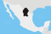
Hidalgo Location in Mexico | ||
| Coordinates: 27°47′28″N 99°52′27″W / 27.79111°N 99.87417°WCoordinates: 27°47′28″N 99°52′27″W / 27.79111°N 99.87417°W | ||
| Country | Mexico | |
| State | Coahuila | |
| Municipal seat | Hidalgo | |
| Area | ||
| • Total | 1,619.8 km2 (625.4 sq mi) | |
| Population (2010) | ||
| • Total | 1,852 | |

Hidalgo is one of the 38 municipalities of Coahuila, in north-eastern Mexico. The municipal seat lies at Hidalgo. The municipality covers an area of 1619.8 km² and is located on the international border between Mexico and the USA, there formed by the Río Bravo del Norte (Rio Grande), adjacent to the U.S. state of Texas.
As of 2010, the municipality had a total population of 1,852.[1]
Towns and villages
The largest localities (cities, towns, and villages) are:
| Name | 2010 Census Population |
|---|---|
| Hidalgo | 1,638 |
| El Semoro (Arroyitos) | 12 |
| Los Borregos | 12 |
| San Francisco | 12 |
| Total Municipality | 1,852 |
Adjacent municipalities and counties
- Anáhuac Municipality, Nuevo León - southeast and south
- Juárez Municipality - southwest
- Villa Unión Municipality - west
- Guerrero Municipality - northwest
- Webb County, Texas - northeast
References
- ↑ 2010 census tables: INEGI accessdate=April 29, 2011
This article is issued from Wikipedia - version of the 4/8/2013. The text is available under the Creative Commons Attribution/Share Alike but additional terms may apply for the media files.