Henley Beach, South Australia
| Henley Beach Adelaide, South Australia | |||||||||||||
|---|---|---|---|---|---|---|---|---|---|---|---|---|---|
 Henley Beach jetty | |||||||||||||
| Population | 5,562 (2011 census)[1] | ||||||||||||
| • Density | 2,220/km2 (5,760/sq mi) | ||||||||||||
| Established | c. 1860[2] | ||||||||||||
| Postcode(s) | 5022[3] | ||||||||||||
| Area | 2.5 km2 (1.0 sq mi) | ||||||||||||
| Location | 9.7 km (6 mi) W of Adelaide city centre[3] | ||||||||||||
| LGA(s) | City of Charles Sturt[4] | ||||||||||||
| State electorate(s) | Colton (2011)[5] | ||||||||||||
| Federal Division(s) | Hindmarsh (2011)[6] | ||||||||||||
| |||||||||||||


Henley Beach is a coastal suburb of Adelaide, South Australia in the City of Charles Sturt.
History
Named for English town of Henley-on-Thames, the Town of Henley Beach was promoted in the South Australian Register in 1860 as being "free from all the noxious smells which have been cause of complaint elsewhere".[2] The Register again advertised the township in 1874:[2]
While admitted to be one of the finest in the colony, [it] has been somewhat neglected owing to the road not being made. The District Council and private enterprise, however, have overcome this...— The Manning Index of South Australian History
Earliest neighbouring suburbs in the mid 20th century before name changes and deletions - Kirkcaldy, Grangeville & Fulham Park. Trains & Trams ventured to Henley Beach until they were disbanded in 1957.
Geography
Henley Beach lies between the suburbs of West Beach and Grange.[7]
Demographics
The 2006 Census by the Australian Bureau of Statistics counted 5,405 persons in Henley Beach on census night. Of these, 49.9% were male and 50.1% were female.[8]
The majority of residents (73.6%) are of Australian birth, with a further 6.8% identifying England as their country of origin.[8]
The age distribution of Henley Beach residents is skewed slightly higher than the greater Australian population. 71.2% of residents were over 25 years in 2006, compared to the Australian average of 66.5%; and 28.8% were younger than 25 years, compared to the Australian average of 33.5%.[8]
Politics
Local government
Henley Beach is part of Henley Ward in the City of Charles Sturt local government area, being represented in that council by Jim Fitzpatrick and Robert Randall.[4] It was part of the Henley & Grange Council from 1915 until the merger with the City of Hindmarsh Woodville to create the City of Charles Sturt on 1 January 1997.[9][10]
State and federal
Henley Beach lies in the state electoral district of Colton[5] and the federal electoral division of Hindmarsh.[6] The suburb is represented in the South Australian House of Assembly by Paul Caica[5] and federally by Matt Williams.[6]
Community
Schools
There are several schools in the suburb, including Fulham Gardens Primary School (Mitton Avenue), Fulham North Primary School (Cheadle Street), Henley High School (Cudmore Terrace), St Michael's College, Henley Beach Primary School and Star of the Sea School a[11]
Facilities and attractions
Shopping and dining
There are several shops, hotels and restaurants in the streets adjoining Henley Square
Parks
Henley Square is located behind Henley Jetty on the Esplanade. Other significant greenspace in the suburb is the Henley Grange Memorial Oval and John Mitchell Oval. Henley Beach extends the length of the suburb.[7]
Transportation
Roads
Henley Beach is serviced by Grange Road and Henley Beach Road, both connecting the suburb to Adelaide City Centre. Seaview Road runs along the coast.[7]
Public transport
Henley Beach is serviced by public transport run by the Adelaide Metro.[12]
Bus services within the suburb include:
- Buses to city from Seaview Rd: H30/X30 and from stop 30 Military Rd (Foodland): 286, 287 & H33.
- H22/H32 to Henley Beach South.
- To Glenelg is the suburban connector route 300 service from Seaview Road & Harbourtown shopping precinct.
Gallery
 Araucaria trees at Henley Beach
 Henley Beach jetty
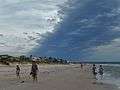 Cloudy summer weather
 Sunset
 The Ramsgate
 Henley Beach North
See also
| Wikimedia Commons has media related to Henley Beach, South Australia. |
References
- ↑ Australian Bureau of Statistics (31 October 2012). "Henley Beach (State Suburb)". 2011 Census QuickStats. Retrieved 5 October 2016.
- 1 2 3 "Place Names of South Australia". The Manning Index of South Australian History. State Library of South Australia. Retrieved 1 February 2012.
- 1 2 "Henley Beach, South Australia (Adelaide)". Postcodes-Australia. Postcodes-Australia.com. Retrieved 1 February 2012.
- 1 2 "City of Charles Sturt Wards and Council Members" (PDF). City of Charles Sturt. Retrieved 1 February 2012.
- 1 2 3 "Electoral Districts - Electoral District for the 2010 Election". Electoral Commission SA. Retrieved 1 February 2012.
- 1 2 3 "Find my electorate: Hindmarsh". Australian Electoral Commission. Retrieved 1 February 2012.
- 1 2 3 Adelaide and surrounds street directory (49th ed.). UBD. 2011. ISBN 978-0-7319-2652-7.
- 1 2 3 Australian Bureau of Statistics (25 October 2007). "Henley Beach (State Suburb)". 2006 Census QuickStats. Retrieved 1 February 2012.
- ↑ Marsden, S (1977). A History of Woodville. Corporation of the City of Woodville. p. 3. ISBN 0-9599828-4-1.
- ↑ "About Our City". The City of Charles Sturt. Retrieved 3 November 2015.
- ↑ "Australian Schools Directory". Australian Schools Directory. Retrieved 1 February 2012.
- ↑ "Public Transport in Adelaide". Adelaide Metro official website. Dept. for Transport, Energy and Infrastructure, Public Transport Division. Retrieved 1 February 2012.
External links
- "City of Charles Sturt". Official website. City of Charles Sturt. Retrieved 1 February 2012.
Coordinates: 34°55′12″S 138°29′38″E / 34.92°S 138.494°E