Hay River Reserve
| Hay River Reserve K'atlodeeche/Katl'odeeche First Nation Hay River Dene 1 | |
|---|---|
| K'atlodeechee First Nation | |
 Hay River Reserve | |
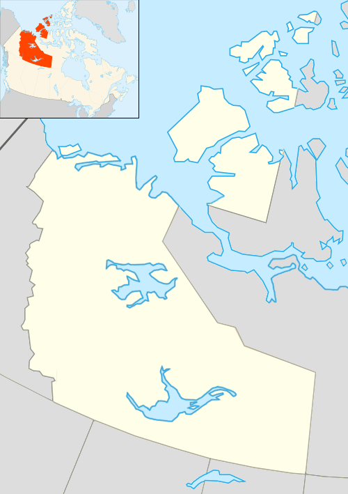
| Coordinates: 60°50′01″N 115°45′57″W / 60.83361°N 115.76583°WCoordinates: 60°50′01″N 115°45′57″W / 60.83361°N 115.76583°W | |
| Country | Canada |
| Territory | Northwest Territories |
| Region | South Slave Region |
| Constituency | Deh Cho |
| Census division | Region 4 |
| Government | |
| • Chief | Roy Fabien |
| • Senior Administrative Officer | Scotty Edgerton |
| • MLA | Michael McLeod |
| Area[1] | |
| • Land | 134.07 km2 (51.76 sq mi) |
| Elevation | 165 m (541 ft) |
| Population (2011)[1] | |
| • Total | 292 |
| • Density | 2.2/km2 (6/sq mi) |
| Time zone | Mountain (MST) (UTC-7) |
| • Summer (DST) | MDT (UTC-6) |
| Canadian Postal code | X0E 1G4 |
| Area code(s) | 867 |
| Telephone exchange | 874 |
| - Food price index | 105.2A |
|
Sources: Department of Municipal and Community Affairs,[2] Prince of Wales Northern Heritage Centre,[3] Canada Flight Supplement[4] ^A 2009 figure based on Yellowknife = 100[5] | |
Hay River Reserve (also known as K'atlodeeche/Katl'odeeche First Nation or Hay River Dene 1[1]) is one of only two Indian reserves[6] in Canada's Northwest Territories. Located in the South Slave Region, it is a Slavey community with a population of 292 (of which the majority are First Nations) at the 2011 census.[1][7] The main languages on the reserve are South Slavey, Chipewyan, and English.[8] In 2012 the Government of the Northwest Territories reported that the population was 341.[5]
The reserve covers an area of 52 sq mi (130 km2) and claims a band membership of 600 people.[9] The reserve is governed by a Band Council, consisting of a Chief and four Counselors, who are elected every two years on "Treaty Day". Along with the Fort Providence Dene Band the reserve operates "Evergreen Forestry Management Ltd."[10] The reserve also runs the Ehdah Cho Store,[6] "Tu-Cho Gha Contracting",[11] and the "Nats’jee Keh Treatment Centre".
Primary and secondary education in the community is provided by Chief Sunrise Education Centre.[12]
History
Although the Dene had been using the area around the mouth of the Hay River for many years as a fishing site it was not settled until the 1890s when Chief Chiatlo led a group to the site. Later both the Anglican, with a mission school, and the Roman Catholic Church along with trading posts and the Royal Canadian Mounted Police arrived.[13] However, the NWT Government says that the first building in the area was the Hudson's Bay Company, followed by the Roman Catholic Mission, and then the Anglican Mission.[14]
The original site was located right at the mouth of the river just east of Vale Island at 60°51′32″N 115°43′33″W / 60.85889°N 115.72583°W[15] However, this site was subject to flooding and it was decided to move to a different area. The current site is located on the south shore of the Hay River, near the mouth of Great Slave Lake[16] In 1974 the then chief, Daniel Sonfrere, negotiated a settlement with the Government of Canada and the first reserve in the NWT was formed.[13]

The site of the original mission buildings, including St. Peter’s Anglican Church, Ste. Anne’s Roman Catholic Church, the remains of a rectory, and associated cemeteries, was designated as a National Historic Site of Canada in 1992, due to its association with the meeting of Dene and European cultures.[17]
Climate
| Climate data for Hay River/Merlyn Carter Airport | |||||||||||||
|---|---|---|---|---|---|---|---|---|---|---|---|---|---|
| Month | Jan | Feb | Mar | Apr | May | Jun | Jul | Aug | Sep | Oct | Nov | Dec | Year |
| Record high humidex | 10.6 | 12.9 | 14.6 | 25.8 | 31.1 | 35.1 | 44.6 | 39.8 | 32.2 | 25.4 | 12.8 | 11.2 | 44.6 |
| Record high °C (°F) | 10.7 (51.3) |
13.9 (57) |
15.6 (60.1) |
26.0 (78.8) |
33.3 (91.9) |
34.0 (93.2) |
35.0 (95) |
36.7 (98.1) |
30.0 (86) |
25.4 (77.7) |
15.0 (59) |
12.2 (54) |
36.7 (98.1) |
| Average high °C (°F) | −17.3 (0.9) |
−14.2 (6.4) |
−7.8 (18) |
2.9 (37.2) |
10.7 (51.3) |
18.0 (64.4) |
21.2 (70.2) |
19.6 (67.3) |
13.2 (55.8) |
4.1 (39.4) |
−7.7 (18.1) |
−14.4 (6.1) |
2.4 (36.3) |
| Daily mean °C (°F) | −21.8 (−7.2) |
−19.6 (−3.3) |
−13.8 (7.2) |
−2.7 (27.1) |
5.4 (41.7) |
12.5 (54.5) |
16.1 (61) |
14.6 (58.3) |
8.7 (47.7) |
0.5 (32.9) |
−11.6 (11.1) |
−18.8 (−1.8) |
−2.5 (27.5) |
| Average low °C (°F) | −26.2 (−15.2) |
−24.9 (−12.8) |
−19.8 (−3.6) |
−8.1 (17.4) |
0.0 (32) |
7.0 (44.6) |
10.9 (51.6) |
9.5 (49.1) |
4.1 (39.4) |
−3.2 (26.2) |
−15.4 (4.3) |
−23.1 (−9.6) |
−7.4 (18.7) |
| Record low °C (°F) | −47.8 (−54) |
−48.3 (−54.9) |
−44.4 (−47.9) |
−38.9 (−38) |
−20.5 (−4.9) |
−5.6 (21.9) |
0.7 (33.3) |
−1.1 (30) |
−11.7 (10.9) |
−24.3 (−11.7) |
−40.8 (−41.4) |
−47.2 (−53) |
−48.3 (−54.9) |
| Record low wind chill | −58.7 | −60.4 | −54.9 | −47.7 | −26.6 | −7.4 | 0.0 | 0.0 | −17.1 | −34.3 | −54.4 | −55.8 | −60.4 |
| Average precipitation mm (inches) | 16.4 (0.646) |
14.3 (0.563) |
14.4 (0.567) |
12.6 (0.496) |
23.3 (0.917) |
31.9 (1.256) |
43.0 (1.693) |
58.7 (2.311) |
44.6 (1.756) |
35.7 (1.406) |
24.8 (0.976) |
16.8 (0.661) |
336.4 (13.244) |
| Average rainfall mm (inches) | 0.1 (0.004) |
0.2 (0.008) |
0.2 (0.008) |
4.3 (0.169) |
18.0 (0.709) |
31.9 (1.256) |
43.0 (1.693) |
58.7 (2.311) |
43.0 (1.693) |
16.8 (0.661) |
0.9 (0.035) |
0.3 (0.012) |
217.4 (8.559) |
| Average snowfall cm (inches) | 19.2 (7.56) |
16.9 (6.65) |
16.4 (6.46) |
8.7 (3.43) |
5.2 (2.05) |
0.1 (0.04) |
0.0 (0) |
0.0 (0) |
1.5 (0.59) |
19.9 (7.83) |
30.4 (11.97) |
20.7 (8.15) |
138.9 (54.69) |
| Average precipitation days (≥ 0.2 mm) | 11.3 | 9.7 | 8.5 | 5.0 | 8.0 | 8.8 | 9.9 | 11.3 | 12.2 | 12.6 | 14.2 | 11.4 | 122.8 |
| Average rainy days (≥ 0.2 mm) | 0.1 | 0.2 | 0.2 | 2.0 | 6.7 | 8.8 | 9.9 | 11.3 | 11.9 | 6.2 | 1.0 | 0.6 | 58.9 |
| Average snowy days (≥ 0.2 cm) | 12.0 | 10.1 | 8.7 | 3.7 | 1.8 | 0.1 | 0.0 | 0.0 | 0.8 | 8.1 | 14.5 | 12.4 | 72.2 |
| Average relative humidity (%) | 69.2 | 66.3 | 61.3 | 60.2 | 55.0 | 54.4 | 57.6 | 59.9 | 62.5 | 70.6 | 78.0 | 73.7 | 64.0 |
| Source: Environment Canada Canadian Climate Normals 1981–2010[18] | |||||||||||||
See also
References
- 1 2 3 4 Hay River Dene 1, IRI Northwest Territories (Census subdivision)
- ↑ "NWT Communities - Hay River Reserve". Government of the Northwest Territories: Department of Municipal and Community Affairs. Retrieved 2014-01-29.
- ↑ "Northwest Territories Official Community Names and Pronunciation Guide". Prince of Wales Northern Heritage Centre. Yellowknife: Education, Culture and Employment, Government of the Northwest Territories. Archived from the original on 2016-01-13. Retrieved 2016-01-13.
- ↑ Canada Flight Supplement. Effective 0901Z 15 September 2016 to 0901Z 10 November 2016
- 1 2 Hay River Reserve - Statistical Profile at the GNWT
- 1 2 Public Works and Government Services Canada
- ↑ 2006 Aboriginal Population Profile
- ↑ "Hay River Reserve at the GNWT". Legislative Assembly of the Northwest Territories. Archived from the original on 2013-10-17.
- ↑ Katlodeeche First Nation Reserve
- ↑ Indian and Northern Affairs Canada
- ↑ NWT Aboriginal Directory - South Slave Region
- ↑ http://www.ssdec.nt.ca/schools/Chief_Sunrise.htm
- 1 2 History - Katl'odeeche (Hay River Dene Reserve)
- ↑ NWT Bureau of Statistics
- ↑ Map of Vale Island
- ↑ Map of the area
- ↑ Hay River Mission Sites. Canadian Register of Historic Places. Retrieved 22 October 2013.
- ↑ "Hay River A" (CSV (3069 KB)). Canadian Climate Normals 1981–2010. Environment Canada. Climate ID: 2202400. Retrieved 2014-01-09.
External links
| Census divisions | |||||||||||
|---|---|---|---|---|---|---|---|---|---|---|---|
| Former census divisions | |||||||||||
| Dehcho Region |
| ||||||||||
| Inuvik Region |
| ||||||||||
| North Slave Region |
| ||||||||||
| Sahtu Region |
| ||||||||||
| South Slave Region |
| ||||||||||
| Weather stations (outside of communities) | |||||||||||
| Mine sites |
| ||||||||||
| DEW line and NWS sites |
| ||||||||||
| Hudson's Bay Company trading posts | |||||||||||
| Former districts |
| ||||||||||
| |||||||||||
| Numbered Treaties | |
|---|---|
| Saskatchewan | |
| Alberta |
|
| British Columbia | |
| Northwest Territories |
|