Haugan, Montana
Haugan (also Waugan) is an unincorporated community in Mineral County, Montana, United States.[1] Haugan is situated 16 miles (26 km) east of the Idaho border and 90 miles (140 km) west of Missoula on Interstate 90 at the Haugan Exit #16.[2]
Haugan was named for H. G. Haugan, Land Commissioner of the Chicago, Milwaukee & St. Paul Railway.[3] Haugan was established and maintained to serve as a pusher station for the Milwaukee Road railroad trains ascending the Bitterroot Range of the Rocky Mountains.[4]
Haugan was one of several area towns to be destroyed during the Great Fire of 1910.[5] Haugan had a post office for nearly seventy years in the twentieth century. Opened on March 25, 1911, the post office closed on August 31, 1944, only to reopen four years later. This second post office operated from June 16, 1948 to July 22, 1983.[6]
Haugan is surrounded by the Lolo National Forest and is the site of the Savenac Nursery Historic District. The nearby Haugan/Randolph Creek Loop Snowmobile Trail offers cross-country skiing, snowmobiling and other winter sport. Also nearby is the summit of Haugan Mountain.
The community is most commonly known for its Silver Dollars tourist area. Signs telling drivers the distance are seen on Interstate 90 around Western Montana, Northern Idaho, and Eastern Washington.[7]
References
- ↑ U.S. Geological Survey Geographic Names Information System: Haugan, Montana
- ↑ Haugan, Montana Office of Tourism, 2009. Accessed 2009-03-14.
- ↑ "Origins of Names on Milwaukee". Roundup Record-Tribune & Winnett Times. August 22, 1940. p. 6. Retrieved 27 April 2015.
- ↑ Compiled Montana Place Names, Montana Railroad History. Accessed 2009-03-14.
- ↑ Cheney, Roberta Carkeek. Names on the Face of Montana: The Story of Montana's Place Names. Missoula: Mountain, 1983.
- ↑ U.S. Geological Survey Geographic Names Information System: Haugan Post Office
- ↑ Lincoln's Silver Dollar: 46,785 and growing, Montana Gaming Group, November 2006. Accessed 2009-03-14.
Further reading
- Lutz, Dennis J. Montana Post Offices and Postmasters Rochester: Johnson, 1986.
- Pyne, Stephen J. Year of the Fires: The Story of the Great Fires of 1910. Missoula: Mountain, 2008.
External links
- Milwaukee Road Historical Association
- Haugan/Randolph Creek Loop Snowmobile Trail. Haugan, MT
- About Beautiful Haugan, MT
- Mineral County Chamber of Commerce
- The Milwaukee Road Rocky Mountain Division
- CMSP&P Haugan, MT
Municipalities and communities of Mineral County, Montana, United States | ||
|---|---|---|
| Towns | 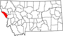 | |
| CDPs | ||
| Unincorporated communities | ||
Coordinates: 47°23′00″N 115°23′59″W / 47.38333°N 115.39972°W