Harveysburg, Ohio
| Harveysburg, Ohio | |
|---|---|
| Village | |
|
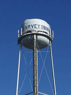
Water tower | |
| Nickname(s): Village on the lake | |
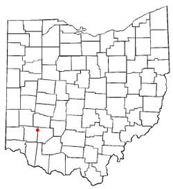 Location of Harveysburg, Ohio | |
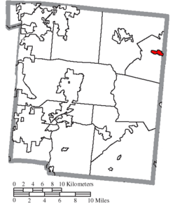 Location of Harveysburg in Warren County | |
| Coordinates: 39°30′0″N 84°0′14″W / 39.50000°N 84.00389°WCoordinates: 39°30′0″N 84°0′14″W / 39.50000°N 84.00389°W | |
| Country | United States |
| State | Ohio |
| County | Warren |
| Founded | 1829 |
| Established | 1831 |
| Village | 1844 |
| Government | |
| • Type | Council-city manager |
| • Mayor | Dick Verga |
| Area[1] | |
| • Total | 1.01 sq mi (2.62 km2) |
| • Land | 0.99 sq mi (2.56 km2) |
| • Water | 0.02 sq mi (0.05 km2) |
| Elevation[2] | 928 ft (283 m) |
| Population (2010)[3] | |
| • Total | 546 |
| • Estimate (2012[4]) | 545 |
| • Density | 551.5/sq mi (212.9/km2) |
| Time zone | Eastern (EST) (UTC-5) |
| • Summer (DST) | EDT (UTC-4) |
| ZIP code | 45032 |
| Area code(s) | 513 |
| FIPS code | 39-34384[5] |
| GNIS feature ID | 1064810[2] |
Harveysburg is a village in Massie Township, Warren County, Ohio, United States. The population was 546 at the 2010 census. It is best known as the home of the Ohio Renaissance Festival.
History
Harveysburg was platted in 1829 by William Harvey, and named for him.[6] Ardent abolitionists, the Harvey family established the Harvey Free Negro School in 1831.[7] A post office has been in operation at Harveysburg since 1839.[8]
Geography
Harveysburg is located at 39°30′0″N 84°0′14″W / 39.50000°N 84.00389°W (39.500100, −84.003915).[9]
According to the United States Census Bureau, the village has a total area of 1.01 square miles (2.62 km2), of which 0.99 square miles (2.56 km2) is land and 0.02 square miles (0.05 km2) is water.[1]
Demographics
| Historical population | |||
|---|---|---|---|
| Census | Pop. | %± | |
| 1830 | 99 | — | |
| 1850 | 329 | — | |
| 1860 | 445 | 35.3% | |
| 1870 | 388 | −12.8% | |
| 1880 | 539 | 38.9% | |
| 1890 | 402 | −25.4% | |
| 1900 | 435 | 8.2% | |
| 1910 | 359 | −17.5% | |
| 1920 | 355 | −1.1% | |
| 1930 | 361 | 1.7% | |
| 1940 | 354 | −1.9% | |
| 1950 | 477 | 34.7% | |
| 1960 | 514 | 7.8% | |
| 1970 | 486 | −5.4% | |
| 1980 | 425 | −12.6% | |
| 1990 | 437 | 2.8% | |
| 2000 | 563 | 28.8% | |
| 2010 | 546 | −3.0% | |
| Est. 2015 | 551 | [10] | 0.9% |
2010 census
As of the census[3] of 2010, there were 546 people, 204 households, and 147 families residing in the village. The population density was 551.5 inhabitants per square mile (212.9/km2). There were 237 housing units at an average density of 239.4 per square mile (92.4/km2). The racial makeup of the village was 95.1% White, 1.5% African American, 0.4% Asian, 0.2% from other races, and 2.9% from two or more races. Hispanic or Latino of any race were 0.2% of the population.
There were 204 households of which 37.3% had children under the age of 18 living with them, 57.8% were married couples living together, 7.4% had a female householder with no husband present, 6.9% had a male householder with no wife present, and 27.9% were non-families. 20.6% of all households were made up of individuals and 5.9% had someone living alone who was 65 years of age or older. The average household size was 2.68 and the average family size was 3.08.
The median age in the village was 37.3 years. 26.4% of residents were under the age of 18; 5.9% were between the ages of 18 and 24; 27.1% were from 25 to 44; 31.4% were from 45 to 64; and 9.3% were 65 years of age or older. The gender makeup of the village was 51.1% male and 48.9% female.
2000 census
As of the census[5] of 2000, there were 563 people, 191 households, and 152 families residing in the village. The population density was 857.1 people per square mile (329.4/km²). There were 208 housing units at an average density of 316.7 per square mile (121.7/km²). The racial makeup of the village was 96.45% White, 2.13% African American, 0.18% Asian, 0.18% from other races, and 1.07% from two or more races. Hispanic or Latino of any race were 1.95% of the population.
There were 191 households out of which 45.5% had children under the age of 18 living with them, 62.8% were married couples living together, 13.1% had a female householder with no husband present, and 19.9% were non-families. 14.7% of all households were made up of individuals and 4.7% had someone living alone who was 65 years of age or older. The average household size was 2.95 and the average family size was 3.29.
In the village the population was spread out with 32.3% under the age of 18, 7.8% from 18 to 24, 32.7% from 25 to 44, 19.4% from 45 to 64, and 7.8% who were 65 years of age or older. The median age was 31 years. For every 100 females there were 94.1 males. For every 100 females age 18 and over, there were 92.4 males.
The median income for a household in the village was $44,750, and the median income for a family was $49,063. Males had a median income of $31,923 versus $23,333 for females. The per capita income for the village was $16,918. About 7.7% of families and 8.6% of the population were below the poverty line, including 8.4% of those under age 18 and none of those age 65 or over.
Notable people
- Rev. Larry Davis, a Baptist minister who pleaded guilty to charges stemming from misappropriation of church funds
- Kersey Graves, a skeptic, atheist, spiritualist, theological reformist, and writer
- Donald Edgar "Buz" Lukens, a Republican member of the U.S. House of Representatives from Ohio
Government services
The entire village is in the Clinton Massie Local School District. Mail is delivered through the Harveysburg post office while telephone service is supplied through the Waynesville exchanges.
Gallery
 Federal Thunderbolt 1003 Tornado siren located at the Massie Township fire department in Harveysburg, Ohio.
See also
References
- 1 2 "US Gazetteer files 2010". United States Census Bureau. Retrieved January 6, 2013.
- 1 2 "US Board on Geographic Names". United States Geological Survey. 2007-10-25. Retrieved 2008-01-31.
- 1 2 "American FactFinder". United States Census Bureau. Retrieved January 6, 2013.
- ↑ "Population Estimates". United States Census Bureau. Retrieved June 17, 2013.
- 1 2 "American FactFinder". United States Census Bureau. Retrieved 2008-01-31.
- ↑ The History of Warren County, Ohio: Containing a History of the County ; Its Townships, Towns. W.H. Beers & Company. 1882. p. 653.
- ↑ Ohio Historic Places Dictionary. North American Book Dist LLC. 2008. p. 1377. ISBN 978-1-878592-70-5.
- ↑ "Warren County". Jim Forte Postal History. Retrieved 2 March 2015.
- ↑ "US Gazetteer files: 2010, 2000, and 1990". United States Census Bureau. 2011-02-12. Retrieved 2011-04-23.
- ↑ "Annual Estimates of the Resident Population for Incorporated Places: April 1, 2010 to July 1, 2015". Retrieved July 2, 2016.
- ↑ "Census of Population and Housing". Census.gov. Retrieved June 4, 2015.
External links
Municipalities and communities of Warren County, Ohio, United States | ||
|---|---|---|
| Cities | 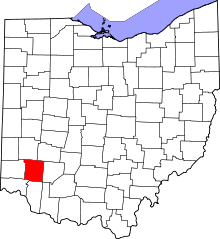 | |
| Villages | ||
| Townships | ||
| CDPs | ||
| Unincorporated communities |
| |
| Ghost towns | ||
| Footnotes | ‡This populated place also has portions in an adjacent county or counties | |