Mason, Ohio
| Mason, Ohio | |
|---|---|
| City | |
|
Aerial view of Mason | |
| Nickname(s): "Home of the Comets" | |
| Motto: "more than you imagine." | |
 Location of Mason, Ohio | |
 Location of Mason in Warren County | |
| Coordinates: 39°21′29″N 84°18′43″W / 39.35806°N 84.31194°WCoordinates: 39°21′29″N 84°18′43″W / 39.35806°N 84.31194°W | |
| Country | United States |
| State | Ohio |
| County | Warren |
| Government | |
| • Type | Mayor-council |
| • Mayor | Victor Kidd |
| Area[1] | |
| • Total | 18.67 sq mi (48.36 km2) |
| • Land | 18.63 sq mi (48.25 km2) |
| • Water | 0.04 sq mi (0.10 km2) |
| Elevation[2] | 810 ft (247 m) |
| Population (2010)[3] | |
| • Total | 30,712 |
| • Estimate (2012[4]) | 31,091 |
| • Density | 1,648.5/sq mi (636.5/km2) |
| Time zone | Eastern (EST) (UTC-5) |
| • Summer (DST) | EDT (UTC-4) |
| ZIP code | 45040 |
| Area code(s) | 513 |
| FIPS code | 39-48188[5] |
| GNIS feature ID | 1061481[2] |
| Website | imaginemason.org |

Mason is a city in southwestern Warren County, Ohio, United States, approximately 22 miles (35 km) from downtown Cincinnati. As of the 2010 census, Mason's population was 30,712.[6]
Mason was transformed into a large, bustling community, and one of the most affluent in Greater Cincinnati, beginning in the 1990s. Mason sits at the core of the Cincinnati-Dayton Metropolitan Region, the 14th largest urban area in the nation. In 2013, Mason was ranked seventh in Money Magazine's 2013 Top 50 Best Places to live in the United States.[7] In 2008 and 2011, CNN named Mason one of the top 100 places to live in the United States.[8]
Mason is home to Kings Island amusement park and one of the largest tennis stadiums in the world, the Lindner Family Tennis Center, home of the Western & Southern Open, one of the world's top tennis tournaments for both men and women.
History
On June 1, 1803, Revolutionary War veteran William Mason paid $1,700 at auction to purchase 640 acres (2.6 km2) of land in what is now downtown Mason. In 1815, he platted 16 lots on this land and named the village "Palmira." In 1832, two years after the death of William Mason and according to his will, more than 40 additional lots were platted on the north, south, and west of Palmira. When the plat was officially recorded, the name of the village was listed as "Palmyra."
In 1835, a petition was sent to the federal post office to correct the name of the town. It had been listed as Kirkwood, possibly an error because the postmaster at the time was William Kirkwood. When village officials were informed that there was another Palmyra in Ohio, the name was officially changed to "Mason."
Mason remained a small farming community for another 125 years. In 1970, a year before the town was incorporated to become a city, there were fewer than 5,700 residents.[9]
In February 1997, Mason withdrew from surrounding Deerfield Township by forming a paper township called Mason Township.[10]
Demographics
| Historical population | |||
|---|---|---|---|
| Census | Pop. | %± | |
| 1850 | 431 | — | |
| 1860 | 441 | 2.3% | |
| 1870 | 387 | −12.2% | |
| 1880 | 431 | 11.4% | |
| 1890 | 564 | 30.9% | |
| 1900 | 629 | 11.5% | |
| 1910 | 737 | 17.2% | |
| 1920 | 816 | 10.7% | |
| 1930 | 854 | 4.7% | |
| 1940 | 902 | 5.6% | |
| 1950 | 1,196 | 32.6% | |
| 1960 | 4,727 | 295.2% | |
| 1970 | 5,677 | 20.1% | |
| 1980 | 8,692 | 53.1% | |
| 1990 | 11,452 | 31.8% | |
| 2000 | 22,019 | 92.3% | |
| 2010 | 30,712 | 39.5% | |
| Est. 2015 | 32,662 | [11] | 6.3% |
| Sources:[4][5][12][13][14][15][16][17] | |||
The median income for a household in the city was $89,569, and the median income for a family was $103,459[3] Males had a median income of $96,002 and females had a median income of $75,968. The per capita income for the city was $37,948. The median house price was $320,289. About 1.6% of families and 2.8% of the population were below the poverty line, including 1.8% of those under age 18 and 4.8% of those age 65 or over.
The city is in the Mason City School District. Mason is served by two interstates, I-71 and I-75.
2010 census
As of the census[18] of 2010, there were 30,712 people, 11,016 households, and 8,205 families residing in the city. The population density was 1,648.5 inhabitants per square mile (636.5/km2). There were 11,471 housing units at an average density of 615.7 per square mile (237.7/km2). The racial makeup of the city was 85.1% White, 3.3% African American, 0.2% Native American, 9.0% Asian, 0.1% Pacific Islander, 0.8% from other races, and 1.5% from two or more races. Hispanic or Latino of any race were 3.2% of the population.
There were 11,016 households of which 44.5% had children under the age of 18 living with them, 63.4% were married couples living together, 8.4% had a female householder with no husband present, 2.7% had a male householder with no wife present, and 25.5% were non-families. 22.4% of all households were made up of individuals and 8.3% had someone living alone who was 65 years of age or older. The average household size was 2.77 and the average family size was 3.30.
The median age in the city was 38.4 years. 30.8% of residents were under the age of 18; 5.7% were between the ages of 18 and 24; 26.1% were from 25 to 44; 27.4% were from 45 to 64; and 9.9% were 65 years of age or older. The gender makeup of the city was 48.5% male and 51.5% female.
2000 census
As of the census[5] of 2000, there were 22,016 people, 7,789 households, and 5,981 families residing in the city. The population density was 1,250.0 people per square mile (482.7/km²). There were 8,111 housing units at an average density of 460.5 per square mile (177.8/km²). The racial makeup of the city was 94.79% White, 1.61% African American, 0.19% Native American, 2.18% Asian, 0.01% Pacific Islander, 0.30% from other races, and 0.93% from two or more races. Hispanic or Latino of any race were 0.97% of the population.
There are 7,789 households 45.2% of which have children under the age of 18, 67.5% have married couples living together, 6.8% had a female householder with no husband present, and 23.2% were non-families. 20.0% of all households were made up of individuals and 6.7% had someone living alone who was 65 years of age or older. The average household size was 2.80 persons and the average family size was 3.27 persons.
In the city the population was spread out with 32.1% under the age of 18, 5.1% between 18 and 24, 35.3% between 25 and 44, 19.1% between 45 and 64, and 8.4% over the age of 65. The median age is 34 years. For every 100 females there were 95.7 males. For every 100 females age 18 and over, there were 92.4 males.
Government/Facilities
City council is the legislative body of Mason's city government, and a city manager is appointed by council. Three or four council members are elected in odd-numbered years and serve four-year terms. City government is housed primarily at the Mason Municipal Center, a 120,000 square-foot, two-story facility which opened in fall 2002. Its most distinct feature is a 51-foot-high central atrium. The facility houses Mason Municipal Court, the police and fire departments, a community meeting room and all other city departments except public works and public utilities.[19]
Mason is home to seven city parks which cover about 300 acres and include fishing lakes, walking trails, ball fields, tennis courts, picnic shelters and playgrounds. The 199,000 square-foot multi-use Mason Community Center, which opened in 2003, is one of the largest public recreation facilities in the state. It has two pools, gymnasium, field house, fitness center, walking track, senior center, exergames, climbing wall, and classroom and meeting areas. A continually expanding network of bike paths connects neighborhoods to schools, parks and downtown.[20][21]
The Mason Veterans Memorial, adjacent to the Mason Municipal Center, was dedicated on Saturday, November 8, 2003. The late Neil Armstrong, a Korean War veteran and the first man to walk on the moon, was the guest of honor. The main feature of the memorial is a set of 10 pillars representing the 10 major conflicts in American history. The height of each pillar is proportional to the number of casualties in the war. The memorial also features an eternal flame.[22]
The Mason Police Department is accredited by the Commission on Accreditation for Law Enforcement Agencies (CALEA). The department employs 39 full-time sworn police officers, including the chief, two assistant chiefs, four lieutenants, and four sergeants. Additionally, the department has seven non-sworn support personnel, including two court security officers. The City of Mason Police Department operates 17 fully equipped marked police cruisers, eight unmarked police cars, and one D.A.R.E. car. In addition, the department operates several special purpose vehicles, including motorcycles, bicycles, and Segways.[23]
The Mason Fire Department has more than 60 fire and emergency medical personnel, including the fire chief, three deputy chiefs, administrative staff, fire inspector, and full or part-time firefighters. Firefighters are also trained as paramedics or emergency medical technicians (EMT's). The department has 17 vehicles including one Quint, two pumpers, one 100-foot tower ladder, one heavy rescue/hazardous materials truck, four paramedic vehicles, one paramedic response car, two fire safety inspector cars and additional staff vehicles. These vehicles respond from one of the city's two fire stations.[24]
Economy
Mason tourist attractions include: Kings Island amusement park and water park; Great Wolf Lodge indoor water park and resort; The Beach water park; and The Lindner Family Tennis Center, which hosts the historic Western & Southern Open men's and women's tennis tournaments, part of the top nine tennis tournaments in the world as part of the ATP World Tour Masters 1000 series.
Mason's largest employers include Procter & Gamble's Mason Business Center, the headquarters of Luxottica Retail and Cintas corporate headquarters. Other notable companies with large operations in Mason are Mitsubishi Electric, L-3 Communications and Heinz.[25]
Over 500 businesses operate in Mason's 18 square miles. High-tech companies, corporate headquarters, and light industries are particularly attracted to Mason. More than 90 corporations have headquarters or manufacturing operations in Mason's 24 commerce parks.[20]
Geography
Mason is located at 39°21′29″N 84°18′43″W / 39.35806°N 84.31194°W (39.358009, -84.311822).[26]
According to the United States Census Bureau, the city has a total area of 18.67 square miles (48.36 km2), of which 18.63 square miles (48.25 km2) is land and 0.04 square miles (0.10 km2) is water.[1]
Climate
| Climate data for Mason, Ohio | |||||||||||||
|---|---|---|---|---|---|---|---|---|---|---|---|---|---|
| Month | Jan | Feb | Mar | Apr | May | Jun | Jul | Aug | Sep | Oct | Nov | Dec | Year |
| Record high °F (°C) | 72 (22) |
76 (24) |
84 (29) |
89 (32) |
93 (34) |
97 (36) |
104 (40) |
101 (38) |
98 (37) |
88 (31) |
81 (27) |
75 (24) |
104 (40) |
| Average high °F (°C) | 38 (3) |
43 (6) |
53 (12) |
65 (18) |
75 (24) |
83 (28) |
87 (31) |
86 (30) |
79 (26) |
68 (20) |
54 (12) |
43 (6) |
64.5 (18) |
| Average low °F (°C) | 19 (−7) |
21 (−6) |
30 (−1) |
39 (4) |
49 (9) |
58 (14) |
63 (17) |
61 (16) |
53 (12) |
41 (5) |
32 (0) |
24 (−4) |
40.8 (4.9) |
| Record low °F (°C) | −25 (−32) |
−13 (−25) |
−10 (−23) |
18 (−8) |
27 (−3) |
36 (2) |
40 (4) |
41 (5) |
26 (−3) |
12 (−11) |
−3 (−19) |
−22 (−30) |
−25 (−32) |
| Average precipitation inches (mm) | 3.18 (80.8) |
2.72 (69.1) |
3.73 (94.7) |
4.10 (104.1) |
4.96 (126) |
4.54 (115.3) |
4.04 (102.6) |
4.18 (106.2) |
3.14 (79.8) |
3.09 (78.5) |
3.65 (92.7) |
3.35 (85.1) |
44.68 (1,134.9) |
| Source: The Weather Channel[27] | |||||||||||||
Media
Mason is part of the Cincinnati media market. Although no broadcast stations are licensed to Mason itself, the city is home to the transmitter site of Clear Channel Communications' WLW (700 Cincinnati), which uses one of only seven remaining Blaw-Knox diamond-shaped towers. WLW was once (1934–1939) the most powerful broadcast station in the country at 500 kilowatts.

Newspapers/websites covering Mason include the Cincinnati Enquirer, MasonBuzz.com and Today's Pulse.
Due to Mason's proximity to Dayton, approximately 30 miles north, Dayton radio and television stations also are easily received in the area. However, only two Dayton television stations, WHIO-TV (CBS) and WPTD (PBS), are carried on local Time Warner cable.
Education
Mason City Schools is consistently rated one of the top school districts in the state, with a perfect rating of 26 out of 26 indicators on the 2011-2012 Ohio Report Card, according to the district's website, MasonOhioSchools.com. The district earned "Excellent with Distinction" from the Ohio Department of Education and had the sixth-highest Performance Index Score in the state. Also in 2011-2012, the high school had 16 National Merit Semifinalists, and six National Merit Scholars. The Mason City School District has received Ohio Blue Ribbons for Excellence. The city's property taxes are above surrounding area averages and are the school district's major source of funding.
High school programs in athletics and academics have been successful at the state level, earning team state titles in Division I in:
- Boys Soccer—2013[28]
- Boys Cross Country—2008, 2014[29]
- Girls Golf—2008, 2009, 2010[29]
- Girls Basketball—2000[29]
- Girls Track and Field—2004[29]
- Girls Cross Country—2012, 2013[29]
The district joined the Greater Miami Conference (GMC), the public school league with the largest enrollments in Greater Cincinnati, in 2007-08, and has won the All Sports Trophy in each of its seven years.[30]
Mason has five public schools: Mason Early Childhood Center (PK-2), Western Row Elementary School (grades 2-3), Mason Intermediate School (grades 4-6), Mason Middle School (grades 7-8), and William Mason High School. Mason also has a community center that connected to the high school. The last building to open was the Mason Early Childhood ("MECC") which opened in 2006. Mason City Schools feature broadband networks while supporting over 4,600 classroom computersThere are approximately 2.2 students per computer in the district. The district also supports individual teacher pages for posting work assignments and class information (such as Edline and Mason Comets). Parents have secure web access to student information.[31] The most recent building project was in 2008-09 with an addition to the high school, which was built in 2001. The addition included an additional three-story pod that added three computer labs, over 30 new classrooms, a new lunchroom, and new athletic and choral offices.
Mason is also home to Sinclair Community College's Courseview Campus, which opened in 2007. The facility is on 75 acres near I-71. As of fall 2013 it has a capacity of 2,500 students and offers 17 degree and 18 certificate programs. In early 2013 Sinclair announced that it expects the Courseview Campus to serve 10,000 students within the next 25 years.[32]
Notable people
- Kadar Brock, notable artist
- George Clooney, Academy Award-winning actor[33]
- Majel Coleman, actress and model
- Brant Daugherty, actor
- Josh Kline, National Football League offensive lineman
- Dan Patrick, journalist
References
- 1 2 "US Gazetteer files 2010". United States Census Bureau. Retrieved 2013-01-06.
- 1 2 "US Board on Geographic Names". United States Geological Survey. 2007-10-25. Retrieved 2008-01-31.
- 1 2 "American FactFinderpublisher =US Census Bureau". Retrieved May 30, 2012.
- 1 2 "Population Estimates". United States Census Bureau. Retrieved 2013-06-17.
- 1 2 3 "American FactFinder". United States Census Bureau. Retrieved 2008-01-31.
- ↑ "American FactFinder2". Retrieved 2010-03-20.
- ↑ "MONEY's Best Places To Live 2013". MONEY.com. Retrieved 15 January 2016.
- ↑ CNN Best Places to Live: Top 100 - Mason. Retrieved on 2008-10-26.
- ↑ Springman, Rose Marie (1982). Around Mason, Ohio: A Story. The Author.
- ↑ Liebler, Kym; Albert, Tanya (May 12, 1998). "If township ends, what happens?". The Cincinnati Enquirer. Gannett Company. Retrieved September 17, 2013.
But based on a quick review, Mason likely would not be able to absorb Deerfield Township if it were dissolved, said Cheryl Subler, policy analyst for the County Commissioner Association of Ohio. According to 1953 case law, a paper township 'may not be considered an adjoining township,' she said.
- ↑ "Annual Estimates of the Resident Population for Incorporated Places: April 1, 2010 to July 1, 2015". Retrieved July 2, 2016.
- ↑ "Population of Civil Divisions Less than Counties" (PDF). Statistics of the Population of the United States at the Tenth Census. U.S. Census Bureau. Retrieved 28 November 2013.
- ↑ "Population of Civil Divisions Less than Counties" (PDF). Statistics of the Population of the United States at the Tenth Census. U.S. Census Bureau. Retrieved 28 November 2013.
- ↑ "Population: Ohio" (PDF). 1910 U.S. Census. U.S. Census Bureau. Retrieved 28 November 2013.
- ↑ "Population: Ohio" (PDF). 1930 US Census. U.S. Census Bureau. Retrieved 28 November 2013.
- ↑ "Number of Inhabitants: Ohio" (PDF). 18th Census of the United States. U.S. Census Bureau. Retrieved 22 November 2013.
- ↑ "Ohio: Population and Housing Unit Counts" (PDF). U.S. Census Bureau. Retrieved 22 November 2013.
- ↑ "American FactFinder". United States Census Bureau. Retrieved 2013-01-06.
- ↑ "Mason enjoying new city building". enquirer.com. Retrieved 15 January 2016.
- 1 2 "Mason Today". imaginemason.org. Retrieved 15 January 2016.
- ↑ "Cincinnati.com". Cincinnati.com. Retrieved 15 January 2016.
- ↑ "Mason Veterans Memorial". imaginemason.org. Retrieved 15 January 2016.
- ↑ "About the Department". imaginemason.org. Retrieved 15 January 2016.
- ↑ "Fire". imaginemason.org. Retrieved 15 January 2016.
- ↑ "Top 10 Employers - Mason, OH". imaginemason.org. Retrieved 15 January 2016.
- ↑ "US Gazetteer files: 2010, 2000, and 1990". United States Census Bureau. 2011-02-12. Retrieved 2011-04-23.
- ↑ "MONTHLY AVERAGES for Mason, OH". The Weather Channel. Retrieved November 4, 2008.
- ↑ "2013 Soccer State Tournament Coverage". ohsaa.org. Retrieved 15 January 2016.
- 1 2 3 4 5 OHSAA. "Ohio High School Athletic Association Web site". Retrieved 2008-11-09.
- ↑ "Greater Miami Conference". gmcsports.com. Retrieved 15 January 2016.
- ↑ http://masonohioschools.com/
- ↑ http://www.sinclair.edu/courseview/about/history/
- ↑ Richardson, Rachel (June 4, 2014). "George Clooney developed star power in Mason". Cincinnati.com. Retrieved January 1, 2016.
Further reading
- Elva R. Adams. Warren County Revisited. [Lebanon, Ohio]: Warren County Historical Society, 1989.
- The Centennial Atlas of Warren County, Ohio. Lebanon, Ohio: The Centennial Atlas Association, 1903.
- John W. Hauck. Narrow Gauge in Ohio. Boulder, Colorado: Pruett Publishing, 1986. ISBN 0-87108-629-8
- Josiah Morrow. The History of Warren County, Ohio. Chicago: W.H. Beers, 1883. (Reprinted several times)
- Ohio Atlas & Gazetteer. 6th ed. Yarmouth, Maine: DeLorme, 2001. ISBN 0-89933-281-1
- William E. Smith. History of Southwestern Ohio: The Miami Valleys. New York: Lewis Historical Publishing, 1964. 3 vols.
- Rose Marie Springman. Around Mason, Ohio: A Story. [Mason, Ohio?]: The Author, 1982.
- State of Ohio Mock Trial Organization.
- Warren County Engineer's Office. Official Highway Map 2003. Lebanon, Ohio: The Office, 2003.
External links
 Mason, Ohio travel guide from Wikivoyage
- Mason, Ohio at DMOZ
Municipalities and communities of Warren County, Ohio, United States | ||
|---|---|---|
| Cities | 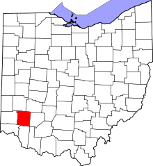 | |
| Villages | ||
| Townships | ||
| CDPs | ||
| Unincorporated communities |
| |
| Ghost towns | ||
| Footnotes | ‡This populated place also has portions in an adjacent county or counties | |