Bent Mountain, Virginia
| Bent Mountain, Virginia | |
|---|---|
| Unincorporated community | |
 Bent Mountain, Virginia  Bent Mountain, Virginia | |
| Coordinates: 37°08′28″N 80°07′09″W / 37.14111°N 80.11917°WCoordinates: 37°08′28″N 80°07′09″W / 37.14111°N 80.11917°W | |
| Country | United States |
| State | Virginia |
| County | Roanoke |
| Elevation | 2,612 ft (796 m) |
| Time zone | Eastern (EST) (UTC-5) |
| • Summer (DST) | EDT (UTC-4) |
| ZIP code | 24059 |
| Area code(s) | 540 |
| GNIS feature ID | 1477109[1] |
Bent Mountain is an unincorporated community in Roanoke County, Virginia, United States. Bent Mountain is located on U.S. Route 221 13.6 miles (21.9 km) southwest of Roanoke. Bent Mountain has a post office with ZIP code 24059.[2][3]
At over 3,000 feet in elevation, "...it affords one of the clearest views of the Roanoke Valley."[4]
The roads through Bent Mountain are also historic. "The Salem and Bent Mountain Turnpike Company was charted in 1840 to build a road from Salem, Virginia across Twelve O'clock Knob (Roanoke County, Virginia) to Back Creek, Virginia and thence to the top of Bent Mountain. The road was long delayed in construction, but the route planned was eventually used, and the road is now a hard surfaced state highway." Part of this road followed the famous Trader's Path.[5]
There are two theories about the origin of the name, "Bent Mountain." One of them is that the mountain is named for two early surveyors in the area, James Bent and William Bent, who were brothers and from Pennsylvania. The second theory is that the mountain is shaped like a horseshoe or "bent" mountain. There is also a tradition that the Bent Mountain area had settlers before the rest of the region, probably soon after 1740.[6]
After the Civil War, Jordan Woodrum purchased a large tract of "waste land", mostly mountainous tree and shrub, and thought by many to be of little value. However, he planted the hillsides with Newtown Pippin apple trees, and sparked a new era in agriculture in the region.[7]
References
- ↑ "Bent Mountain". Geographic Names Information System. United States Geological Survey.
- ↑ United States Postal Service (2012). "USPS - Look Up a ZIP Code". Retrieved 2012-02-15.
- ↑ "Postmaster Finder - Post Offices by ZIP Code". United States Postal Service. Retrieved August 23, 2012.
- ↑ Kagey, Deedie Dent. When Past Is Prologue: A History of Roanoke County. Roanoke, Va: Roanoke County Sesquicentennial Committee, 1988. http://www.worldcat.org/oclc/19279340 Page 24.
- ↑ Writers' Program (U.S.). Roanoke, Story of County and City. [Roanoke]: [Stone Print. and manufacturing Co.], 1942. Page 186 and 183. http://www.worldcat.org/oclc/2881615
- ↑ Kagey, Deedie Dent. When Past Is Prologue: A History of Roanoke County. Roanoke, Va: Roanoke County Sesquicentennial Committee, 1988. http://www.worldcat.org/oclc/19279340 Pages 299-307.
- ↑ "History of Roanoke County". by Jack, George S., and Edward Boyle Jacobs. Roanoke, Va: Stone, 1912. Pages 74-75.
Municipalities and communities of Roanoke County, Virginia, United States | ||
|---|---|---|
| Town | 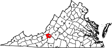 | |
| CDPs | ||
| Unincorporated communities | ||
| Footnotes | ‡This populated place also has portions in an adjacent county or counties | |