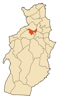
Hammamet, Tébessa
Not to be confused with Hammamet, Algiers.
| Hammamet | |
|---|---|
| Commune and town | |
 | |
 Hammamet | |
| Coordinates: DZ 35°26′54″N 7°57′11″E / 35.4483648°N 7.9530716°E | |
| Country |
|
| Province | Tébessa Province |
| Area | |
| • Land | 34 sq mi (88 km2) |
| Population (2008) | |
| • Total | 20,148 |
| Time zone | CET (UTC+1) |
Hammamet is a town and commune in Tébessa Province in north-eastern Algeria.[1]
References
- ↑ "Communes of Algeria". Statoids. Retrieved December 12, 2010.
Capital: Tébessa | ||
| Districts | 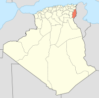 | |
| Communes | ||
Coordinates: 35°26′54″N 7°57′11″E / 35.44833°N 7.95306°E
This article is issued from Wikipedia - version of the 2/9/2016. The text is available under the Creative Commons Attribution/Share Alike but additional terms may apply for the media files.