Tébessa
| Tebessa / Tibesti Tibesti / البرج | |
|---|---|
| City | |
 | |
 | |
 Tebessa / Tibesti | |
| Coordinates: 35°24′N 8°7′E / 35.400°N 8.117°ECoordinates: 35°24′N 8°7′E / 35.400°N 8.117°E | |
| Country |
|
| Province | Tebessa Province |
| District | Tebessa District |
| Area | |
| • Total | 14,227 km2 (5,493 sq mi) |
| Elevation | 858 m (2,815 ft) |
| Population (2007) | |
| • Total | 634,332 |
| • Density | 45/km2 (120/sq mi) |
| Time zone | West Africa Time (UTC+1) |
Tébessa (Berber: Tbessa or Tibesti, Arabic: تبسة), is the capital city of Tébessa Province, in the Shawi region of Algeria, 20 kilometers west from the border with Tunisia. Nearby is also a phosphate mine. The city is famous for the traditional Algerian carpets in the region, and is home to over 634,332 people (in 2007).
History
For the Ancient Greeks, Tébessa was known as Theveste (Θεβέστη or Hekatompyle, Ἑκατομπύλη; meaning hundred gates). In 146 BCE, Tbessa it became part of the Roman Empire with the name Theveste.
During the 1st century CE, the Legio III Augusta resided there before being transferred to Lambaesis. It was made a colonia probably under Trajan.
There is mention of a council held there by the Donatists. Among its saints were St Lucius, its bishop, who in 256 assisted at the Council of Carthage and died as a martyr two years later; St Maximilianus, martyred 12 March 295; St Crispina, martyred 5 December 304. Some of its bishops are known: Romulus in 349; Urbicus in 411; Felix exiled by the Vandals in 484; Palladius mentioned in an inscription.
During the 4th and 5th century AD Thebeste was a centre of Manichaeism as well. In June 1918 a codex of 26 leaves written in Latin by Manichaeans was discovered in a cave near the city. A month later Henri Omont found the missing initial 13 leaves. The whole book is now known as the Tebessa codex and it is kept in Cologne. It has been edited by Markus Stein (Bonn).
It was rebuilt by the patrician Solomon at the beginning of the reign of Justinian I, and he built a tomb there which still exists. Under the Ottoman Empire, Thebeste had a garrison of Janissaries. Tebessa is very rich in ancient monuments, among them being a triumphal arch of Caracalla, a temple, a Christian basilica of the 4th century. At the time of Trajan, it was a flourishing city with c. 30,000 inhabitants.
In the 7th century AD, after the Arab invasion of the region, Thebeste lost its importance. Later, during the 16th century, the Ottomans established a small military garrison there.
In the 11th century, Banu_Hilal, an Arab tribe living between Nile and Red Sea, settled in Tunisia, Tripolitania (western Libya) and Constantinois (eastern Algeria) which was Tebessa party.
In 1851 it was occupied by the French. Under the name of Tebessa it became the capital of a canton, then an arrondissement of the départment of Constantine in Algeria, later, it became capital of an arrondissement in the department of Bône, now (1974) it is capital of a province of its own, bearing the same name.
Main sights
- Arch of Caracalla, a Roman triumphal arch (214 AD).
- Roman theatre
- Temple of Minerva (early 3rd century AD), with walls decorated by mosaics.
- Amphitheatre (4th century AD)
- Remains of the basilica of St. Crispinus (4th century AD), one of the biggest in Africa. It has also chapels, baptism urns, catacombs and gardens.
- Byzantine walls (6th century), popularly known as "Solomon's Walls" and flanked by thirteen square towers.
- Archaeological museum.
Climate
Tébessa has a semi-arid climate (Köppen climate classification BSk), with hot, fairly dry summers and mild, somewhat wetter winters.
| Climate data for Tébessa | |||||||||||||
|---|---|---|---|---|---|---|---|---|---|---|---|---|---|
| Month | Jan | Feb | Mar | Apr | May | Jun | Jul | Aug | Sep | Oct | Nov | Dec | Year |
| Record high °C (°F) | 24.0 (75.2) |
30.1 (86.2) |
32.0 (89.6) |
32.4 (90.3) |
40.6 (105.1) |
41.3 (106.3) |
42.5 (108.5) |
43.0 (109.4) |
40.0 (104) |
37.3 (99.1) |
31.0 (87.8) |
27.0 (80.6) |
43 (109.4) |
| Average high °C (°F) | 11.7 (53.1) |
13.5 (56.3) |
15.7 (60.3) |
19.2 (66.6) |
24.6 (76.3) |
30.7 (87.3) |
34.2 (93.6) |
33.3 (91.9) |
28.6 (83.5) |
22.6 (72.7) |
16.5 (61.7) |
12.9 (55.2) |
21.96 (71.54) |
| Daily mean °C (°F) | 6.4 (43.5) |
7.7 (45.9) |
9.5 (49.1) |
12.6 (54.7) |
17.4 (63.3) |
22.5 (72.5) |
25.4 (77.7) |
24.9 (76.8) |
21.2 (70.2) |
16.1 (61) |
10.7 (51.3) |
7.5 (45.5) |
15.16 (59.29) |
| Average low °C (°F) | 1.1 (34) |
1.9 (35.4) |
3.4 (38.1) |
5.9 (42.6) |
10.0 (50) |
14.2 (57.6) |
16.5 (61.7) |
16.4 (61.5) |
13.7 (56.7) |
9.5 (49.1) |
4.8 (40.6) |
2.0 (35.6) |
8.28 (46.91) |
| Record low °C (°F) | −8.0 (17.6) |
−6.6 (20.1) |
−6.0 (21.2) |
−4.0 (24.8) |
0.0 (32) |
3.0 (37.4) |
8.9 (48) |
8.0 (46.4) |
2.0 (35.6) |
−1.0 (30.2) |
−3.4 (25.9) |
−11.0 (12.2) |
−11 (12.2) |
| Average precipitation mm (inches) | 27.1 (1.067) |
30.3 (1.193) |
44.8 (1.764) |
30.6 (1.205) |
36.5 (1.437) |
31.2 (1.228) |
11.3 (0.445) |
25.1 (0.988) |
29.4 (1.157) |
23.6 (0.929) |
29.0 (1.142) |
23.6 (0.929) |
342.5 (13.484) |
| Average relative humidity (%) | 75.1 | 70.8 | 65.0 | 64.1 | 58.7 | 49.6 | 43.9 | 48.3 | 61.6 | 64.9 | 72.2 | 74.7 | 62.41 |
| Source #1: NOAA (1970-1990)[1] | |||||||||||||
| Source #2: climatebase.ru (extremes, humidity)[2] | |||||||||||||
Transportation
Tébessa is connected by road and rail with the other parts of both Algeria and Tunisia. It is served by Tébessa Airport for air transport.
External links
- Official site of Tebessa
- Acta Maximiliani Martyris
- Page with photos of ancient ruins (German)
 Herbermann, Charles, ed. (1913). "Theveste". Catholic Encyclopedia. New York: Robert Appleton Company.
- This article incorporates text from a publication now in the public domain: Herbermann, Charles, ed. (1913). "Theveste". Catholic Encyclopedia. New York: Robert Appleton.
References
- ↑ "Climate Normals for Tebessa". Retrieved 11 February 2013.
- ↑ "Tebessa, Algeria". Climatebase.ru. Retrieved 11 February 2013.
- Stein (M.) (ed.) Manichaica Latina 3.1. Codex Thevestinus (Papyrologica Coloniensia volume 27/3.1.) Paderborn, Munich, Vienna and Zurich: Ferdinand Schöningh, 2004, Pp. xx + 328; Stein (M.) (ed.) Manichaica Latina 3.2. Codex Thevestinus (Papyrologica Coloniensia volume 27/3.2.) Paderborn, Munich, Vienna and Zurich: Ferdinand Schöningh, 2006, Pp. vi + 81, ills.
Capital: Tébessa | ||
| Districts | 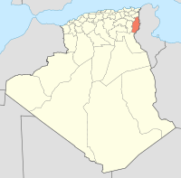 | |
| Communes | ||
| Wikimedia Commons has media related to Tébessa. |