Grade I listed buildings in Gravesham

There are over 9,000 Grade I listed buildings in England. This page is a list of these buildings in the district of Gravesham in Kent.

Gravesham

Name Location Type Completed [note 1]Date designated Grid ref.[note 2]
Geo-coordinates
Entry number [note 3]Image
Cobham College Cobham, Gravesham Kitchen Late 16th century 28 August 2000 TQ6696868343
51°23′22″N 0°23′54″E / 51.389566°N 0.398338°E / 51.389566; 0.398338 (Cobham College)
1096317
Cobham Hall (including Kitchen and Stable Court) Cobham House Until 1662 27 August 1952 TQ6836668914
51°23′39″N 0°25′07″E / 51.394283°N 0.418682°E / 51.394283; 0.418682 (Cobham Hall (including Kitchen and Stable Court))
1095053
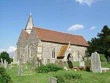
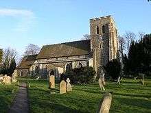
Parish Church of St Mary Magdalene Cobham Church About 1200 21 November 1966 TQ6696968383
51°23′24″N 0°23′54″E / 51.389925°N 0.398371°E / 51.389925; 0.398371 (Parish Church of St Mary Magdalene)
1350259
The Mausoleum, Cobham Hall Cobham Steps 1783 27 August 1952 TQ6943768379
51°23′21″N 0°26′02″E / 51.389158°N 0.433807°E / 51.389158; 0.433807 (The Mausoleum, Cobham Hall)
1095055
Church of St Mary Higham Church Saxon 21 November 1966 TQ7164074207
51°26′27″N 0°28′06″E / 51.440851°N 0.468257°E / 51.440851; 0.468257 (Church of St Mary)
1350225
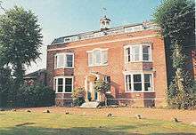
Gadshill Place Higham House 1779 27 August 1952 TQ7102070872
51°24′40″N 0°27′28″E / 51.411079°N 0.457736°E / 51.411079; 0.457736 (Gadshill Place)
1049037
Luddesdown Court Luddesdown House 17th century 27 August 1952 TQ6691366164
51°22′12″N 0°23′47″E / 51.370006°N 0.396526°E / 51.370006; 0.396526 (Luddesdown Court)
1096343
Nurstead Court Meopham Aisled House c.1320 21 November 1966 TQ6405668568
51°23′33″N 0°21′24″E / 51.392436°N 0.356628°E / 51.392436; 0.356628 (Nurstead Court)
1350239
Parish Church of St John the Baptist Meopham Parish Church 1320-25 21 November 1966 TQ6447166240
51°22′17″N 0°21′41″E / 51.371401°N 0.361511°E / 51.371401; 0.361511 (Parish Church of St John the Baptist)
1039866
Parish Church of St Botolph The Hill Parish Church Earlier 4 July 1952 TQ6234974141
51°26′35″N 0°20′05″E / 51.442995°N 0.334665°E / 51.442995; 0.334665 (Parish Church of St Botolph)
1054093

Notes

  1. The date given is the date used by Historic England as significant for the initial building or that of an important part in the structure's description.
  2. Sometimes known as OSGB36, the grid reference is based on the British national grid reference system used by the Ordnance Survey.
  3. The "List Entry Number" is a unique number assigned to each listed building and scheduled monument by Historic England.

Media related to Grade I listed buildings in Gravesham at Wikimedia Commons

This article is issued from Wikipedia - version of the 3/24/2015. The text is available under the Creative Commons Attribution/Share Alike but additional terms may apply for the media files.