Goodland, Kansas
| Goodland, Kansas | |
|---|---|
| County seat | |
|
The Sunflowers by Van Gogh (2014) | |
| Nickname(s): The Golden Buckle on the Wheat Belt | |
 Location within Sherman County and Kansas | |
 KDOT map of Sherman County (legend) | |
| Coordinates: 39°20′55″N 101°42′40″W / 39.34861°N 101.71111°WCoordinates: 39°20′55″N 101°42′40″W / 39.34861°N 101.71111°W | |
| Country | United States |
| State | Kansas |
| County | Sherman |
| Incorporated | September 5, 1887 |
| Government | |
| • Type | Council-Manager |
| • Mayor | Brian Linin |
| • City Manager | Gerry Bieker |
| Area[1] | |
| • Total | 4.37 sq mi (11.32 km2) |
| • Land | 4.36 sq mi (11.29 km2) |
| • Water | 0.01 sq mi (0.03 km2) |
| Elevation | 3,681 ft (1,122 m) |
| Population (2010)[2] | |
| • Total | 4,489 |
| • Estimate (2015)[3] | 4,457 |
| • Density | 1,000/sq mi (400/km2) |
| Time zone | Mountain (MST) (UTC-7) |
| • Summer (DST) | MDT (UTC-6) |
| ZIP code | 67735 |
| Area code(s) | 785 |
| FIPS code | 20-26875 |
| GNIS feature ID | 0471241 [4] |
| Website | cityofgoodland.org |

Goodland is a city in and the county seat of Sherman County, Kansas, United States.[5] As of the 2010 census, the city population was 4,489.[6] It was named after Goodland, Indiana.[7] Goodland is home to Northwest Kansas Technical College.
History
One of the earliest pieces of recorded history relating to Goodland concerns the Kidder Massacre. On July 2, 1867, a detachment of the 2nd United States Cavalry Regiment was massacred; second lieutenant Lyman S. Kidder in command of the party, a sergeant, a corporal, eight privates and an Indian guide lost their lives. They were carrying dispatches for Lieutenant Colonel George Custer. Later, Custer found evidence of a running battle along Beaver Creek, which led to a ravine where the remains were found. They had been killed by Cheyenne and/or Sioux Indians.[8]
In 1886, there were four communities vying to become county seat for Sherman County: Itasca, Voltaire, Sherman Center and Eustis. A man named Clark showed up in the county in 1887 proposing to create a new town to settle the dispute. The new town was to be named Goodland. A vote for the county seat was held among the county population and Goodland won with 872 of the 1495 votes cast while with Eustis received 611 and Voltaire received 12. Citizens of Eustis declared that the votes were unfair but the state department said that nothing could be done as all the voting was complete. The Supreme Court of Kansas considered various proceedings but did not change the outcome of the vote. Eustis refused to yield the county records it held until January 13, 1888, when an armed group from Goodland seized the records and sent them to the new county seat.[9]
Goodland sprang up around the Chicago, Rock Island and Pacific Railroad that had been built through it.[10] The town was named after Goodland, Indiana.[11]
Government
Goodland utilizes a council-manager style of government. Five commissioners are elected at large. A mayor is elected from among the commission to serve ceremonial purposes and chair the commission meetings. The commission is responsible for appointing a city manager, who handles the day-to-day operations of the city.
Goodland has a full-time police department that provides 24/7 law enforcement coverage within the city limits.
The city also boasts its own power plant, which ensures that citizens can access electricity even if outside power sources become unavailable.
The National Weather Service maintains a full-featured Weather Forecast Office in Goodland with doppler radar and a 19 County Warning Area (CWA) including 3 counties in eastern Colorado, 3 counties in southwest Nebraska, and 13 counties in northwest Kansas. Aviation forecasts are created for two sites: Goodland, Kansas, and McCook, Nebraska. The office also has a fire weather and hydrologic program. The surface observation program is limited to the supplemental climatological observations. The office supports approximately 75 observers in the cooperative observer program. The office employees 22 people.
Geography
Goodland is located at 39°20′55″N 101°42′40″W / 39.34861°N 101.71111°W (39.348583, −101.711148) at an elevation of 3,681 feet (1,122 m).[4][12] It lies on the south side of the Middle Fork of Sappa Creek, part of the Republican River watershed, in the High Plains region of the Great Plains. Located at the intersection of Interstate 70 and K-27 in northwest Kansas, Goodland is roughly 17 miles (27 km) east of the Colorado state line, 176 miles east-southeast of Denver, 265 miles (426 km) northwest of Wichita, and 383 miles (616 km) west of Kansas City.[13]
According to the United States Census Bureau, the city has a total area of 4.37 square miles (11.32 km2), of which 4.36 square miles (11.29 km2) is land and 0.01 square miles (0.03 km2) is water.[1]
Climate
Goodland's climate is officially classed as Humid continental (Koppen Dfa); although it only just misses a semi-arid (Bsk) classification and is also close to a wet-summer continental climate (Dwa). Winters are generally cold and dry, summers hot and moderately wet. The average temperature for the year is 51 °F (10 °C) with temperatures exceeding 90 °F (32 °C) an average of 50 days a year and dropping below 32 °F (0 °C) an average of 159 days a year. Due to its higher elevation, Goodland experiences stronger wind and higher snowfall totals than other locations in Kansas. Wind speed averages 13 mph (21 km/h).[14] On average, Goodland receives 19.75 inches (502 mm) of precipitation annually, and snowfall averages 41.9 inches (1,064 mm) per year.[15] On average, January is the coolest month, and July is both the warmest month and the wettest month. The hottest temperature recorded in Goodland was 111 °F (44 °C) in 1940; the coldest temperature recorded was -27 °F (-33 °C) in 1989.[16]
| Climate data for Goodland, Kansas (1981–2010 normals, extremes 1895–present) | |||||||||||||
|---|---|---|---|---|---|---|---|---|---|---|---|---|---|
| Month | Jan | Feb | Mar | Apr | May | Jun | Jul | Aug | Sep | Oct | Nov | Dec | Year |
| Record high °F (°C) | 79 (26) |
81 (27) |
90 (32) |
96 (36) |
104 (40) |
110 (43) |
111 (44) |
108 (42) |
105 (41) |
96 (36) |
87 (31) |
83 (28) |
111 (44) |
| Average high °F (°C) | 42.4 (5.8) |
45.3 (7.4) |
54.6 (12.6) |
63.6 (17.6) |
73.0 (22.8) |
83.9 (28.8) |
90.0 (32.2) |
87.5 (30.8) |
79.1 (26.2) |
66.2 (19) |
52.4 (11.3) |
42.5 (5.8) |
65.0 (18.3) |
| Daily mean °F (°C) | 29.6 (−1.3) |
32.3 (0.2) |
40.5 (4.7) |
49.2 (9.6) |
59.4 (15.2) |
69.7 (20.9) |
75.7 (24.3) |
73.7 (23.2) |
64.6 (18.1) |
51.9 (11.1) |
39.0 (3.9) |
29.9 (−1.2) |
51.3 (10.7) |
| Average low °F (°C) | 16.9 (−8.4) |
19.4 (−7) |
26.5 (−3.1) |
34.7 (1.5) |
45.8 (7.7) |
55.6 (13.1) |
61.3 (16.3) |
60.0 (15.6) |
50.1 (10.1) |
37.5 (3.1) |
25.7 (−3.5) |
17.3 (−8.2) |
37.6 (3.1) |
| Record low °F (°C) | −26 (−32) |
−22 (−30) |
−20 (−29) |
0 (−18) |
21 (−6) |
31 (−1) |
40 (4) |
38 (3) |
19 (−7) |
1 (−17) |
−12 (−24) |
−27 (−33) |
−27 (−33) |
| Average precipitation inches (mm) | 0.38 (9.7) |
0.49 (12.4) |
1.07 (27.2) |
1.59 (40.4) |
2.95 (74.9) |
3.25 (82.6) |
3.47 (88.1) |
2.70 (68.6) |
1.22 (31) |
1.37 (34.8) |
0.71 (18) |
0.46 (11.7) |
19.66 (499.4) |
| Average snowfall inches (cm) | 5.9 (15) |
5.4 (13.7) |
6.8 (17.3) |
4.2 (10.7) |
0.5 (1.3) |
0 (0) |
0 (0) |
0 (0) |
0.4 (1) |
2.2 (5.6) |
4.6 (11.7) |
5.5 (14) |
35.5 (90.2) |
| Average precipitation days (≥ 0.01 in) | 3.9 | 4.8 | 6.0 | 7.7 | 10.5 | 9.4 | 9.9 | 8.8 | 5.5 | 5.6 | 4.6 | 3.9 | 80.5 |
| Average snowy days (≥ 0.1 in) | 3.7 | 4.1 | 3.6 | 2.0 | 0.2 | 0 | 0 | 0 | 0.2 | 0.8 | 2.9 | 3.5 | 21.0 |
| Source: The Weather Channel;[16] National Weather Service[15] | |||||||||||||
Demographics
| Historical population | |||
|---|---|---|---|
| Census | Pop. | %± | |
| 1890 | 1,027 | — | |
| 1900 | 1,059 | 3.1% | |
| 1910 | 1,993 | 88.2% | |
| 1920 | 2,664 | 33.7% | |
| 1930 | 3,626 | 36.1% | |
| 1940 | 3,306 | −8.8% | |
| 1950 | 4,690 | 41.9% | |
| 1960 | 4,459 | −4.9% | |
| 1970 | 5,510 | 23.6% | |
| 1980 | 5,708 | 3.6% | |
| 1990 | 4,983 | −12.7% | |
| 2000 | 4,948 | −0.7% | |
| 2010 | 4,489 | −9.3% | |
| Est. 2015 | 4,457 | [3] | −0.7% |
| U.S. Decennial Census[17] 2012 Estimate[18] | |||
2010 census
As of the census[2] of 2010, there were 4,489 people, 1,985 households, and 1,161 families residing in the city. The population density was 1,029.6 inhabitants per square mile (397.5/km2). There were 2,395 housing units at an average density of 549.3 per square mile (212.1/km2). The racial makeup of the city was 93.0% White, 0.7% African American, 0.4% Native American, 0.4% Asian, 0.1% Pacific Islander, 3.3% from other races, and 2.1% from two or more races. Hispanic or Latino of any race were 11.0% of the population.
There were 1,985 households of which 27.6% had children under the age of 18 living with them, 44.2% were married couples living together, 10.0% had a female householder with no husband present, 4.3% had a male householder with no wife present, and 41.5% were non-families. 36.0% of all households were made up of individuals and 15.5% had someone living alone who was 65 years of age or older. The average household size was 2.21 and the average family size was 2.85.
The median age in the city was 40 years. 22.7% of residents were under the age of 18; 10.1% were between the ages of 18 and 24; 22.2% were from 25 to 44; 25.9% were from 45 to 64; and 19% were 65 years of age or older. The gender makeup of the city was 49.3% male and 50.7% female.
2000 census
As of the census of 2000, there were 4,948 people, 2,085 households, and 1,259 families residing in the city. The population density was 1,127.1 people per square mile (435.2/km²). There were 2,410 housing units at an average density of 549.0 per square mile (212.0/km²). The racial makeup of the city was 93.35% White, 0.42% African American, 0.32% Native American, 0.24% Asian, 0.12% Pacific Islander, 4.53% from other races, and 1.01% from two or more races. Hispanic or Latino of any race were 9.03% of the population.
There were 2,085 households out of which 27.6% had children under the age of 18 living with them, 50.5% were married couples living together, 7.1% had a female householder with no husband present, and 39.6% were non-families. 32.4% of all households were made up of individuals and 16.0% had someone living alone who was 65 years of age or older. The average household size was 2.31 and the average family size was 2.95.
In the city the population was spread out with 23.3% under the age of 18, 13.9% from 18 to 24, 23.3% from 25 to 44, 21.5% from 45 to 64, and 18.0% who were 65 years of age or older. The median age was 37 years. For every 100 females there were 103.4 males. For every 100 females age 18 and over, there were 100.6 males.
As of 2000 the median income for a household in the city was $31,356, and the median income for a family was $38,309. Males had a median income of $28,589 versus $20,798 for females. The per capita income for the city was $17,105. About 9.7% of families and 12.1% of the population were below the poverty line, including 11.4% of those under age 18 and 8.1% of those age 65 or over.

Education
Primary and secondary education
Unified School District 352 operates three public schools in the city:[19]
- West Elementary School (Grades from pre-kindergarten to 3)
- North School (3-6)
- Goodland Junior Senior High School (7–12)
Colleges and universities
Media
The Goodland Star-News is the city's sole newspaper, published twice weekly.[20] Four radio stations are licensed to and/or broadcast from Goodland. KLOE broadcasts a full service News/Talk format on 730 AM.[21][22] KKCI plays a Classic Rock format, broadcasting on 102.5 FM.[23][24] KWGB, which is licensed to Colby, Kansas, broadcasts from Goodland on 97.9 FM, playing a Country format.[23][25] Licensed to Goodland, KGCR broadcasts on 107.7 FM from near Brewster, Kansas, playing a Christian Contemporary format.[23][26]
Goodland is in the Wichita-Hutchinson, Kansas television market.[27] CBS affiliate KBSL-DT, a satellite station of KWCH-DT in Wichita, is licensed to Goodland and broadcasts on digital channel 10.[28][29]
Culture
In popular culture
Goodland was briefly mentioned in the 2006–08 television series Jericho.
In L.E. Howel’s novel, Planetfall, Goodland is the hometown of astronaut Karla Dawson and is a featured location in the story.[30]
In T.D. Shields' novels, "Into Shadow" and "Into Light," Goodland is the site of the new national capital after Washington D.C. (among many other cities) is destroyed by war and climate change.[31]
Notable people
Notable individuals who were born in and/or have lived in Goodland include:
- Milo Baughman (1923-2003), furniture designer[32]
- Brook Berringer (1973-1996), football quarterback for University of Nebraska[33]
- John Wayne Delehant (1890-1972), U.S. federal judge[34]
- Harry D. Felt (1902-1992), U.S. Navy Admiral[35]
- Mike Friede (1957- ), football wide receiver[36]
- Dave Jones (1947- ), football wide receiver[37]
- Tinker Keck (1976- ), former football player for University of Cincinnati
- Marla Luckert (1955- ), Kansas Supreme Court justice[38]
- Charles I. Sparks (1872-1937), U.S. Representative from Kansas[39]
- Deanell Reece Tacha (1946- ), U.S. federal judge[40]
See also
References
- 1 2 "US Gazetteer files 2010". United States Census Bureau. Retrieved 2012-07-06.
- 1 2 "American FactFinder". United States Census Bureau. Retrieved 2012-07-06.
- 1 2 "Annual Estimates of the Resident Population for Incorporated Places: April 1, 2010 to July 1, 2015". Retrieved July 2, 2016.
- 1 2 "US Board on Geographic Names". United States Geological Survey. 2007-10-25. Retrieved 2008-01-31.
- ↑ "Find a County". National Association of Counties. Retrieved 2011-06-07.
- ↑ "2010 City Population and Housing Occupancy Status". U.S. Census Bureau. Retrieved March 27, 2011.
- ↑ Kansas State Historical Society (1916). Biennial Report of the Board of Directors of the Kansas State Historical Society. Kansas State Printing Plant. p. 300.
- ↑ Johnson, Randy and Nancy P. Allen. "Find Custer! The Kidder Tragedy" Published by authors ISBN 0-9620742-1-7. December 1990. url: http://www.goodlandnet.com/history/kidder.htm
- ↑ Parker, Tony. Sherman County Star. url: http://www.goodlandnet.com/history/countyseatfight.htm. Retrieved 29 September 2009.
- ↑ Blackmar, Frank Wilson (1912). Kansas: A Cyclopedia of State History, Embracing Events, Institutions, Industries, Counties, Cities, Towns, Prominent Persons, Etc. Standard Publishing Company. p. 764.
- ↑ "Profile for Goodland, Kansas". ePodunk. Retrieved 23 June 2014.
- ↑ "US Gazetteer files: 2010, 2000, and 1990". United States Census Bureau. 2011-02-12. Retrieved 2011-04-23.
- ↑ "City Distance Tool". Geobytes. Retrieved 2010-05-22.
- ↑ "Historical Weather for Goodland, Kansas, United States of America". Weatherbase. Retrieved 2010-05-22.
- 1 2 "NOWData - NOAA Online Weather Data". National Weather Service Forecast Office - Goodland, KS. Retrieved 2010-05-22.
- 1 2 "Average weather for Goodland, KS". The Weather Channel. Retrieved 2010-05-22.
- ↑ United States Census Bureau. "Census of Population and Housing". Retrieved February 14, 2014.
- ↑ "Annual Estimates of the Resident Population: April 1, 2010 to July 1, 2012". Retrieved February 14, 2014.
- ↑ "Goodland USD 352". Goodland USD 352. Retrieved 2010-05-22.
- ↑ "Goodland Star News". Mondo Times. Retrieved 2010-05-22.
- ↑ "AMQ AM Radio Database Query". Federal Communications Commission. Retrieved 2009-09-12.
- ↑ "Station Information Profile". Arbitron. Retrieved 2009-09-12.
- 1 2 3 "FMQ FM Radio Database Query". Federal Communications Commission. Retrieved 2009-09-12.
- ↑ "Radio Stations in Goodland, Kansas". Radio-Locator. Retrieved 2011-05-28.
- ↑ "KWGB-FM 97.9 MHz". Radio-Locator. Retrieved 2011-05-27.
- ↑ "Contact Us". Tri-State Praise KGCR & Classic KGCR. Retrieved 2013-06-25.
- ↑ "TV Market Maps". EchoStar Knowledge Base. Retrieved 2011-05-28.
- ↑ "TVQ TV Database Query". Federal Communications Commission. Retrieved 2009-09-12.
- ↑ "About Us". KWCH-DT. Retrieved 2011-05-28.
- ↑ "Authors Supporting Authors". Megan Cyrulewski.
- ↑ http://taradon.wix.com/tdshields#!Is-Goodland-for-Real/c1q8z/D6759C41-3E19-411A-BEC9-2DAC61BF3DE7
- ↑ "Obituary: Milo Ray Baughman". Deseret News. 2003-07-30. Retrieved 2015-07-02.
- ↑ Christopherson, Brian (2007-09-27). "High school coach remembers Berringer for more than football". Lincoln Journal Star. Retrieved 2015-07-02.
- ↑ "Delehant, John Wayne". Biographical Directory of Federal Judges. Federal Judicial Center. Retrieved 2015-07-03.
- ↑ Moritz, Charles; Wilson Company, H.W (1959), Current Biography Yearbook 1959, H.W. Wilson Co., ISBN 978-0-8242-0125-8
- ↑ "Mike Friede". Just Sports Stats. Retrieved 2015-07-02.
- ↑ "Dave Jones". Just Sports Stats. Retrieved 2015-07-02.
- ↑ "Honorable Marla J. Luckert". Kansas Judicial Branch. Retrieved 2015-07-02.
- ↑ "Sparks, Charles Isaac (1872-1937)". Biographical Directory of the United States Congress. Retrieved 2015-07-02.
- ↑ "Tacha, Deanell Reece". Biographical Directory of Federal Judges. Federal Judicial Center. Retrieved 2015-07-03.
Further reading
- History of the State of Kansas; William G. Cutler; A.T. Andreas Publisher; 1883. (Online HTML eBook)
- Kansas : A Cyclopedia of State History, Embracing Events, Institutions, Industries, Counties, Cities, Towns, Prominent Persons, Etc; 3 Volumes; Frank W. Blackmar; Standard Publishing Co; 944 / 955 / 824 pages; 1912. (Volume1 - Download 54MB PDF eBook),(Volume2 - Download 53MB PDF eBook), (Volume3 - Download 33MB PDF eBook)
External links
- City
- Schools
- USD 352, local school district
- Photos
- Giant van Gogh painting Part of the Big Easel Project
- Maps
- Goodland City Map, KDOT
Municipalities and communities of Sherman County, Kansas, United States | ||
|---|---|---|
| Cities | 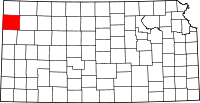 | |
| Unincorporated communities | ||
| Townships | ||