Girraween, New South Wales
| Girraween Sydney, New South Wales | |||||||||||||
|---|---|---|---|---|---|---|---|---|---|---|---|---|---|
 Girraween Public School | |||||||||||||
| Population | 4,693 (2011 census)[1] | ||||||||||||
| Postcode(s) | 2145 | ||||||||||||
| Location | 30 km (19 mi) west of Sydney CBD | ||||||||||||
| LGA(s) | Cumberland Council | ||||||||||||
| Region | Greater Western Sydney | ||||||||||||
| State electorate(s) | Prospect | ||||||||||||
| Federal Division(s) | Greenway | ||||||||||||
| |||||||||||||
Girraween is a suburb of Sydney, in the state of New South Wales, Australia. Girraween is located 30 km west of the Sydney central business district, in the local government area of Cumberland Council and is part of the Greater Western Sydney region.
History
Girraween is an Aboriginal word meaning place of flowers. This area was part of the estate of D'Arcy Wentworth, who was honoured in the naming of the nearby suburb of Wentworthville.[2]
Demographics
At the 2011 census, there were 4,693 residents in Girraween. Just under half (44.6%) of people were born in Australia, with the top other countries of birth being India 15.8%, Sri Lanka 9.8% and Malta 3.6%. In Girraween, 59.4% of people spoke a language other than English at home. The most common other languages spoken were Tamil 16.2%, Hindi 4.2% and Maltese 3.5%. The top responses for religious affiliation were Catholic 28.1%, Hinduism 27.5% and Anglican 8.2%.[1]
Transport
Girraween is serviced by the 705 bus route from Blacktown to Parramatta. There is no railway station although it is a short walk through Civic Park, to Pendle Hill railway station. Also, Toongabie Railway station is also easily accessible.
Schools
- Girraween High School (Selective)
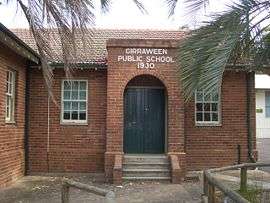
- Girraween Public School
- St Anthony's Girraween (Catholic)
Sport and recreation
- Girraween Eagles and Girraween Park.
- Civic Park, just over the eastern border in Pendle Hill has a basketball court, a netball court, tennis courts, barbecue areas and a playground area.
- Toongabbie Little Athletics Club is based at CV Kelly Park, which is within Girraween.
References
- 1 2 Australian Bureau of Statistics (31 October 2012). "Girraween (State Suburb)". 2011 Census QuickStats. Retrieved 4 May 2013.
- ↑ The Book of Sydney Suburbs, Compiled by Frances Pollon, Angus & Robertson Publishers, 1990, Published in Australia ISBN 0-207-14495-8, page 108
| Wikimedia Commons has media related to Girraween, New South Wales. |
Coordinates: 33°48′05″S 150°56′35″E / 33.80128°S 150.94305°E