Gillis, Louisiana
| Gillis, Louisiana | |
|---|---|
| Census-designated place | |
 Gillis | |
| Coordinates: 30°22′24″N 93°12′2″W / 30.37333°N 93.20056°WCoordinates: 30°22′24″N 93°12′2″W / 30.37333°N 93.20056°W | |
| Area | |
| • Total | 4.3 km2 (1.7 sq mi) |
| • Land | 4.3 km2 (1.7 sq mi) |
| • Water | 0 km2 (0 sq mi) |
| Elevation | 8 m (26 ft) |
| Population (2010) | |
| • Total | 657 |
| • Density | 152.6/km2 (395/sq mi) |
Gillis is an unincorporated community and census-designated place (CDP) in northern Calcasieu Parish, Louisiana, United States. As of the 2010 census it had a population of 657.[1]
Geography
Gillis is located in northeastern Calcasieu Parish, 12 miles (19 km) north of Lake Charles and 36 miles (58 km) south of DeRidder. U.S. Route 171 is the main road through the community.
Gillis falls under the school district of Iowa, a town 20 miles (32 km) to the southeast, though most parents send their children to schools much closer to home. Students who live in the Gillis community may attend Gillis Elementary on Topsy Road and Moss Bluff Middle School and Sam Houston High School in Moss Bluff.
References
- ↑ "Geographic Identifiers: 2010 Demographic Profile Data (G001): Gillis CDP, Louisiana". U.S. Census Bureau, American Factfinder. Retrieved August 15, 2014.
Municipalities and communities of Calcasieu Parish, Louisiana, United States | ||
|---|---|---|
| Cities | 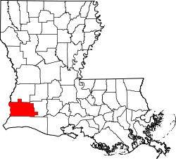 | |
| Towns | ||
| CDPs | ||
| Other unincorporated communities | ||
This article is issued from Wikipedia - version of the 11/17/2014. The text is available under the Creative Commons Attribution/Share Alike but additional terms may apply for the media files.