Georgia State Route 110
| ||||
|---|---|---|---|---|
|
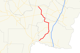
Georgia State Route 110 highlighted in red | ||||
| Route information | ||||
| Maintained by GDOT | ||||
| Length: | 46.2 mi[1] (74.4 km) | |||
| Major junctions | ||||
| South end: |
| |||
|
| ||||
| North end: |
| |||
| Location | ||||
| Counties: | Camden, Brantley | |||
| Highway system | ||||
| ||||

State Route 110 (SR 110) is a state highway in the southeast part of the U.S. state of Georgia. The highway runs 46.2 miles (74.4 km) from a point east of Folkston, northeast to Woodbine, north to Waverly, and northwest to a point east of Hortense.
Route description
SR 110 begins at an intersection with SR 40 about 5 miles (8.0 km) east of Folkston. The route heads northeast to an intersection with US 17/SR 25 in Woodbine. The three routes begin a concurrency to the north. Just after leaving the city, it crosses the Satilla River. In White Oak, SR 110 intersects SR 252. In Waverly, SR 110 departs the concurrency to the northwest. Just before Atkinson, the route has a very brief concurrency with US 82/SR 520. The route leaves Atkinson to the north and curves to the northwest to its northern terminus, at an intersection with SR 32, east of Hortense.[1]
Major intersections
| County | Location | mi[1] | km | Destinations | Notes |
|---|---|---|---|---|---|
| Camden | | 0.0 | 0.0 | Southern terminus | |
| Woodbine | 14.4 | 23.2 | Southern end of US 17/SR 25 concurrency | ||
| Satilla River via the J. Edwin Godley Memorial Bridge at mile 14.8 | |||||
| White Oak | 18.9 | 30.4 | |||
| Waverly | 23.2 | 37.3 | Northern end of US 17/SR 25 concurrency | ||
| Brantley | | 36.8 | 59.2 | Southern end of US 82/SR 520 concurrency | |
| Atkinson | 37.2 | 59.9 | Northern end of US 82/SR 520 concurrency | ||
| | 46.2 | 74.4 | Northern terminus | ||
1.000 mi = 1.609 km; 1.000 km = 0.621 mi
| |||||
See also
-
.svg.png) Georgia (U.S. state) portal
Georgia (U.S. state) portal -
 U.S. Roads portal
References
- 1 2 3 Google (October 22, 2012). "Route of SR 110" (Map). Google Maps. Google. Retrieved October 22, 2012.
External links
![]() Media related to Georgia State Route 110 at Wikimedia Commons
Media related to Georgia State Route 110 at Wikimedia Commons