Garfield, Kansas
| Garfield, Kansas | |
|---|---|
| City | |
|
City Hall, Library, Post Office (2009) | |
 Location within Pawnee County and Kansas | |
 KDOT map of Pawnee County (legend) | |
| Coordinates: 38°4′35″N 99°14′42″W / 38.07639°N 99.24500°WCoordinates: 38°4′35″N 99°14′42″W / 38.07639°N 99.24500°W | |
| Country | United States |
| State | Kansas |
| County | Pawnee |
| Area[1] | |
| • Total | 0.54 sq mi (1.40 km2) |
| • Land | 0.54 sq mi (1.40 km2) |
| • Water | 0 sq mi (0 km2) |
| Elevation | 2,077 ft (633 m) |
| Population (2010)[2] | |
| • Total | 190 |
| • Estimate (2015)[3] | 185 |
| • Density | 350/sq mi (140/km2) |
| Time zone | Central (CST) (UTC-6) |
| • Summer (DST) | CDT (UTC-5) |
| ZIP code | 67529 |
| Area code(s) | 620 |
| FIPS code | 20-25750 [4] |
| GNIS feature ID | 0475938 [5] |

Garfield is a city in Pawnee County, Kansas, United States. As of the 2010 census, the city population was 190.[6]
History
Garfield is named for James A. Garfield, 20th President of the United States.[7]
The first post office in Garfield was established in 1873.[8]
Geography
Garfield is located at 38°4′35″N 99°14′42″W / 38.07639°N 99.24500°W (38.076310, -99.244994).[9] According to the United States Census Bureau, the city has a total area of 0.54 square miles (1.40 km2), all of it land.[1]
Demographics
| Historical population | |||
|---|---|---|---|
| Census | Pop. | %± | |
| 1910 | 333 | — | |
| 1920 | 368 | 10.5% | |
| 1930 | 451 | 22.6% | |
| 1940 | 335 | −25.7% | |
| 1950 | 297 | −11.3% | |
| 1960 | 278 | −6.4% | |
| 1970 | 261 | −6.1% | |
| 1980 | 277 | 6.1% | |
| 1990 | 236 | −14.8% | |
| 2000 | 198 | −16.1% | |
| 2010 | 190 | −4.0% | |
| Est. 2015 | 185 | [3] | −2.6% |
| U.S. Decennial Census | |||
2010 census
As of the census[2] of 2010, there were 190 people, 82 households, and 49 families residing in the city. The population density was 351.9 inhabitants per square mile (135.9/km2). There were 102 housing units at an average density of 188.9 per square mile (72.9/km2). The racial makeup of the city was 92.6% White, 2.1% Native American, and 5.3% from two or more races. Hispanic or Latino of any race were 6.8% of the population.
There were 82 households of which 17.1% had children under the age of 18 living with them, 52.4% were married couples living together, 6.1% had a female householder with no husband present, 1.2% had a male householder with no wife present, and 40.2% were non-families. 32.9% of all households were made up of individuals and 21.9% had someone living alone who was 65 years of age or older. The average household size was 2.32 and the average family size was 2.90.
The median age in the city was 49.4 years. 20.5% of residents were under the age of 18; 6.9% were between the ages of 18 and 24; 16.9% were from 25 to 44; 35.3% were from 45 to 64; and 20.5% were 65 years of age or older. The gender makeup of the city was 45.8% male and 54.2% female.
2000 census
As of the census[4] of 2000, there were 198 people, 83 households, and 62 families residing in the city. The population density was 369.3 people per square mile (141.6/km²). There were 97 housing units at an average density of 180.9 per square mile (69.4/km²). The racial makeup of the city was 97.98% White, 0.51% African American, 0.51% Native American, 0.51% from other races, and 0.51% from two or more races. Hispanic or Latino of any race were 0.51% of the population.
There were 83 households out of which 31.3% had children under the age of 18 living with them, 60.2% were married couples living together, 8.4% had a female householder with no husband present, and 25.3% were non-families. 24.1% of all households were made up of individuals and 10.8% had someone living alone who was 65 years of age or older. The average household size was 2.39 and the average family size was 2.74.
In the city the population was spread out with 25.3% under the age of 18, 6.6% from 18 to 24, 21.2% from 25 to 44, 26.3% from 45 to 64, and 20.7% who were 65 years of age or older. The median age was 42 years. For every 100 females there were 98.0 males. For every 100 females age 18 and over, there were 94.7 males.
The median income for a household in the city was $38,500, and the median income for a family was $39,583. Males had a median income of $23,750 versus $21,250 for females. The per capita income for the city was $15,767. About 4.5% of families and 5.8% of the population were below the poverty line, including 2.1% of those under the age of eighteen and 4.8% of those sixty five or over.
See also
References
- 1 2 "US Gazetteer files 2010". United States Census Bureau. Retrieved 2012-07-06.
- 1 2 "American FactFinder". United States Census Bureau. Retrieved 2012-07-06.
- 1 2 "Annual Estimates of the Resident Population for Incorporated Places: April 1, 2010 to July 1, 2015". Retrieved July 2, 2016.
- 1 2 "American FactFinder". United States Census Bureau. Retrieved 2008-01-31.
- ↑ "US Board on Geographic Names". United States Geological Survey. 2007-10-25. Retrieved 2008-01-31.
- ↑ "2010 City Population and Housing Occupancy Status". U.S. Census Bureau. Retrieved September 15, 2011.
- ↑ Gannett, Henry (1905). The Origin of Certain Place Names in the United States. Govt. Print. Off. p. 134.
- ↑ "Kansas Post Offices, 1828-1961". Kansas Historical Society. Archived from the original on October 9, 2013. Retrieved 22 June 2014.
- ↑ "US Gazetteer files: 2010, 2000, and 1990". United States Census Bureau. 2011-02-12. Retrieved 2011-04-23.
Further reading
- USA
- The Story of the Marking of the Santa Fe Trail by the Daughters of the American Revolution in Kansas and the State of Kansas; Almira Cordry; Crane Co; 164 pages; 1915. (Download 4MB PDF eBook)
- The National Old Trails Road To Southern California, Part 1 (LA to KC); Automobile Club Of Southern California; 64 pages; 1916. (Download 6.8MB PDF eBook)
External links
| Wikimedia Commons has media related to Garfield, Kansas. |
- City
- Schools
- USD 495, local school district
- Maps
- Garfield City Map, KDOT
Municipalities and communities of Pawnee County, Kansas, United States | ||
|---|---|---|
| Cities | 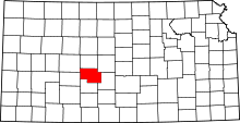 | |
| Unincorporated communities | ||