Fountain Green, Utah
| Fountain Green, Utah | |
|---|---|
| City | |
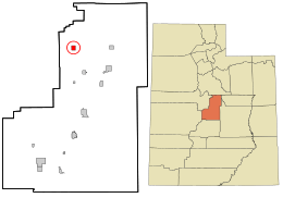 Location in Sanpete County and the state of Utah. | |
| Coordinates: 39°37′40″N 111°38′22″W / 39.62778°N 111.63944°WCoordinates: 39°37′40″N 111°38′22″W / 39.62778°N 111.63944°W | |
| Country | United States |
| State | Utah |
| County | Sanpete |
| Settled | March 1859 |
| Founded by | George W. Johnson |
| Named for | Springs and meadows |
| Area | |
| • Total | 1.4 sq mi (3.6 km2) |
| • Land | 1.4 sq mi (3.6 km2) |
| • Water | 0.0 sq mi (0.0 km2) |
| Elevation | 5,899 ft (1,798 m) |
| Population (2012) | |
| • Total | 1,077 |
| • Density | 672.2/sq mi (259.5/km2) |
| Time zone | Mountain (MST) (UTC-7) |
| • Summer (DST) | MDT (UTC-6) |
| ZIP code | 84632 |
| Area code(s) | 435 |
| FIPS code | 49-26720[1] |
| GNIS feature ID | 1441187[2] |
Fountain Green is a city in Sanpete County, Utah, United States. The population was 1071 at the 2010 census.
Geography
Fountain Green is located at 39°37′40″N 111°38′22″W / 39.627653°N 111.639310°W (39.627653, -111.639310).[3]
According to the United States Census Bureau, the city has a total area of 1.4 square miles (3.7 km2), all of it land.
Demographics
| Historical population | |||
|---|---|---|---|
| Census | Pop. | %± | |
| 1870 | 562 | — | |
| 1880 | 881 | 56.8% | |
| 1890 | 677 | −23.2% | |
| 1900 | 755 | 11.5% | |
| 1910 | 875 | 15.9% | |
| 1920 | 1,169 | 33.6% | |
| 1930 | 982 | −16.0% | |
| 1940 | 988 | 0.6% | |
| 1950 | 767 | −22.4% | |
| 1960 | 544 | −29.1% | |
| 1970 | 467 | −14.2% | |
| 1980 | 578 | 23.8% | |
| 1990 | 578 | 0.0% | |
| 2000 | 945 | 63.5% | |
| 2010 | 1,071 | 13.3% | |
| Est. 2015 | 1,083 | [4] | 1.1% |
As of the census[1] of 2010, there were 1071 people, and 370 households, 88.4% of which were occupied housing units. The population density was 705 people per square mile. The racial makeup of the city was 89.07% White, 0.10% African American, 0.60% Native American, and 1.73% from other races. Hispanic or Latino of any race were 8.50% of the population.
Education
Fountain Green is located in the North Sanpete School District and contains an elementary school. Students attend North Sanpete Middle School in Moroni and North Sanpete High School in Mount Pleasant.
Events
The annual city celebration is Lamb Day. Held in July of each year, it is famous for its underground pit cooking of over 30 lambs that are made into delicious lamb sandwiches. The event includes a play, mutton busting, carnival, softball games, fun run, and a great parade down State Street.
See also
References
- 1 2 "American FactFinder". United States Census Bureau. Retrieved 2008-01-31.
- ↑ "US Board on Geographic Names". United States Geological Survey. 2007-10-25. Retrieved 2008-01-31.
- ↑ "US Gazetteer files: 2010, 2000, and 1990". United States Census Bureau. 2011-02-12. Retrieved 2011-04-23.
- ↑ "Annual Estimates of the Resident Population for Incorporated Places: April 1, 2010 to July 1, 2015". Retrieved July 2, 2016.
- ↑ "Census of Population and Housing". Census.gov. Retrieved June 4, 2015.
 |
Rocky Ridge Mona |
Payson, Elk Ridge Santaquin |
Uinta National Forest | |
| Nephi | |
Fairview | ||
| ||||
| | ||||
| Levan | Wales, Moroni | Mount Pleasant |
Municipalities and communities of Sanpete County, Utah, United States | ||
|---|---|---|
| Cities | 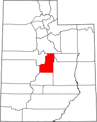 | |
| Towns | ||
| Unincorporated communities | ||
| Ghost towns | ||