Fouillouse
| Fouillouse | ||
|---|---|---|
|
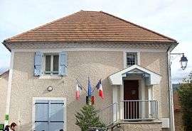
The town hall of Fouillouse | ||
| ||
 Fouillouse | ||
|
Location within Provence-A.-C.d'A. region  Fouillouse | ||
| Coordinates: 44°27′30″N 6°00′16″E / 44.4583°N 6.0044°ECoordinates: 44°27′30″N 6°00′16″E / 44.4583°N 6.0044°E | ||
| Country | France | |
| Region | Provence-Alpes-Côte d'Azur | |
| Department | Hautes-Alpes | |
| Arrondissement | Gap | |
| Canton | Tallard | |
| Intercommunality | Tallard-Barcillonnette | |
| Government | ||
| • Mayor (2008–2014) | André Bontemps | |
| Area1 | 7.24 km2 (2.80 sq mi) | |
| Population (2008)2 | 188 | |
| • Density | 26/km2 (67/sq mi) | |
| Time zone | CET (UTC+1) | |
| • Summer (DST) | CEST (UTC+2) | |
| INSEE/Postal code | 05057 / 05130 | |
| Elevation |
599–1,081 m (1,965–3,547 ft) (avg. 830 m or 2,720 ft) | |
|
1 French Land Register data, which excludes lakes, ponds, glaciers > 1 km² (0.386 sq mi or 247 acres) and river estuaries. 2 Population without double counting: residents of multiple communes (e.g., students and military personnel) only counted once. | ||

Fouillouse is a commune in the Hautes-Alpes department in southeastern France.
Population
| Historical population | ||
|---|---|---|
| Year | Pop. | ±% |
| 1962 | 82 | — |
| 1968 | 87 | +6.1% |
| 1975 | 87 | +0.0% |
| 1982 | 95 | +9.2% |
| 1990 | 124 | +30.5% |
| 1999 | 138 | +11.3% |
| 2008 | 188 | +36.2% |
See also
References
| Wikimedia Commons has media related to Fouillouse. |
This article is issued from Wikipedia - version of the 1/30/2015. The text is available under the Creative Commons Attribution/Share Alike but additional terms may apply for the media files.