Fort Coffee, Oklahoma
| Fort Coffee, Oklahoma | |
|---|---|
| Town | |
 Location of Fort Coffee, Oklahoma | |
| Coordinates: 35°17′57″N 94°34′48″W / 35.29917°N 94.58000°WCoordinates: 35°17′57″N 94°34′48″W / 35.29917°N 94.58000°W | |
| Country | United States |
| State | Oklahoma |
| County | Le Flore |
| Area | |
| • Total | 6.4 sq mi (16.7 km2) |
| • Land | 6.4 sq mi (16.6 km2) |
| • Water | 0.0 sq mi (0.0 km2) |
| Elevation | 463 ft (141 m) |
| Population (2010) | |
| • Total | 424 |
| • Density | 64/sq mi (24.8/km2) |
| Time zone | Central (CST) (UTC-6) |
| • Summer (DST) | CDT (UTC-5) |
| FIPS code | 40-27150[1] |
| GNIS feature ID | 1092956[2] |
Fort Coffee is a town in Le Flore County, Oklahoma, United States. Originally constructed as a U. S. Army fort in 1834, it was named for U. S. General John Coffee, a veteran of the Seminole Wars.[3] It is part of the Fort Smith, Arkansas-Oklahoma Metropolitan Statistical Area. The population was 424 at the 2010 census, a gain of 2.9 percent from 412 at the 2000 census.[4]
History
The town of Fort Coffee traces its beginning to 1832, when the Choctaw Indian tribe was removed from the southeastern United States and transported to land in the eastern part of Indian Territory (now in the state of Oklahoma). Most of the travel was by water, and the site of Fort Coffee became a port on the Arkansas River.[3]
In 1834, the Choctaw Nation petitioned the U. S. War Department to construct a fort that would stop the flow of alcohol and other illegal items from flowing into their territory along the Arkansas River. The garrison succeeded in its mission and also built roads connecting Fort Smith, Arkansas, Fort Gibson, and Fort Towson. The army abandoned Fort Coffee in 1838 when Fort Smith was reestablished. In 1843, the Choctaw nation allowed the Methodist Episcopal church to establish the Fort Coffee Choctaw Boys Academy in the buildings. This school continued until the outbreak of the Civil War, when Confederate forces commanded by General Stand Watie occupied the site. The Union Army recaptured the fort in 1863. Most of the buildings were burned during this time. Several small houses were built using the foundation stones.[3]
The Choctaw were required to release their slaves by the Reconstruction Treaty of 1866. Many of the freed men remained in the Choctaw Nation lands. Many of these were legally adopted into the Choctaw Nation in 1885, thus qualifying for land allotments by the Dawes Commission.[3]
The local economy has largely been based on agriculture. Major crops included cotton, livestock and soybeans. There was a cotton gin in Fort Coffee to handle locally grown crops. The Fort Smith and Western Railroad and the Kansas City, Pittsburg and Gulf Railway (bought by the Kansas City Southern Railway in 1900) transported the products to outside markets.[3]
The town of Fort Coffee did not incorporate until 1998.[3]
Geography
Fort Coffee is located at 35°17′57″N 94°34′48″W / 35.299124°N 94.580011°W.[5] It is 6 miles (9.7 km) northeast of Spiro.[3]
According to the United States Census Bureau, the town has a total area of 6.4 square miles (17 km2), of which, 6.4 square miles (17 km2) of it is land and 0.16% is water.
Demographics
| Historical population | |||
|---|---|---|---|
| Census | Pop. | %± | |
| 2000 | 412 | — | |
| 2010 | 424 | 2.9% | |
| Est. 2015 | 413 | [6] | −2.6% |
At the 2000 census,[1] there were 412 people, 163 households and 109 families residing in the town. The population density was 64.1 per square mile (24.7/km2). There were 176 housing units at an average density of 27.4 per square mile (10.6/km2). The racial makeup of the town was 26.21% White, 62.86% African American, 3.88% Native American, and 7.04% from two or more races.
There were 163 households, of which 30.1% had children under the age of 18 living with them, 45.4% were married couples living together, 14.7% had a female householder with no husband present, and 33.1% were non-families. 31.9% of all households were made up of individuals and 11.7% had someone living alone who was 65 years of age or older. The average household size was 2.53 and the average family size was 3.17.
Age distribution was 23.8% under the age of 18, 9.7% from 18 to 24, 24.0% from 25 to 44, 28.6% from 45 to 64, and 13.8% who were 65 years of age or older. The median age was 41 years. For every 100 females there were 104.0 males. For every 100 females age 18 and over, there were 106.6 males.
The median household income was $26,827, and the median family income was $31,528. Males had a median income of $26,094 versus $22,344 for females. The per capita income for the town was $14,039. About 25.6% of families and 30.6% of the population were below the poverty line, including 36.9% of those under age 18 and 50.0% of those age 65 or over.
References
- 1 2 "American FactFinder". United States Census Bureau. Retrieved 2008-01-31.
- ↑ "US Board on Geographic Names". United States Geological Survey. 2007-10-25. Retrieved 2008-01-31.
- 1 2 3 4 5 6 7 [http://www.okhistory.org/publications/enc/entry.php?entry=FO058 Denni Peterson. s"Fort Coffee." Encyclopedia of Oklahoma History and Culture. Retrieved September 16, 2012.
- ↑ CensusViewer:Fort Coffee, Oklahoma Population. Retrieved September 14, 2012.
- ↑ "US Gazetteer files: 2010, 2000, and 1990". United States Census Bureau. 2011-02-12. Retrieved 2011-04-23.
- ↑ "Annual Estimates of the Resident Population for Incorporated Places: April 1, 2010 to July 1, 2015". Retrieved July 2, 2016.
- ↑ "Census of Population and Housing". Census.gov. Retrieved June 4, 2015.
External links
- Encyclopedia of Oklahoma History and Culture - Fort Coffee
- Oklahoma Digital Maps: Digital Collections of Oklahoma and Indian Territory
Municipalities and communities of Le Flore County, Oklahoma, United States | ||
|---|---|---|
| Cities | 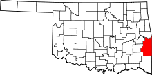 | |
| Towns | ||
| CDP | ||
| Other unincorporated communities | ||
| Footnotes | ‡This populated place also has portions in an adjacent county or counties | |