Forest City, Pennsylvania
| Forest City, Pennsylvania | |
|---|---|
| Borough | |
|
436 Main Street | |
| Motto: One Mile Of Hospitality | |
 Forest City, Pennsylvania | |
| Coordinates: 41°39′03″N 75°28′05″W / 41.65083°N 75.46806°WCoordinates: 41°39′03″N 75°28′05″W / 41.65083°N 75.46806°W | |
| Country | United States |
| State | Pennsylvania |
| County | Susquehanna |
| Settled | 1871 |
| Incorporated | 1888 |
| Area | |
| • Total | 0.9 sq mi (2.4 km2) |
| Population (2010) | |
| • Total | 1,911 |
| • Density | 2,123.3/sq mi (829.4/km2) |
| Time zone | Eastern (EST) (UTC-5) |
| • Summer (DST) | EDT (UTC-4) |
| Zip code | 18421 |
| Area code(s) | 570 Exchange: 785 |

Forest City is a borough in Susquehanna County, Pennsylvania. Forest City is situated at the corner of Susquehanna County, Lackawanna County and Wayne County and is designated by a marker which is located in the Forest City Industrial Park.
Forest City is 4 avenues by 10 blocks as the 'main city' with a small surrounding suburb housing 1,911 in the 2010 census, with 87% of the population living 'in town'.
At its height in the early twentieth century, between the timber, silk, lumber and coal industries, the population was close to 6,000- a booming town with a busy Main Street.
History
The land that would become Forest City had been known as "Forest Mills" since the 1850s. From 1879-1886, the post office was called "Pentecost". It was named after one of the first local settlers, William Pentecost, who had started the lumbering and milling industries in the area. The post office was renamed Forest City in 1886, and the Forest City borough was formed in 1888.[1]
Between 1866 and 1871, the Jefferson Branch, a railroad spur of the D & H Canal Company, was built in Forest Mills.[1] It ran between Susquehanna Depot and Carbondale, transporting the harvested lumber. Lumbering was the only industry of this area, with the exception of a small mining operation run by William Pentecost, which supplied only sufficient coal to neighboring farmers for winter fuel.[2]
In 1871, an outcropping of coal was discovered. The Hillside Coal and Iron Company bought large tracts of land in the area, and by 1872 the first commercially profitable coal mining enterprise was established at North Railroad Street. A small breaker erected on Railroad Street processed the 75 ton daily output from this operation until 1883.[2]
In 1886, another shaft, Shaft No. 2, was opened. This brought an influx of miners, mostly Welsh, into the area. There were now 300 men and boys employed in the production of coal.[2]
Coal mining continued until The Great Depression hit this town hard, as primary sector of the economy products as lumber and coal were hardest hit. The population slowly dwindled as the coal mining came to a halt. Today, the Forest City Area Historical Society serves as a reminder of this once flourishing coal town.[2]
There are important agricultural interests in the region. At the onset of the twentieth century, coal-mining and silk manufacturing were the chief industries, but they have declined to the vanishing point.
Geography
Forest City is 23 miles (37 km) north by east of Scranton.
Forest City is located at 41°39′3″N 75°28′5″W / 41.65083°N 75.46806°W (41.650907, -75.468180).[3]
According to the United States Census Bureau, the borough has a total area of 0.9 square miles (2.3 km2), of which, 0.9 square miles (2.3 km2) of it is land and 0.04 square miles (0.10 km2) of it (3.23%) is water.
Demographics
| Historical population | |||
|---|---|---|---|
| Census | Pop. | %± | |
| 1870 | 993 | — | |
| 1880 | 990 | −0.3% | |
| 1890 | 2,319 | 134.2% | |
| 1900 | 4,279 | 84.5% | |
| 1910 | 5,749 | 34.4% | |
| 1920 | 6,004 | 4.4% | |
| 1930 | 5,209 | −13.2% | |
| 1940 | 4,266 | −18.1% | |
| 1950 | 3,122 | −26.8% | |
| 1960 | 2,651 | −15.1% | |
| 1970 | 2,322 | −12.4% | |
| 1980 | 1,924 | −17.1% | |
| 1990 | 1,846 | −4.1% | |
| 2000 | 1,855 | 0.5% | |
| 2010 | 1,911 | 3.0% | |
| Est. 2015 | 1,809 | [4] | −5.3% |
| Sources:[5][6][7] | |||
As of the census[8] of 2010, there were 1,911 people, 817 households, and 462 families residing in the borough.
The entire village is only .9034 square miles or 2.33 km².
There are 817 households out of which 28.3% have children under the age of 18 living with them, 34.6% are married couples living together, 15.1% have a female householder with no husband present, and 43.5% are non-families. 39.2% of all households are made up of individuals and 23.5% have someone living alone who was 65 years of age or older. The average household size is 2.23 and the average family size is 2.91.
The median age is 47. For every 100 females there are 84.0 males. For every 100 females age 18 and over, there are 78.0 males.
The median income for a household in the borough is $33,618, and the median income for a family is $41,985. The per capita income for the borough is $19,245. About 6.4% of families and 21.3% of the population live below the poverty line, including 28.4% of those under age 18 and 17.4% of those age 65 or over.
Churches
Due to the historical influx of immigrants settling in primary sector of the economy towns such as Forest City, as each successive ethnic minority would build their own church. In its height in the 1920s, Forest City was known as "the town with the most churches in it" to the locals.
Until recently, Forest City's overwhelmingly Roman Catholic population boasted five churches: St. Anthony, St. Michael, St. Agnes, St. Joseph, and Sacred Heart. Each of these churches were ethnic, St. Agnes being Irish, St. Anthony's was Lithuanian; St. Michael's was Slovakian; St. Joseph's was Slovenian; and Sacred Heart was Polish. Early consolidations were planned in the 1970s, but public resistance kept some of the buildings intermittently open for decades. The Ascension of Our Lord Parish was created and dedicated in 2010, and the worship site, St. Joseph's Church, was renovated to accommodate the merger.
Forest City is also home to an Episcopal, Byzantine Catholic Church and a non-denominational church. The Methodist Church closed May 2013.
Senior Care
The William Penn apartment complex for seniors is on Main Street and the Forest City Nursing and Rehab Center is on Delaware Street. This represents up to 7% of the population of Forest City.
Economy
Although Forest City's Main Street houses several business, most residents shop in the larger towns closer to Carbondale, Pennsylvania. Main Street features a number of small businesses. YUM Brands put a franchise business in town that thrives.
Government and Government Services
Forest City has its own police department which serves some surrounding municipalities on a contractual basis. The police department consists of a Police Chief, Assistant Police Chief and several Patrol Officers. The police department is located on the second floor of Forest City's Boro Hall, which also is the office for town's mayor. Boro Hall also houses the Forest City Library.
Forest City has two parks: John F. Kennedy Park and Babe Ruth Park. Kennedy Park, located on Pennsylvania Route 247, five blocks from Main Street, has a lake, baseball fields, tennis and basketball courts, frisbee golf course, playground, and nature trail. Babe Ruth Park is located on Railroad Street and features a playground, playing field, and a basketball court.
Forest City holds an annual festival every year called "Old Home Week". What was once a week long celebration is now a one-day event. Economics, and the donations of the few Forest City businesses has made it unsustainable as a week-long event.
Forest City is the starting point to the Steamtown Marathon, which is held the Sunday before Columbus Day.[9]
Education
Forest City Regional School District is a Preschool-12th grade public school district serving residents of Forest City.

According to the 2010 census, there are at least 17 students per grade living in Forest City.
Notable residents
- Samuel Rothafel, founder of Radio City Music Hall
- Patrick H. O'Malley, Jr., vaudevillian and film actor
References
- 1 2 "County Info". Susquehannna County Historical Society. Retrieved 1 February 2016.
- 1 2 3 4 "A Short History of Forest City". Retrieved 13 February 2016.
compiled from the booklet published for the Forest City Centennial in 1964
- ↑ "US Gazetteer files: 2010, 2000, and 1990". United States Census Bureau. 2011-02-12. Retrieved 2011-04-23.
- ↑ "Annual Estimates of the Resident Population for Incorporated Places: April 1, 2010 to July 1, 2015". Retrieved July 2, 2016.
- ↑ "Census of Population and Housing". U.S. Census Bureau. Retrieved 11 December 2013.
- ↑ "American FactFinder". United States Census Bureau. Retrieved 2008-01-31.
- ↑ "Incorporated Places and Minor Civil Divisions Datasets: Subcounty Resident Population Estimates: April 1, 2010 to July 1, 2012". Population Estimates. U.S. Census Bureau. Retrieved 11 December 2013.
- ↑ "American FactFinder". United States Census Bureau. Retrieved 2011-05-14.
- ↑ "Events - Steamtown Marathon". Lackawanna County Convention and Visitors Bureau. Retrieved 1 February 2016.
External links
- The Forest City News
- Forest City Area Historical Society
- Pictures
- A short history of Forest City
- Forest City Regional School District
- Forest City PA 1937 short film
Municipalities and communities of Susquehanna County, Pennsylvania, United States | ||
|---|---|---|
| Boroughs | 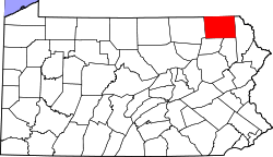 | |
| Townships | ||
| Unincorporated community | ||